River Goul facts for kids
Quick facts for kids River Goul |
|
|---|---|

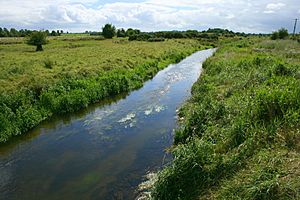
Goul near Galmoy
|
|

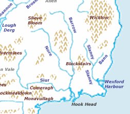
Map of the source of the Nore, Ireland
|
|
|
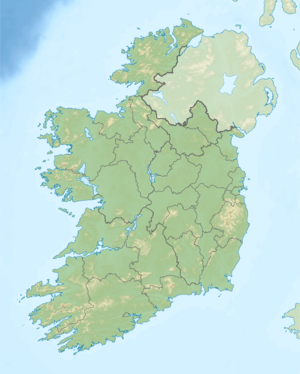
Location of the mouth in Ireland
|
|
| Native name | An Gabhail |
| Counties | Tipperary, Kilkenny, Laois |
| Towns | Johnstown, Galmoy, Durrow |
| Physical characteristics | |
| Main source | Slieveardagh Hills Slieveardagh Hills 349 m (1,145 ft) 52°51′04″N 7°26′38″W / 52.85111°N 7.44389°W |
| River mouth | Celtic Sea Waterford Harbour, County Waterford 0 m (0 ft) 52°11′N 6°56′W / 52.183°N 6.933°W |
| Basin features | |
| Progression | River Goul—River Erkina—River Nore |
| Bridges | Ballyboodin Bridge |
The River Goul (which means An Gabhail in Irish) is a river in Ireland. It flows through three different counties: Tipperary, Kilkenny, and Laois. The River Goul is a smaller river that flows into a larger one called the River Erkina. The River Erkina then flows into an even bigger river, the River Nore. This means the Goul is a tributary of the Erkina, and the Erkina is a tributary of the Nore.
Exploring the River Goul
The River Goul starts its journey in the Slieveardagh Hills. These hills are about six kilometres south of a town called Urlingford. The river begins high up, at about 349 metres (1,145 feet) above sea level.
The River's Path
As the River Goul flows, it enters Urlingford from the southeast. It passes right under the town's Main Street. You can see it near the bridge at Urlingford Castle. From there, the river travels north. It flows between the towns of Johnstown and Galmoy.
Journey to County Laois
After passing these towns, the River Goul continues its path into County Laois. It travels several kilometres west of Durrow. This is where it meets and joins the River Erkina. The Erkina then carries the water further, eventually reaching the River Nore.
 | Isaac Myers |
 | D. Hamilton Jackson |
 | A. Philip Randolph |


