River Wissey facts for kids
Quick facts for kids River Wissey |
|
|---|---|

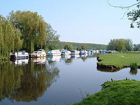
The river at Hilgay
|
|
| Country | England |
| County | Norfolk |
| Physical characteristics | |
| Main source | Shipdham 70 m (230 ft) 52°38′17″N 0°53′24″E / 52.6381°N 0.8900°E |
| River mouth | River Great Ouse Fordham 4 m (13 ft) 52°33′58″N 0°20′37″E / 52.5661°N 0.3436°E |
| Length | 31 mi (50 km) |
The River Wissey is a river in Norfolk, eastern England. It starts near Shipdham and flows for about 31 miles (50 km). The river joins the River Great Ouse at Fordham. The last 11.2 miles (18.0 km) of the river can be used by boats.
The upper parts of the river have many old and interesting buildings nearby. The Wissey flows through the beautiful parkland of Pickenham Hall. It also passes through the Army's Stanford Training Area (STANTA). This area was created in 1942 when six villages were moved. The river once powered mills at Hilborough and Northwold. At Whittington, the river becomes wide enough for boats. This area is surrounded by fenland, which is very flat and wet. Pumping stations help move water from ditches into the river.
People have used the river for travel since at least the time of the Domesday Book. However, there are not many old records about it. This is because there wasn't a big town at the start of the river where boats could load goods. In 1925, a sugar-beet factory was built at Wissington. It could only be reached by river or train. This brought more activity to the river. But in 1943, a road was built to the factory. After that, fewer boats used the river. Today, only pleasure boats use the River Wissey.
Contents
Exploring the River Wissey's Path
The River Wissey is a tributary of the Great Ouse. It begins near Shipdham in Norfolk. The river flows for almost 31 miles (50 km). It passes through several places like Necton, North Pickenham, and Stoke Ferry. Finally, it joins the Great Ouse south of Downham Market at Fordham.
The river's path has changed over time. It used to flow to Wisbech, which got its name from the river. In the past, it was also called the River Stoke. The Wissey starts close to the source of the River Yare. The Yare flows in the opposite direction.
The River's Start: Upper Reaches
Near the river's start is Manor Farm. This old building dates back to the 1500s. It has been changed and updated over many years. The farm also has ancient fishponds. The river continues west, passing Huntingfield Hall farmhouse. This building is also from the 1500s.
The Wissey then flows along the north side of Bradenham. The village church is separated from the main village by the river. It's a medieval building made of flint and brick. Most of it is from the 1300s. West of the village, the river passes a small water treatment plant. It then flows north of Holme Hale and south of Necton.
The river turns south and goes under Station Road at Erneford Bridge. Near the bridge is Erneford House, built around 1700. The Wissey then passes under an old railway bridge. It continues east of North Pickenham. The church there was mostly rebuilt in 1863.
At South Pickenham, the river flows through the parkland of Pickenham Hall. This park covers about 139 acres (56 ha). It has lots of grass and old oak trees. About 11 acres (4.5 ha) are gardens that lead down to the river. The river has been made wider here. A rustic oak bridge from the early 1900s connects the gardens to the park.
Pickenham Hall itself was built between 1902 and 1905. It was designed by the Arts and Crafts architect Robert Weir Schultz. At Great Cressingham, an old manor house sits on the east bank. It has special brick designs from 1542. The river then turns southwest. Home Lane crosses the river by a ford at Hilborough. South of the village is Hilborough Mill and the miller's house, built in 1819. The mill still has most of its old machinery.
Further south is Bodney Hall farmhouse, from the 1500s. There are also old fish ponds marked on maps. The river then goes through an area used by the army for training. During the Second World War, this area was an air force base called RAF Bodney. The river passes Langford Church, a medieval building. Its windows are covered because it's inside the Army's Stanford Training Area.
A smaller river joins the Wissey from the east. This tributary starts near Merton and flows through a large lake called Stanford Water. The nearby village of Stanford was one of six villages moved in 1942 for the training area.
After this, the river turns west. It passes gravel pits near Ickburgh. Near the A1065 road bridge is Bridge House. This building was changed in the 1800s. But it still has parts of an old chapel from the 1200s. The river then flows northwest, passing lakes near Didlington Hall. Two sluices mark where Northwold watermill used to be. It was taken down after 1938.
The River Gadder and its branch, the Oxborough Drain, flow into the Wissey from the north. North of Whittington, there's an old pumping station. Here, the river becomes wide enough for boats. It is now only about 7 feet (2 m) above sea level.
The River's End: Lower Reaches
The Stringside Drain flows into the river from the north. This is just before the A134 bridge at Whittington. This spot is where boats can turn around. Below the bridge, there was once a wharf for a malt factory. A path runs along the north bank of the river. It's a good path from Whittington to Wissington. Stoke Ferry, with its windmill, is close to the river's north bank. It is protected by flood banks.
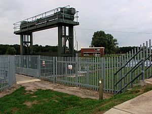
Below Stoke Ferry, the river meets the Cut-off Channel. This is a 28-mile (45 km) long drain built in the 1950s and 1960s. It helps control floods. When there's a flood, it carries extra water from the River Lark, the Little Ouse, and the River Wissey. A special gate, called a guillotine sluice, closes off the river. This sends floodwater into the Cut-off Channel. The river then flows over the channel on a concrete bridge.
Near this junction, there's a pumping station. It pumps water from the river to a drinking water plant. In 2012, a special fish pass was built here. It helps fish swim past the flood barriers to reach places upstream where they lay eggs. This pass was the first of its kind in the UK.
Methwold Lode flows into the river from the south. The river is then held in by wide flood banks. Wissington bridge is quite new. When the sugar-beet factory was built in 1925, there was no road to it. The new bridge provides more space for boats underneath. At Hilgay, the Cut-off Channel runs very close to the river. Snowre Hall, a 15th-century building, is on its north bank.
Hilgay is the biggest village on the river. It sits on a raised area, about 66 feet (20 m) above the surrounding fenland. This height difference has become more noticeable as the fenland has been drained and the ground has shrunk. In old times, Hilgay was known for its many fish and eels. Hilgay Old Bridge still crosses the river. The newer A10 bypass also crosses just below it. The last important spot before the river joins the Great Ouse is the railway bridge. This bridge carries the Ely to King's Lynn train line over the river.
The river below Whittington flows through fenland. It has banks to keep it separate from the lower land around it. Special groups called internal drainage boards (IDBs) manage the water in these areas. Several pumping stations move water from ditches into the river.
A Look Back: River Wissey History
The "ey" part of the name "Wissey" means "river." So, "River Wissey" actually means "River River"! There aren't many old records about the Wissey. This is different from nearby rivers like the River Lark. Those rivers had big towns at the start of their boat routes.
The Wissey is mentioned in the Domesday Book from 1086. It says the river could be used by boats from "Oxenburgh" to King's Lynn and Cambridge. There are still signs of an old village near the river at Oxborough Ferry. In 1575, officials decided the river should be cleared and made wider. They also said the bridge at Stoke Ferry needed fixing. This bridge caused problems because a local leader lost money from ferry tolls when it was built. He destroyed it, but was forced to rebuild it.
In the 1750s, there were wharfs at Oxborough Hithe. They handled goods like coal and grain. There were also boat houses about 1-mile (1.6 km) upstream at Northwold. In 1814, a special law was passed about the Wissey. It was mostly about draining the land, not just about boats. This law allowed people to widen the river in some areas. Landowners had to pay for this work. They could also charge tolls for using the north bank of the river.
Trade continued at wharfs in Oxborough Hithe and Stoke Ferry until at least 1858. It might have gone on even longer. A train line didn't arrive until 1882. A barge named Wissey was used for trade in the late 1800s. It was known to travel to Cambridge.
One of the busiest times for the river was between 1925 and 1943. The Wissington sugar-beet factory opened in 1925. Until 1941, the only ways to reach it were by river or by a special train line. During the Second World War, the factory area was used by the government. They used prisoners of war to fix the railway and build roads to the factory. Three tugboats, named Hilgay, Littleport, and Wissington, pulled 24 steel barges. These barges carried sugar beet to King's Lynn in winter. In summer, they brought coal back.
Interesting Places Along the Wissey
| Point | Coordinates (Links to map resources) |
OS Grid Ref | Notes |
|---|---|---|---|
| Mouth (Jn with Great Ouse) | 52°33′58″N 0°20′38″E / 52.5662°N 0.3438°E | TL589990 | |
| Wissington Railway Bridge | 52°33′13″N 0°26′42″E / 52.5537°N 0.4451°E | TL658979 | disused - by Sugar Factory |
| Connection to Cut Off Channel | 52°33′41″N 0°30′39″E / 52.5614°N 0.5109°E | TL702989 | |
| Stringside Drain | 52°34′01″N 0°32′07″E / 52.5669°N 0.5353°E | TL719995 | Head of navigation |
| Northwold Bridge | 52°32′23″N 0°36′34″E / 52.5396°N 0.6095°E | TL770967 | |
| A1065 Mundford Bridge | 52°31′05″N 0°39′46″E / 52.5180°N 0.6627°E | TL807944 | |
| Great Cressingham Bridge | 52°34′56″N 0°43′29″E / 52.5821°N 0.7247°E | TF846017 | |
| Source near Bradenham | 52°38′18″N 0°53′23″E / 52.6382°N 0.8896°E | TF956084 |
 | Chris Smalls |
 | Fred Hampton |
 | Ralph Abernathy |


