Riverside Archeological District facts for kids
Quick facts for kids |
|
|
Riverside Archeological District
|
|

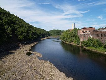
Portions of the district are visible on the left side of this photograph
|
|
| Lua error in Module:Location_map at line 420: attempt to index field 'wikibase' (a nil value). | |
| Nearest city | Gill and Greenfield, Massachusetts |
|---|---|
| NRHP reference No. | 75000256 |
| Added to NRHP | July 9, 1975 |
The Riverside Archeological District is a special historical area in Gill and Greenfield, Massachusetts. It's a place where scientists study the past by digging up old things. This important site was added to the National Register of Historic Places in 1975, which means it's officially recognized for its historical value.
Contents
What is the Riverside Archeological District?
The Riverside Archeological District is a large area of land located north of Turners Falls, Massachusetts. This spot is famous for its big whitewater rapids on the Connecticut River. The district stretches across parts of both Gill and Greenfield in northern Massachusetts. It's a very important place because it's near where four smaller rivers meet the Connecticut River.
Why is this area so important?
This area has a very long history, going back to the late Pleistocene period, which was the last Ice Age! That's thousands of years ago. When European settlers first arrived in the 1600s, many Native American groups lived here. It was also the site of a big battle in 1676 during King Philip's War. People have known this area was historically significant since the 1800s. They often found small artifacts and unique burial sites here.
Discovering the Past: Archeological Digs
Formal archeological work began in the early 1900s. In 1915 and 1916, many artifacts from Gill were collected. These items are now kept at the American Indian Archaeological Institute in Washington, DC. Archeologists have continued to study this area throughout the 20th century, slowly uncovering more secrets from the past.
Where is the Riverside Archeological District located?
The Riverside Archeological District has clear boundaries that help protect it. Its western edge is near Adams Street in Greenfield. To the east, it reaches the Lily's Pond area of Barton Cove in Gill. This is a calm, sheltered part of the Connecticut River. The northern boundary is just north of Riverside Cemetery in Gill. The very southern part of the district might even extend a little bit across the river into the village of Turners Falls itself.
 | Jewel Prestage |
 | Ella Baker |
 | Fannie Lou Hamer |

