
Rivière-du-Loup facts for kids
Quick facts for kids
Rivière-du-Loup
|
|||
|---|---|---|---|
|
City
|
|||
.jpg)
Downtown Rivière-du-Loup
|
|||
|
|||

Location within Rivière-du-Loup RCM
|
|||

Rivière-du-Loup
Location in Eastern Quebec
|
|||
| Country | |||
| Province | |||
| Region | Bas-Saint-Laurent | ||
| RCM | Rivière-du-Loup | ||
| Settled | 1850 as Fraserville | ||
| Constituted | December 30, 1998 | ||
| Area | |||
| • City | 138.40 km2 (53.44 sq mi) | ||
| • Land | 83.74 km2 (32.33 sq mi) | ||
| • Urban | 20.17 km2 (7.79 sq mi) | ||
| • Metro | 543.02 km2 (209.66 sq mi) | ||
| Population
(2021)
|
|||
| • City | 20,118 | ||
| • Density | 240.2/km2 (622/sq mi) | ||
| • Urban | 19,081 | ||
| • Urban density | 945.8/km2 (2,450/sq mi) | ||
| • Metro | 30,025 | ||
| • Metro density | 55.3/km2 (143/sq mi) | ||
| • Pop 2016-2021 | |||
| • Dwellings | 10,045 | ||
| Time zone | UTC−5 (EST) | ||
| • Summer (DST) | UTC−4 (EDT) | ||
| Postal code(s) |
G5R
|
||
| Area code(s) | 418 and 581 | ||
| Highways |
|||

Rivière-du-Loup is a city in Quebec, Canada. It is located on the south shore of the Saint Lawrence River. In 2021, about 20,118 people lived there. It is one of the biggest cities in the Bas-Saint-Laurent region. The city is also an important center for the Rivière-du-Loup Regional County Municipality.
Contents
History of Rivière-du-Loup
The city gets its name from the nearby river. In French, Rivière du Loup means Wolf's River. This name might come from an old native tribe called "Les Loups" (The Wolves). Or, it could be from the many seals that used to live at the river's mouth. Seals were once called loup-marin (sea wolves) in French.
How the City Started
Rivière-du-Loup began in 1673. It was part of a land system called the seigneurie. This land was given to Sieur Charles-Aubert de la Chesnaye. In 1850, the community became a village named Fraserville. This name honored Alexander Fraser, an early Scottish settler. It became a city in 1910. In 1919, the city changed its name back to Rivière-du-Loup.
Language Changes Over Time
Between 1850 and 1919, many English-speaking people moved to the city. Most of them left the area by the 1950s. Today, only about 1% of the people in Rivière-du-Loup speak English as their first language.
A Historical Event in 1950
In the fall of 1950, an important event happened in Rivière-du-Loup. A United States Air Force plane had engine problems. It was carrying a special device. This device was released and then safely destroyed before it hit the ground. The explosion spread a small amount of a material called uranium.
People and Population
In 2021, the city of Rivière-du-Loup had a population of 20,118 people. These people lived in 9,482 homes. The city's population grew by 3.1% from 2016 to 2021. The land area of the city is about 83.74 square kilometers. This means there are about 240 people living in each square kilometer.
Arts and Culture
One exciting event in Rivière-du-Loup is the annual Festival Vues dans la tête de... film festival. It's a great place to see movies and enjoy art.
Getting Around Town

Rivière-du-Loup is a common stop for travelers. It's located on the main route between Quebec City, the Maritimes, and the Gaspé Peninsula. The Trans-Canada Highway passes through the city. Here, Autoroute 20 changes to Autoroute 85, which continues south.
Travel Options
- Ferry: You can take a ferry across the Saint Lawrence River. It goes to Saint-Siméon on the north shore.
- Airport: The city has its own airport, the Rivière-du-Loup Airport (YRI).
- Train: You can also reach Rivière-du-Loup by train. The Via Rail train called "The Ocean" stops here. It travels between Montreal and Halifax.
Media in Rivière-du-Loup
Television Stations
Rivière-du-Loup has a unique television setup. Because of its hilly land, TV stations often use two transmitters. This helps make sure everyone in the city gets a clear signal. Each station has a main transmitter and a smaller one. The smaller one helps people in the lower parts of the city.
Here are some of the TV stations you can watch:
| Channel | Call sign | Network | Notes |
|---|---|---|---|
| 9.1 | CIMT-DT | TVA | Has a second transmitter on channel 41. |
| 29.1 | CFTF-DT | Noovo | Has a second transmitter on channel 11. |
Radio Stations
You can listen to several radio stations in Rivière-du-Loup:
- FM 89.5 - CJBR-FM-1, Ici Radio-Canada Première (News and talk)
- FM 90.7 - CBRX-FM-3, Ici Musique (Music)
- FM 103.7 - CIEL-FM, AC (Adult Contemporary music)
- FM 107.1 - CIBM-FM, CHR (Pop music)
- FM 107.9 - CIBM-FM-1 (Another signal for CIBM-FM)
Notable People from Rivière-du-Loup
Many interesting people have connections to Rivière-du-Loup.
- Sir John A. Macdonald, Canada's first prime minister, had a summer home here.
People born in Rivière-du-Loup include:
- Danielle April, an artist.
- Joseph Jean Benoit, a high-ranking military doctor.
- Nicolas Dickner, a writer.
- Dr. John McLoughlin, often called "the father of Oregon" in the United States.
- Louis-Philippe Picard, who was a member of the Canadian Parliament.
- Maurice Arthur Pope, a soldier and diplomat.
- Alex Belzile, a professional hockey player.
- Allan Sirois, a professional hockey player.
- Alexandre-Antonin Taché, an important religious leader.
Images for kids
-
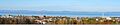
Panorama of Rivière-du-Loup's skyline
See also
 In Spanish: Rivière-du-Loup para niños
