Rivière aux Mélèzes facts for kids
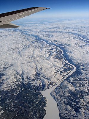
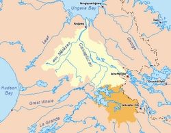
The Rivière aux Mélèzes is a river located in Nunavik, a northern part of Quebec, Canada. It's also known as the Larch River. In the Inuktitut language, the local people call it Kuuvik. This river forms a major part of the large Koksoak River system. Another important river that feeds into the Koksoak is the Caniapiscau River, which is to the south.
Contents
What's in a Name? The Larch River
The name "Larch River" comes from the special larch trees found here. These trees grow in the river's sheltered valley. This is amazing because the valley is about 400 kilometres (250 miles) north of where most trees can grow! Beyond this sheltered spot, the land is mostly open tundra. Tundra is a cold, treeless plain.
Life Around the Larch River
The area around the Larch River is very remote. It is mostly covered by sparse tundra. This means very few people live there, not even the Inuit people who live in other parts of Nunavik.
The land here is quite flat. It doesn't rise much higher than 300 metres (about 980 feet) above sea level. This is because of the intense glaciation that happened a long time ago. Glaciation means the land was covered by huge sheets of ice. Even after the ice melted, the land slowly rose, a process called post-glacial rebound.
Weather and Climate
The climate around the Larch River is polar. This means it's very cold! Temperatures in January are usually around -20 degrees Celsius (-4 degrees Fahrenheit). In July, the warmest month, temperatures are about 8 degrees Celsius (46 degrees Fahrenheit).
How the River Changed Direction
Scientists believe the Larch River used to flow into Hudson Bay a very long time ago. This was before the Pleistocene epoch, which was a period of Earth's history known for its ice ages.
For about 90% of the Quaternary period (the last 2.6 million years), Nunavik was covered by massive glaciers. These ice sheets were up to four kilometres (2.5 miles) thick! When these glaciers melted during brief warm periods, they left behind ice jams or piles of rock and dirt called moraines. These natural barriers stopped the river from flowing west towards Hudson Bay. Because of this, during these short periods of melting ice, the Larch River started flowing into the Koksoak River instead.
 | Kyle Baker |
 | Joseph Yoakum |
 | Laura Wheeler Waring |
 | Henry Ossawa Tanner |


