Caniapiscau River facts for kids
Quick facts for kids Caniapiscau River |
|
|---|---|

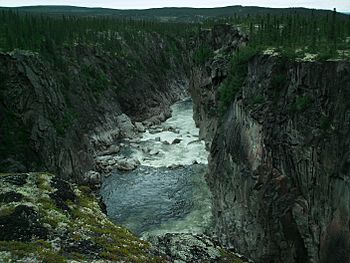
Eaton Canyon
|
|

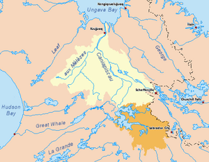
Drainage basin of the Koksoak River in yellow. Diverted basin of the Caniapiscau River in orange
|
|
| Country | Canada |
| Province | Quebec |
| Region | Nord-du-Québec |
| Physical characteristics | |
| Main source | Lake Sevestre 638 m (2,093 ft) 52°32′23″N 68°01′15″W / 52.53972°N 68.02083°W |
| River mouth | Koksoak River About 80 km SW from Kuujjuaq 20 m (66 ft) 57°40′18″N 69°29′12″W / 57.67167°N 69.48667°W |
| Length | 737 km (458 mi) |
The Caniapiscau River is a long river in Nunavik, Quebec, Canada. It flows into the Koksoak River. In the Cree language, its name means rocky point.
The river starts from Lac Sevestre, which is about 53 kilometers (33 miles) southwest of Fermont. It flows north through a wide valley with trees. Then, it makes a sharp turn where it meets the Rivière aux Mélèzes (Larch River). At this meeting point, the river changes its name and becomes the Koksoak River. The Caniapiscau River is about 737 kilometers (458 miles) long.
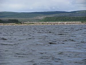
Since 1985, some of the water from the Caniapiscau River's starting point has been sent to the La Grande hydroelectric complex. This means about 45% of the river's water now flows into the La Grande River towards James Bay. The Caniapiscau Reservoir was created, which is a huge lake covering about 4,300 square kilometers (1,700 square miles). This is about nine times bigger than the natural Lake Caniapiscau used to be. The total area that collects water for the river is about 36,800 square kilometers (14,200 square miles).
Between 1981 and 1984, while the Caniapiscau Reservoir was being filled, the river's water levels changed a lot. These changes might have played a part in a sad event in September 1984. A large number of migratory woodland caribou (about 9,600 of them) drowned at Chute du Calcaire (Limestone Falls). This was about 1.5% of the George River caribou herd at the time.
There are no people living permanently along the Caniapiscau River. However, Cree people from the James Bay area and other hunters visit the region. They travel by small planes or use the Trans-Taiga Road. Sometimes, people who enjoy canoeing also explore the river.
Contents
River's Name: What it Means
The name of the Caniapiscau River has changed over time. In 1820, James Clouston, who worked for the Hudson's Bay Company, called it the Caniapuscaw River. This was written in his diary and on his map. Later, in 1828, explorer William Hendry called it Canniappuscaw.
In 1898, a geologist named Albert Peter Low used the spelling Kaniapiskau. By the middle of the 1900s, the spelling we use today became common. The Inuit people have their own names for the river, like Adlait Kuunga or Allait Kuunga, which means "Indian River". It was also known as the Wauguash River.
Amazing Waterfalls and Canyons
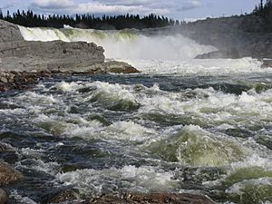
The Caniapiscau River has many beautiful waterfalls and deep canyons. These are natural wonders that show the power of the river. Some of the notable ones include:
- Chute de Facolli
- Chute Chambeaux
- Upper Gorge
- Gorge d'en Bas (Lower Gorge)
- Eaton Canyon
- Chute au Granite
- Chute aux Schistes
- Chute de la Pyrite
- Chute du Calcaire
- Manitou Gorge
Rivers that Join the Caniapiscau
Many smaller rivers flow into the Caniapiscau River. These are called tributaries. They add water to the main river as it flows north. Some of these tributaries are:
- Rivière Bras de Fer
- Rivière du Sable
- Goodwood River
- Rivière Sérigny
- Rivière Pons
- Rivière Beurling
- Rivière de la Mort
- Rivière Châteauguay
- Swampy Bay River
- Situraviup River
- Forbes River
See also
 In Spanish: Río Caniapiscau para niños
 | Charles R. Drew |
 | Benjamin Banneker |
 | Jane C. Wright |
 | Roger Arliner Young |


