Riviera Beach, Maryland facts for kids
Quick facts for kids
Riviera Beach, Maryland
|
|
|---|---|
| Motto(s):
Where bay, river, and creek meet
|
|

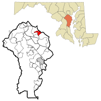
Location of Riviera Beach, Maryland
|
|
| Country | |
| State | |
| County | |
| Area | |
| • Total | 3.21 sq mi (8.31 km2) |
| • Land | 2.63 sq mi (6.81 km2) |
| • Water | 0.58 sq mi (1.49 km2) |
| Elevation | 10 ft (3 m) |
| Population
(2020)
|
|
| • Total | 12,384 |
| • Density | 4,708.75/sq mi (1,817.78/km2) |
| Time zone | UTC−5 (Eastern (EST)) |
| • Summer (DST) | UTC−4 (EDT) |
| ZIP codes |
21122-21123
|
| Area code(s) | 410 |
| FIPS code | 24-66850 |
| GNIS feature ID | 0591144 |
Riviera Beach is a community in Anne Arundel County, Maryland, United States. It is known as a census-designated place (CDP). This means it is a special area used by the government for counting people. In 2020, about 12,384 people lived here.
Contents
History of Riviera Beach
In the past, some communities in Maryland used rules to keep certain groups of people from living there. These rules were called "racially restrictive covenants." They were used to stop African-Americans and other minority groups from buying homes.
For example, an advertisement from 1928 for houses in Riviera Beach called it a "refined, restricted" neighborhood. This meant that only certain people were allowed to live there. These types of rules are now illegal because of the Fair Housing Act of 1968. This law made sure everyone has a fair chance to buy a home.
Geography of Riviera Beach
Riviera Beach is located at 39°09′43″N 76°31′05″W / 39.162008°N 76.517982°W. It sits on the southwest shore of the Patapsco River. This river is a tidal waterway, meaning its water level changes with the ocean tides. The Patapsco River also forms the harbor for the city of Baltimore to the northwest.
The community is surrounded by two smaller tidal waterways. To the southeast, you will find Rock Creek. To the northwest, there is Stoney Creek. Both of these are inlets of the Patapsco River.
According to the United States Census Bureau, Riviera Beach covers a total area of about 8.3 square kilometers (3.2 square miles). Most of this area is land, about 6.8 square kilometers (2.6 square miles). The rest, about 1.5 square kilometers (0.58 square miles), is water. This means about 18% of the area is water.
People of Riviera Beach
| Historical population | |||
|---|---|---|---|
| Census | Pop. | %± | |
| 1950 | 1,849 | — | |
| 1960 | 4,902 | 165.1% | |
| 1970 | 7,464 | 52.3% | |
| 1980 | 8,812 | 18.1% | |
| 1990 | 11,376 | 29.1% | |
| 2000 | 12,695 | 11.6% | |
| 2010 | 12,677 | −0.1% | |
| 2020 | 12,384 | −2.3% | |
| U.S. Decennial Census | |||
The census is a count of people living in an area. In 2000, there were 12,677 people living in Riviera Beach. These people lived in 4,817 households, and 3,373 of these were families.
Population Density
The population density tells us how many people live in a certain amount of space. In 2000, there were about 4,760 people per square mile (1,818 people per square kilometer). There were also 5,098 housing units. A housing unit is a house, apartment, or other place where people live.
Diversity of Residents
Most of the people in Riviera Beach in 2000 were White, making up about 91.6% of the population. About 4.1% were African American. Other groups included Native American (0.2%), Asian (1.1%), and people from two or more races (2.3%). About 2.8% of the population was Hispanic or Latino.
Households and Families
In 2000, about 29.9% of households had children under 18 living with them. About 51.9% were married couples living together. About 12.5% of households had a female head of household with no husband present. Around 30% of households were not families.
About 22.7% of all households were made up of just one person. About 7.7% of these single-person households had someone aged 65 or older living alone. The average household had 2.63 people. The average family had 3.08 people.
Age Distribution
The population of Riviera Beach was spread out by age in 2000. About 22.8% of the people were under 18 years old. About 6.0% were between 18 and 24 years old. The largest group, 29.4%, was between 25 and 44 years old.
About 27.6% were between 45 and 64 years old. Finally, 11.9% of the population was 65 years of age or older. The median age was 37.3 years. This means half the people were younger than 37.3 and half were older.
Income Levels
In 2000, the median income for a household in Riviera Beach was $79,645. The median income for a family was $82,567. "Median income" means that half the households or families earned more than this amount, and half earned less.
Males had a median income of $59,861, while females had a median income of $44,379. The per capita income for the area was $33,507. This is the average income per person.
About 3% of families and 5.5% of the total population lived below the poverty line. This includes about 6.8% of those under 18 and 7.9% of those aged 65 or older. The poverty line is a level of income that is considered too low to meet basic needs.
See also
 In Spanish: Riviera Beach (Maryland) para niños
 | Emma Amos |
 | Edward Mitchell Bannister |
 | Larry D. Alexander |
 | Ernie Barnes |


