Robertson, Queensland facts for kids
Quick facts for kids RobertsonBrisbane, Queensland |
|||||||||||||||
|---|---|---|---|---|---|---|---|---|---|---|---|---|---|---|---|

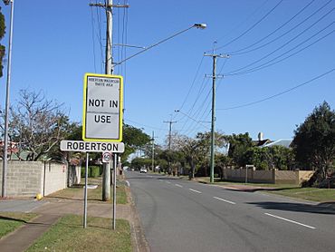
Robertson sign on Musgrave Road, 2018
|
|||||||||||||||
| Population | 4,749 (2021 census) | ||||||||||||||
| • Density | 2,790/km2 (7,200/sq mi) | ||||||||||||||
| Postcode(s) | 4109 | ||||||||||||||
| Area | 1.7 km2 (0.7 sq mi) | ||||||||||||||
| Time zone | AEST (UTC+10:00) | ||||||||||||||
| Location | 13.7 km (9 mi) S of Brisbane CBD | ||||||||||||||
| LGA(s) | City of Brisbane (MacGregor Ward) |
||||||||||||||
| State electorate(s) | Toohey | ||||||||||||||
| Federal Division(s) | Moreton | ||||||||||||||
|
|||||||||||||||
Robertson is a suburb located in the southern part of Brisbane, Queensland, Australia. It's a place where many people live, mostly in houses. In 2021, about 4,749 people called Robertson home.
Contents
Exploring Robertson's Location
Robertson is about 13.7 kilometers (8.5 miles) south-east of the Brisbane CBD (the city center). You can get there easily by road using the M3 Freeway.
The suburb has clear boundaries. Kessels Road is to the north, Mains Road is to the east, and McCullough Street is to the south. Troughton Road forms the western edge. Most of the land in Robertson is used for homes.
Robertson's Past: A Brief History
Robertson got its name on August 1, 1967. It was named after Doctor William Nathaniel Robertson (1866-1938). He was an important person at the University of Queensland. He also helped start the Royal Australasian College of Surgeons.
In the mid-1960s, Robertson was part of a larger area called Sunnybank. There was even a drive-in movie theater where Musgrave and Troughton Roads met.
A big shopping center called Sunnybank Plaza opened in 1975. It was in the south-east part of Robertson. Later, in 1980, Robertson State School opened in the middle of the suburb.
The number of people living in Robertson grew a lot between 1976 and 1986. This happened as the Nathan campus of Griffith University (which opened in 1975) became bigger. By 2002, the primary school had over 600 students!
Sunnybank Plaza was updated and made larger in 1989 and 1995. It grew to 30,000 square meters. It now has a Kmart, supermarkets, movie theaters, and many other shops.
Robertson State School welcomed its first 124 students on January 29, 1980. A preschool center opened shortly after. By 1987, the school had grown to 600 students.
Learning in Robertson
Robertson State School: Primary Education
Robertson State School is a public primary school for students from Prep to Year 6. It's located at 688 Musgrave Road. In 2020, the school had 728 students. It also has a special program for students who need extra support.
This school is known for its strong academic results. Many students (78%) come from homes where a language other than English is spoken.
High School Options for Students
Robertson itself does not have any high schools. Students usually go to nearby schools like Sunnybank State High School or MacGregor State High School. However, some students choose other well-known schools in Brisbane. These include Brisbane State High School and Mansfield State High School.
Getting Around: Public Transport
Robertson has good public transport options. The Brisbane City Council operates bus lines 130 and 140. These buses run along Mains Road at the 'Mains Road at Robertson bus stop'. They are part of the 'Bus Upgrade Zone' (BUZ) services. This means they run very often, so you usually don't need a timetable!
Robertson's Population Over Time
The number of people living in Robertson has changed over the years. Here's a quick look:
| Year | Population |
|---|---|
| 1976 | 945 |
| 1981 | 2434 |
| 1991 | 3815 |
| 2001 | 4309 |
| 2006 | 4751 |
| 2011 | 4867 |
| 2016 | 4973 |
| 2021 | 4749 |
In 2016, Robertson had 4,973 people. About half were female and half were male. The average age of people living there was 32 years old. Children aged 0 to 14 made up 14% of the population. People aged 65 and over made up 15.6%. By 2021, the population was 4,749 people.
 | Selma Burke |
 | Pauline Powell Burns |
 | Frederick J. Brown |
 | Robert Blackburn |


