Coopers Plains, Queensland facts for kids
Quick facts for kids Coopers PlainsBrisbane, Queensland |
|||||||||||||||
|---|---|---|---|---|---|---|---|---|---|---|---|---|---|---|---|

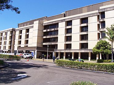
Queen Elizabeth II Jubilee Hospital, 2008
|
|||||||||||||||
| Population | 5,675 (2021 census) | ||||||||||||||
| • Density | 1,351/km2 (3,500/sq mi) | ||||||||||||||
| Postcode(s) | 4108 | ||||||||||||||
| Area | 4.2 km2 (1.6 sq mi) | ||||||||||||||
| Time zone | AEST (UTC+10:00) | ||||||||||||||
| Location | 14.0 km (9 mi) S of Brisbane CBD | ||||||||||||||
| LGA(s) | City of Brisbane (Moorooka Ward) |
||||||||||||||
| State electorate(s) |
|
||||||||||||||
| Federal Division(s) | Moreton | ||||||||||||||
|
|||||||||||||||
Coopers Plains is a suburb located in the southern part of Brisbane, Queensland, Australia. It is a place where people live, work, and go to school. In 2021, about 5,675 people called Coopers Plains home.
Contents
Exploring Coopers Plains
Coopers Plains is about 11 kilometers (7 miles) southwest of Brisbane's city center. It's also where the Queen Elizabeth II Jubilee Hospital is located.
A Look Back in Time: Coopers Plains History
How Coopers Plains Got Its Name
Coopers Plains was first called Cowper's Plains. It was likely named by Patrick Logan after Dr. Henry Cowper, who was a surgeon at the Moreton Bay Penal Settlement. A small settlement for convicts was set up here in 1828. Over time, the name changed. By 1860, it was known as Cooper's Plains, and by 1877, it became Coopers Plains, as we know it today.
Early Developments and Growth
The first post office in Coopers Plains opened in 1876, making it easier for people to send and receive mail.
In 1885, the Coopers Plains railway station opened. This was on the South Coast railway line, which is now called the Beenleigh line. The railway helped the area grow by connecting it to other places.
Land was often advertised for sale in the late 1800s. Estates like "Flemington Estate," "The Orange Grove Estate," and "The Homebush Estate" offered many blocks of land for people to buy and build homes. These advertisements often highlighted how close the land was to the railway station and other services.
Schools and Community Buildings
Orange Grove State School opened its doors on June 27, 1931. This school was later renamed Coopers Plains State School in 1965.
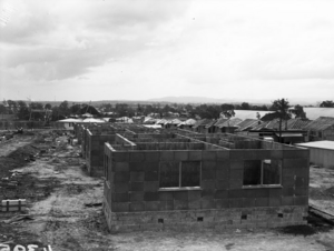
For many years, Coopers Plains was mostly a rural area with farms. This changed in the 1940s during World War II. The United States Army built barracks (living quarters for soldiers) near the railway station in 1942. After the war, these barracks became the Australian Army's Damour Barracks.
A church hall was built in 1928 at 30 Beaton Street. It was used by different Protestant churches and was known as Station United Protestant Church because it was near the railway station. Later, in 1950, the Anglican Church bought the building. It was then sold to the Egyptian Coptic Church in 1986 and renamed St Mary & St Joseph's Coptic Orthodox Church.
In 1975, several churches joined together to form St Davids Coopers Plains Uniting Church.
The Coopers Plains Library opened in 1979, giving residents a place to read and learn. It was updated in 2014.
Who Lives in Coopers Plains?
In 2021, Coopers Plains had a population of 5,675 people. The median age was 34 years old. Many people living here were born in Australia (57%). Other countries of birth included India, China, New Zealand, the Philippines, and England.
Most people (61.9%) spoke only English at home. Other languages spoken included Mandarin, Cantonese, Vietnamese, Hindi, and Punjabi. The most common religious groups were "no religion," Catholic, and Anglican.
Learning in Coopers Plains
Coopers Plains State School is a government primary school for students from Prep to Year 6. It is located at 61 Orange Grove Road. In 2017, the school had 184 students.
Important Facilities
The Health and Food Sciences Precinct (HFSP) opened in 2010. This is a research center for health and food science. It includes the Queensland Centre for Emerging Infectious Diseases (QCEID). This precinct is used by different organizations for research, including the Queensland Department of Agriculture, Fisheries and Forestry, CSIRO, and Queensland University.
Community Amenities
The Brisbane City Council runs a public library at 107 Orange Grove Road. It's a great place for everyone to find books and information.
St Davids Coopers Plains Uniting Church is located at 68 Orange Grove Road. It serves as a place of worship for the community.
Getting Around: Transport in Coopers Plains
Coopers Plains has several bus routes that help people travel around. These include routes like 120 (City – Garden City), 135 (City – Parkinson), and the Great Circle Line (598 and 599). The suburb is also very close to the Griffith University Nathan Campus, making it easy for students to get there.
 | Isaac Myers |
 | D. Hamilton Jackson |
 | A. Philip Randolph |


