Salisbury, Queensland facts for kids
Quick facts for kids SalisburyBrisbane, Queensland |
|||||||||||||||
|---|---|---|---|---|---|---|---|---|---|---|---|---|---|---|---|

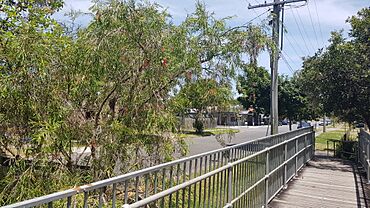
Ainsworth Street, 2022
|
|||||||||||||||
| Population | 6,790 (2021 census) | ||||||||||||||
| • Density | 1,476/km2 (3,820/sq mi) | ||||||||||||||
| Postcode(s) | 4107 | ||||||||||||||
| Area | 4.6 km2 (1.8 sq mi) | ||||||||||||||
| Time zone | AEST (UTC+10:00) | ||||||||||||||
| Location | 13 km (8 mi) S of Brisbane CBD | ||||||||||||||
| LGA(s) | City of Brisbane (Moorooka Ward) |
||||||||||||||
| State electorate(s) | Toohey | ||||||||||||||
| Federal Division(s) | Moreton | ||||||||||||||
|
|||||||||||||||
Salisbury is a lively suburb located south of Brisbane, in Queensland, Australia. It's home to about 6,790 people, according to the 2021 Census.
Contents
Discovering Salisbury's Location
Salisbury is about 12.4 kilometers (7.7 miles) south of Brisbane's main post office. You'll find Toohey Mountain and its reserve on the north-east edge of Salisbury. Today, Salisbury is a mix of homes and businesses. It also has many large park areas in its northern part.
Salisbury's Past: A Quick Look
Salisbury got its name from the home of William Coote. He was an early engineer, architect, and journalist in Brisbane. People think the name comes from Salisbury in England.
Early Transport and Growth
The Beenleigh railway line opened in 1885. It included the Salisbury railway station to serve the area. This helped the area grow.
Land sales started happening around the railway station. For example, the Salisbury Township Estate was sold in 1912. It offered 442 blocks of land. Later, in 1918, the Mountain View Estate was auctioned. It had larger blocks, some up to two acres. These areas were advertised as being high up and near the proposed State School.
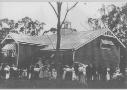
Salisbury State School first opened its doors on May 27, 1920. More land for homes was sold nearby in 1921. The Waratah Heights Estate also sold 90 suburban lots in 1924.
Salisbury During World War II
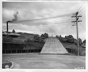
Salisbury was mostly rural until World War II. Because it was a bit out of the way, several factories were built there. In November 1941, the Rocklea Munitions Works opened. This factory made ammunition for the Australian Army. The buildings were even camouflaged to hide them from above. This was the biggest construction project in Queensland during the war.
By late 1943, the factory stopped making ammunition. It was then used to fix engines for the US Army Air Force. These planes were fighting in the South-West Pacific.
To help workers get to these factories, the tram line was extended to Evans Road in 1941. However, Brisbane's tram services stopped completely in 1969.
Post-War Development and Schools
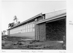
Salisbury State High School opened on February 2, 1954. It was located on a large piece of land. In 1997, it joined with another school to become Nyanda State High School. This school later closed in 2013.
After the war, many more homes were built in Salisbury. The area grew quickly from the 1960s. Roads were also improved to connect Salisbury to other areas.
St Pius X Catholic School opened in 1964. It was started by Father Frank Costello. The school was first run by the Sisters of St Joseph of the Sacred Heart. Later, it came under lay leadership.
Nyanda Station, a train station north of Salisbury, closed in 1978. This happened because of new electric trains. The stations were too close together for the new trains to stop safely.
Southside Christian College started in 1985 with 16 primary students. In 2011, it changed its name to Brisbane Christian College. In 2015, the college bought the old Nyanda State High School site for its middle and senior school students.
St Mary Magdalene Anglican Church was dedicated in 1997. It replaced an old World War II army hut. However, due to fewer people attending, its last service was in 2014.
Who Lives in Salisbury?
In 2021, Salisbury had a population of 6,790 people. In 2016, the median age was 35 years. This was three years younger than the average for Australia. Most people (67.8%) living in Salisbury were born in Australia. Other countries of birth included India, New Zealand, and England. Most people spoke only English at home. Other languages spoken included Mandarin, Cantonese, and Punjabi.
Historical Places in Salisbury
Salisbury has several sites that are listed as heritage places. These are important historical locations. Many of them are former parts of the Rocklea Munitions Works from World War II. Some examples include:
- 45 Assembly Street: Former Shell Machining Shop & Air Raid Shelter
- 9 Chrome Street: Former Oil Store and Lead Press
- 18 Chrome Street: Former S.A.A. Mess
- 100A Dollis Street: Salisbury Railway Station ticket office & footbridge (part)
- 50 Evans Road: Former Chronograph House & Velocity Range Building
- 32 Industries Road: Former Magazine 8A
What Can You Find in Salisbury?
Salisbury has many useful places and facilities. These include:
- Toohey Forest and Toohey Mountain
- The Construction Training Centre
- SkillsTech Australia (Salisbury Campus)
- Brisbane Christian College
- Life Church
- Russ Hall Park
You'll also find local schools, shops, aged care facilities, clubs, and sports areas. The suburb has a railway station and many bus routes. These connect Salisbury to Brisbane's city center and nearby areas.
Salisbury railway station offers regular train services. You can travel to Brisbane and Beenleigh. The book publishing company Boolarong Press also has its main office here.
Parks in Salisbury
Salisbury has many public parks where you can relax and play. Some of these include:
- Assembly Street Park
- Bill Moore Park
- Kellett Road Park
- Lillian Avenue Park
- Rosebank Square Park
- Russ Hall Park
- Salisbury Reserve
Learning in Salisbury
Salisbury has several schools for different age groups.
Salisbury State School is a government primary school for students from Prep to Year 6. It's located on Cripps Street. In 2017, it had 256 students.
St Pius X School is a Catholic primary school for Prep to Year 6 students. It's on Golda Avenue. In 2019, the school had 150 students.
Brisbane Christian College is a private school that teaches students from Prep all the way to Year 12. It has two campuses:
- Its Prep-5 campus is on Golda Avenue.
- Its Year 6-12 campus is on Fairlie Terrace.
In 2017, the college had 820 students.
There isn't a government high school right in Salisbury. Students usually go to nearby high schools like:
- Holland Park State High School
- Sunnybank State High School
- Yeronga State High School
Getting Around Salisbury
Train Services
Commuter trains on the Beenleigh line stop at Salisbury railway station. There's also a plan being looked at by the government for a new passenger train service. This service would go from Salisbury to Beaudesert.
Bus Services
Salisbury is served by Transport for Brisbane buses. These buses connect Salisbury to many places, including:
- QE2 Hospital and the City
- Garden City and the City
- Fortitude Valley
- Sunnybank
- Inala
- Calamvale
- Acacia Ridge and Woolloongabba
Salisbury is located in Translink zone 2 for public transport.
Homes in Salisbury
Most homes in Salisbury are detached houses. They come in different sizes. You can find traditional Queenslander style homes on larger blocks. There are also modern homes on smaller blocks. The area is changing, and many families are choosing to live here.
Main Roads in Salisbury
Salisbury has four main roads that run through the suburb:
- Metroad 2 (Kessels/Riawena Roads) to the south.
- National Route 13 (Beaudesert Road) to the west.
- State Route 11 (Orange Grove Road) to the west.
- State Route 20 (Evans Roads) to the north.
Images for kids
 | William L. Dawson |
 | W. E. B. Du Bois |
 | Harry Belafonte |


