
Rochester, Kentucky facts for kids
Quick facts for kids
Rochester, Kentucky
|
|
|---|---|

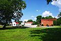
Rochester
|
|

Location of Rochester in Butler County, Kentucky.
|
|
| Country | United States |
| State | Kentucky |
| County | Butler |
| Incorporated | 1839 |
| Area | |
| • Total | 0.49 sq mi (1.28 km2) |
| • Land | 0.47 sq mi (1.21 km2) |
| • Water | 0.03 sq mi (0.07 km2) 5.46% |
| Elevation | 417 ft (127 m) |
| Population
(2020)
|
|
| • Total | 114 |
| • Density | 244.64/sq mi (94.54/km2) |
| Time zone | UTC-6 (CST) |
| • Summer (DST) | UTC-5 (CDT) |
| ZIP code |
42273
|
| Area code(s) | 270 & 364 |
| FIPS code | 21-65982 |
| GNIS feature ID | 0502100 |
Rochester is a small city in Butler County, Kentucky, United States. It is located where the Green River and Mud River meet. This meeting point is called a "confluence." In 2020, the city had a population of 114 people.
Contents
History of Rochester
Rochester started as an early settlement known as "The Mouth." This name came from its important location where the Green and Mud rivers join together.
How Rochester Got Its Name
In the early 1800s, a settler named Thomas Riddick tried to start a town here called "Suffolk." However, that town did not succeed. Rochester was officially established in the 1830s and became an incorporated city in 1839.
The city is connected to the Rochester family. A book from around 1889, “The House of Rochester in Kentucky” by Mrs. Agatha Rochester Strange, says that William Strother Lewis McDowell helped settle Rochester, Kentucky. He did this with the help and guidance of his mother, Nancy “Ann” Jordan Rochester.
Geography of Rochester

Rochester is located in the western part of Butler County. Its coordinates are 37°12′39″N 86°53′33″W. The Green River forms Rochester's northwestern border and also separates it from Ohio County.
A small part of the city's western edge is along the Mud River. This river also marks the border with Muhlenberg County.
Roads and Rivers
Kentucky Route 70 (Rochester Road) goes through the city. It leads east about 14 miles (23 km) to Morgantown, which is the main town in Butler County. To the west, it goes about 10 miles (16 km) to Drakesboro.
Kentucky Route 369 starts in Rochester and heads north. It crosses the Green River using the Rochester Ferry. This route continues north about 14 miles (23 km) to Beaver Dam.
The Rochester Dam is located on the Green River, just west of Rochester.
Land and Water Area
According to the United States Census Bureau, Rochester covers a total area of about 0.49 square miles (1.3 km²). Of this, about 0.03 square miles (0.07 km²), or 5.46%, is water.
Population and People
| Historical population | |||
|---|---|---|---|
| Census | Pop. | %± | |
| 1850 | 56 | — | |
| 1860 | 151 | 169.6% | |
| 1870 | 228 | 51.0% | |
| 1880 | 189 | −17.1% | |
| 1890 | 510 | 169.8% | |
| 1900 | 431 | −15.5% | |
| 1910 | 437 | 1.4% | |
| 1920 | 415 | −5.0% | |
| 1930 | 371 | −10.6% | |
| 1940 | 387 | 4.3% | |
| 1950 | 372 | −3.9% | |
| 1960 | 314 | −15.6% | |
| 1970 | 252 | −19.7% | |
| 1980 | 289 | 14.7% | |
| 1990 | 191 | −33.9% | |
| 2000 | 186 | −2.6% | |
| 2010 | 152 | −18.3% | |
| 2020 | 114 | −25.0% | |
| U.S. Decennial Census | |||
In the year 2000, there were 186 people living in Rochester. These people made up 81 households and 57 families. The city had about 424 people per square mile (164 per km²).
Who Lives in Rochester?
All the people living in Rochester in 2000 were White.
About 23.5% of the households had children under 18 living with them. Most households (59.3%) were married couples. About 8.6% of households were led by a female without a husband present. Nearly 30% of households were not families.
About 27% of all households were individuals living alone. Almost 20% of households had someone aged 65 or older living by themselves. On average, there were 2.30 people per household and 2.75 people per family.
Age and Income
In 2000, the population of Rochester was spread out by age. About 20.4% were under 18 years old. About 22.6% were 65 years or older. The average age in the city was 49 years.
The median income for a household in Rochester was $31,250. For families, the median income was $33,472. The average income per person in the city was $36,708.
About 9% of families and 8.7% of the total population lived below the poverty line. This included 13.3% of those aged 65 or older.
Images for kids
-
Rochester
-

Location of Rochester in Butler County, Kentucky.
See also
 In Spanish: Rochester (Kentucky) para niños
