Rock, Kansas facts for kids
Quick facts for kids
Rock, Kansas
|
|
|---|---|

|
|
| Country | United States |
| State | Kansas |
| County | Cowley |
| Elevation | 1,175 ft (358 m) |
| Population
(2020)
|
|
| • Total | 94 |
| Time zone | UTC-6 (CST) |
| • Summer (DST) | UTC-5 (CDT) |
| ZIP code |
67131
|
| Area code | 620 |
| FIPS code | 20-60400 |
| GNIS ID | 470206 |
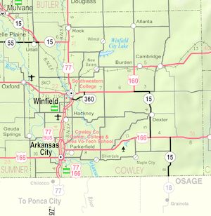
Rock is a small community in Cowley County, Kansas, United States. It is called a census-designated place (CDP). This means it is a place that the government counts as a community for population statistics, even if it's not officially a city or town. In 2020, 94 people lived there.
Contents
Discovering Rock's Past
Rock has an interesting history, from its early days with a post office to important events that shaped the community.
Early Days: 19th Century History
The first post office in Rock opened a long time ago, on August 12, 1870. This was an important step for the community, helping people send and receive mail.
Later, in 1877, a railroad company called the Florence, El Dorado, and Walnut Valley Railroad Company built a train line. This line connected nearby towns like Florence and El Dorado. By 1881, the line was made longer, reaching Douglass and then Arkansas City.
The Atchison, Topeka and Santa Fe Railway company used and managed this train line. It helped people and goods travel between many towns, including Rock, Burns, Augusta, and Winfield. However, the part of the line from Florence to El Dorado was no longer used after 1942.
Key Events in the 20th Century
In 1905, a special bridge called the Bucher Bridge was built near Rock. This bridge is now listed on the National Register of Historic Places, which means it's an important historical site.
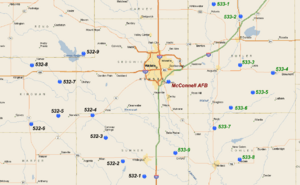
A significant event happened on August 24, 1978. There was a large chemical spill at a Titan II ICBM site located about 2.5 miles south of Rock. This incident caused the community to be evacuated for safety. The site was part of a military base located about 20 miles away.
Rock in the 21st Century
More recently, in 2010, the Keystone XL Pipeline was built about 2.5 miles west of Rock. This pipeline runs from north to south through Butler County. Its construction brought up discussions about tax rules and worries about the environment, especially if there were ever a leak. A pumping station for the pipeline, named Rock, was also built nearby.
Rock's Population: Demographics
The population of Rock is counted by the U.S. Decennial Census every ten years.
| Historical population | |||
|---|---|---|---|
| Census | Pop. | %± | |
| 2020 | 94 | — | |
| U.S. Decennial Census | |||

Learning in Rock: Education
Students in Rock attend public schools that are part of the Udall USD 463 school district.
 | Precious Adams |
 | Lauren Anderson |
 | Janet Collins |


