Rockham, South Dakota facts for kids
Quick facts for kids
Rockham, South Dakota
|
|
|---|---|

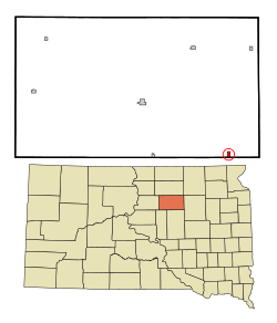
Location in Faulk County and the state of South Dakota
|
|
| Country | United States |
| State | South Dakota |
| County | Faulk |
| Platted | 1886 |
| Area | |
| • Total | 0.50 sq mi (1.29 km2) |
| • Land | 0.50 sq mi (1.29 km2) |
| • Water | 0.00 sq mi (0.00 km2) |
| Elevation | 1,401 ft (427 m) |
| Population
(2020)
|
|
| • Total | 22 |
| • Density | 44.18/sq mi (17.06/km2) |
| Time zone | UTC-6 (Central (CST)) |
| • Summer (DST) | UTC-5 (CDT) |
| ZIP code |
57470
|
| Area code(s) | 605 |
| FIPS code | 46-55540 |
| GNIS feature ID | 1267553 |
Rockham is a small town located in Faulk County, South Dakota, in the United States. It's found near U.S. Route 212. Long ago, it was an important stop on the old Chicago and North Western Railway. In 2020, about 22 people lived in Rockham.
Contents
A Look Back: Rockham's History
Rockham was officially planned and mapped out in 1886. This process is called 'platting'. The town got its name from a city in Australia called Rockhampton. A post office has been open in Rockham since 1887.
Early Development
In 1886, the Chicago & North Western Railway built a train track. This track went from Redfield to Faulkton. Rockham was started as a stop along this new railway line that same year. It was built on land first settled by Anders Opperud. The town officially became a city on March 4, 1909.
Rockham's first school was the F.M. Brown School, built in 1884. Later, the Rockham Public School was built in 1915. The town got its first telephone service in 1903. Electricity was brought to the city in 1919.
Challenges and Changes
In 1925, a tornado caused damage to the Rockham Public School. In 1970, the Chicago & North Western Railway stopped using its train line. This meant Rockham no longer had train service for moving things like grain. The Rockham Public School closed its doors in 1972.
Centennial Celebration
Rockham celebrated its 100th birthday, or centennial, from July 4 to 6, 1986. It was a special event for the town.
Geography: Where is Rockham?
Rockham is a small town. According to the United States Census Bureau, the town covers an area of about 0.50 square miles (1.29 square kilometers). All of this area is land.
Population: Who Lives in Rockham?
| Historical population | |||
|---|---|---|---|
| Census | Pop. | %± | |
| 1910 | 286 | — | |
| 1920 | 347 | 21.3% | |
| 1930 | 288 | −17.0% | |
| 1940 | 220 | −23.6% | |
| 1950 | 113 | −48.6% | |
| 1960 | 197 | 74.3% | |
| 1970 | 60 | −69.5% | |
| 1980 | 52 | −13.3% | |
| 1990 | 48 | −7.7% | |
| 2000 | 53 | 10.4% | |
| 2010 | 33 | −37.7% | |
| 2020 | 22 | −33.3% | |
| U.S. Decennial Census | |||
The number of people living in Rockham has changed a lot over the years. In 1920, the town had its largest population with 347 residents. Since then, the population has generally decreased. By 2020, only 22 people lived there.
More About the 2010 Population
In 2010, there were 33 people living in Rockham. These people lived in 13 different homes. Six of these homes were families. The town had about 66 people per square mile. All the residents were White.
About 23% of the homes had children under 18 living there. Nearly half, 46%, were married couples. About 38% of homes were single individuals. Some of these individuals, 15%, were 65 years or older and lived alone. The average home had about 2.5 people. The average family had 4 people.
The average age of people in Rockham in 2010 was 34.5 years. About 36% of residents were under 18. About 15% were between 25 and 44 years old. Another 27% were between 45 and 64. About 21% were 65 or older. More males lived in Rockham than females. About 60% were male and 39% were female.
See also
 In Spanish: Rockham (Dakota del Sur) para niños
 | Mary Eliza Mahoney |
 | Susie King Taylor |
 | Ida Gray |
 | Eliza Ann Grier |

