Rodophil, Virginia facts for kids
Quick facts for kids
Rodophil, Virginia
|
|
|---|---|

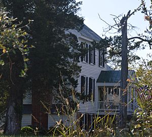
Front of Ingleside, a historic home at 10920 Rodophil Road
|
|
| Country | United States |
| State | Virginia |
| County | Amelia |
| Elevation | 456 ft (139 m) |
| Time zone | UTC−5 (Eastern (EST)) |
| • Summer (DST) | UTC−4 (EDT) |
| ZIP codes |
23002, 23083
|
| Area code(s) | 804 |
| GNIS feature ID | 1477694 |
Rodophil is a small, rural community in western Amelia County, Virginia. It is not a city or town, but an unincorporated community, meaning it's a group of homes and businesses without its own local government. Rodophil is located where two roads, State Route 616 and State Route 620, meet. It is served by the local volunteer fire department and is part of a long bicycle route that goes through Virginia.
Contents
History of Rodophil
How Rodophil Got Its Name
An old map from 1820 showed this small village as "China Grove." Later, it was renamed to honor Rodophil Jeter (1765-1843). He was an important person in Amelia County. He owned land in the area and represented the county in the state government in the early 1800s. Another nearby community, Jetersville, was also named after his family. Sometimes, in older records, the name "Rodophil" was spelled a bit differently, like "Rhodophil" or "Rodolphil."
Early Post Office Services
Rodophil had its own post office by 1835. This building might have been located on Route 620, near the entrance to Ingleside, just north of Route 616. In the late 1800s, there were tens of thousands of these small post offices across the American countryside. Rodophil was still called a "post village" or "post-station" even into the 1920s. However, many of these small post offices closed in the early 1900s. This happened after rural free delivery started, which meant mail was delivered directly to people's homes instead of them having to go to the post office.
Rodophil During the Civil War
During the last days of the Civil War, both Union and Confederate soldiers passed through the Rodophil area. However, there were no major battles fought right in Rodophil itself. Some of the most intense fighting of the war happened nearby in western Amelia County. The last major battle involving General Robert E. Lee's Army of Northern Virginia was fought a few miles southwest of Rodophil. This was the Battle of Sayler's Creek on April 6, 1865. Just three days later, General Lee surrendered to Ulysses S. Grant at Appomattox Court House.
The Rosenwald School Project
Reed Rock School was built around 1923 or 1924. It was one of at least twelve Rosenwald Schools built in Amelia County between 1917 and 1928. These schools were part of a special project that built thousands of facilities across the Southern United States. Their main goal was to improve education for African American children. The design for Reed Rock School included a building for one teacher on a two-acre campus. We don't know exactly where the school was located, but modern-day Reed Rock Road (SR 621) runs northwest of Rodophil. After schools became integrated, the Rosenwald school model was no longer needed. Many of these former school buildings were torn down or sold.
Rodophil Today
Ingleside is a historic house on Route 620 that has connections to the Jeter family. This house was added to the National Register of Historic Places in 1997, meaning it's recognized as an important historical site.
In 2015, the Virginia Department of Transportation replaced a bridge that carried State Route 620 over the Appomattox River into Cumberland County. This bridge was about 5 miles northwest of Rodophil. It had been standing since about 1910 and was one of the last remaining one-lane steel truss bridges in Virginia. The new bridge cost $2.3 million to build.
 | Jackie Robinson |
 | Jack Johnson |
 | Althea Gibson |
 | Arthur Ashe |
 | Muhammad Ali |


