Rorathang facts for kids
Quick facts for kids
Rorathang
|
|
|---|---|
| Country | |
| State | |
| District | Pakyong District |
| Elevation | 500 m (1,600 ft) |
| Language | |
| • Official | Nepali (Gorkha), Lepcha, Limbu, Newari, Rai, Gurung, Mangar, Bhutia, Sherpa, Tamang and Sunwar |
| Time zone | UTC+5:30 (IST) |
| PIN |
737133
|
| Telephone code | 03592 |
| Vehicle registration | SK 01, SK 07 |
| Climate | Cwb |
| Lok Sabha | Sikkim Constituency |
| Nearest cities |
|
| Nearest Airport | Pakyong Airport |
| Nearest Railway Station | Rangpo Junction |
| Vidhan Sabha | Rhenock Constituency |
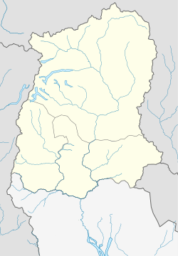
Rorathang is a town in Sikkim, India. It sits on the banks of the Rangpo River. You can find it along National Highway-717A in the Pakyong District.
Contents
Getting Around Rorathang
Roadways
Rorathang is located on National Highway-717A. This highway connects Bagrakote to Gangtok. It passes through places like Labha and Algarah. This highway is part of the Bharatmala Pariyojana. This is a big project by the Ministry of Road Transport and Highways in India.
Several roads meet NH-717A in Rorathang:
- Rangpo-Kumrek-Rorathang Road
- Pakyong-Tareythang-Rorathang Road
- Rongli-Mulukay-Rorathang Road
- Pakyong-Taza-Rorathang Road
The town has good connections to many parts of Sikkim. It also connects to the nearby state of West Bengal. You can find taxis and jeeps to places like:
Bus Services
You can catch Sikkim Nationalized Transport (SNT) buses from Rorathang. One bus goes from Rongli to Sikkim Nationalised Transport Bus Terminus (Siliguri). It travels through Rorathang. Another SNT bus connects Rhenock to Gangtok. There is also a bus from Rolep- Rongli to Gangtok. This bus goes through Pakyong, Rangpo, and Singtam. Many private buses also run from Rorathang. These buses belong to various companies and factories.
Flying In
The closest airport is Pakyong Airport, about 11 kilometers away. Bagdogra International Airport is a bit further, at 98 kilometers.
Train Travel
The nearest train stations are:
- Sevoke Junction, 65 kilometers away.
- Siliguri Junction, 86 kilometers away.
- New Jalpaiguri, 92 kilometers away.
- Malbazar Junction, 112 kilometers away.
- Rangpo Railway Station is being built. It is about 11 kilometers from Rorathang.
Geography
Rorathang is located in the Pakyong district. The area has hills and flat land near rivers. It is part of the Shiwalik range of the Himalayas. This area is good for farming. It has lots of water because many rivers flow through the town and nearby villages. The River Rangpo meets its smaller rivers, Pachey and Reshi, in Rorathang.
Rorathang is on the border between Sikkim and West Bengal. You can cross the Reshi River to reach villages in West Bengal's Kalimpong District. The Rangpo River also marks the border after it meets the Reshi River.
Some villages around Rorathang in Sikkim include:
- Taza
- Tareythang
- Pacheykhani
- Bering
- Kumrek
- Tarpin
- Amba
- Mulukay
- Kamerey
- Bhasmey
- Pithang
- Titribotey
- Padamchey
- Bengthang
- Kaizaley
- Shalghari
The town is 12 kilometers from Rangpo. It is 9 kilometers from Rhenock. Rongli is 14 kilometers away. The main town of the subdivision, Pakyong, is 19 kilometers away.
Economy
Rorathang is an important industrial area in Sikkim. Many companies have set up their businesses here. These include:
- Cipla Pharmaceuticals
- Golden Cross Pharmaceuticals
- Lupin Pharmaceuticals
- Zuventus Healthcare
- Zydus Healthcare
- Zydus Pharmaceuticals
- Swiss Garnier Pharmaceuticals
- Kingfisher Beer Factory
- Indichem Pharmaceuticals
- Alkem Laboratories
- Gati Hydro Electric Power Project
- Savi Healthcare
- Northeast Pharma Packaging Company
- Ideal Cures Private Limited
- National Institute of Electronics & Information Technology
- Malu Electrodes Private Limited
These companies have created many jobs. This has helped Rorathang grow. More people need places to live, so new buildings have been built. The demand for local food like vegetables, dairy products, and meat has also increased. All of this has boosted the local economy.
Farmers trade crops like Large Cardamom, Broom Plant (Kuccho), and Ginger in the town. This happens during their harvest seasons.
The State Bank of Sikkim has a branch in Rorathang. You can also find banking services from State Bank of India, Axis Bank, HDFC Bank, and Central Bank of India.
Rorathang is part of the Pakyong Subdivision of East Sikkim. The town has its own Police Station. A weekly market, called a Haat Bazar, is held every Thursday.
History
Older people in Sikkim say that Rorathang used to be a much larger and older market. It was about 1-2 kilometers from the current town, closer to Pithang, by the Rangpo River. Sadly, in the 1968 Flash Floods of Sikkim, the entire old town was washed away by the River Rangpo and its smaller rivers.
After this big disaster, people slowly started building a new settlement. This new Rorathang is where the town is today. It was built on higher ground, making it safer from floods. Over time, more people moved here. The population grew quickly, especially after many companies and factories were built.
Population
According to the 2011 Census of India, Rorathang has a population of 4,861 people. There are 2,592 males and 2,269 females. About 10.42% of the total population are children aged 0-6 years.
The average number of females per 1000 males (Sex Ratio) in Rorathang is 876. For children, the Child Sex Ratio is 1021. This is higher than the Sikkim average of 957.
The literacy rate in Rorathang is 76.48%. This means most people can read and write. For males, the literacy rate is 81.70%. For females, it is 70.43%.
Climate
Rorathang has a humid subtropical climate. Temperatures can range from 2°C in winter to 30°C in summer. Winters are usually dry, but it rains throughout the year.
The monsoon season starts in the second week of June and lasts until September. During this time, there is heavy rainfall. Landslides and thick fog can make travel difficult. The average rainfall each year is between 2800mm and 3000mm.
The best time to visit is during spring and autumn. There is plenty of sunshine, making it pleasant. However, thunderstorms are common in the afternoons during these seasons. They can bring strong winds, hailstorms, and heavy rain. It is always a good idea to check the weather forecast before planning a trip.
Education
Government Senior Secondary School Rorathang is the main high school in the area. There are also other private and government schools nearby.
For higher studies, students can go to:
- Government Degree College, Rungdung, Rhenock
- Pakim Palantine College, New Market, Pakyong
Places to Visit
- Rorathang Bridge: This bridge crosses the Rangpo River.
- Confluence Point (Kanan Valley Resort): This is where the Reshi River and Rangpo River meet. It's a great spot for a picnic and is about 1 km from Rorathang market.
- Gulmohar Picnic Spot: Located in Kumrek, about 6 km from Rorathang market.
- Rorathang Shivalaya Mandir: A local temple.
- Kali Khola Waterfalls: These waterfalls are about 7.5 kilometers from Rorathang market.
- Gati Hydro Electric Power House, Dam Site: This power plant and its dam are about 10 kilometers from the town.
- Banday Pokhrel View Point: A scenic spot about 12 kilometers from Rorathang market.
 | Sharif Bey |
 | Hale Woodruff |
 | Richmond Barthé |
 | Purvis Young |


