Roxwell facts for kids
Quick facts for kids Roxwell |
|
|---|---|
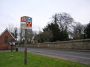
 Village sign and church |
|
| Population | 1,044 (2011 Census) |
| Civil parish |
|
| District |
|
| Shire county | |
| Region | |
| Country | England |
| Sovereign state | United Kingdom |
| Post town | Chelmsford |
| Postcode district | CM1 |
| Police | Essex |
| Fire | Essex |
| Ambulance | East of England |
| EU Parliament | East of England |
Roxwell is a small village located in the county of Essex, England. It's part of the Chelmsford area. The village is about 4 miles (6.4 km) west of Chelmsford, which is the main town of the county.
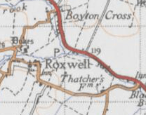
Roxwell is also home to several smaller areas called hamlets. These include Boyton Cross and Chalk End, which are found along the A1060 road. Other hamlets like Peppers Green are in the north, and Radley Green is in the south.
Contents
Exploring Roxwell Village
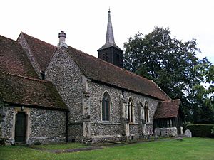
Roxwell has a lovely old church called St Michael and All Angels'. This church was built way back in the 14th century, making it very old and important. It's even listed as a Grade II* building, which means it has special historical value.
The village also has a primary school, which is connected to the local church. There's a traditional English pub called The Chequers, and a village shop that also serves as a post office.
Newland Hall: A Historic Home
Newland Hall is an old manor house in Roxwell. It was built during the time of Queen Elizabeth I by the Newland family. This family were descendants of Ralph de Neweland, who was an important local lord in the 1200s.
Long ago, when the Domesday Book was created (a famous survey of England in 1086), the land where Newland Hall stands was owned by Eustace, Earl of Boulogne. Today, Newland Hall is a popular place for weddings and other events.
Roxwell's Past: A Look Back
In the late 1800s, Roxwell was described as a village located near the River Chelmer. It was about 4.5 miles (7.2 km) west of the Chelmsford train station.
By 1894, the village had its own local government, called a parish council. This council had seven members and a chairman who helped manage village affairs. At that time, there was also another important house called Dukes Manor, which belonged to a noble family known as Lord Petre.
Understanding Roxwell's Population
How Many People Live Here?
According to the 2011 census, Roxwell had a population of 1,044 people. About 23.2% of these residents were between 45 and 59 years old. Most of the people living in Roxwell are white, making up about 93.9% of the population.
Roxwell's Population Over Time
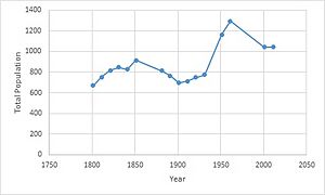
Roxwell's population has changed a lot over the last 200 years. In the early 1800s, the number of people living in the village slowly grew. For about 50 years, the population increased steadily.
However, after this period, the population started to decrease for a while. It even went back to around the same level as it was in 1800, with about 650 people.
Then, the population began to grow again. After World War II ended in 1946, there was a "baby boom," meaning many babies were born. This caused Roxwell's population to reach its highest point around 1960, with over 1,200 people.
After this peak, the population quickly went down. But if we look at the information from all the censuses since 1800, especially the 2011 census, we can see that Roxwell's population is now steadily growing again, reaching just over 1,000 people.
 | May Edward Chinn |
 | Rebecca Cole |
 | Alexa Canady |
 | Dorothy Lavinia Brown |


