Royal Military Canal facts for kids
Quick facts for kids Royal Military Canal Path |
|
|---|---|
| Length | 46 kilometres (29 miles) |
| Location | United Kingdom |
| Use | Hiking |
| Elevation gain/loss | 217 m (712 ft) |
| Difficulty | Easy |
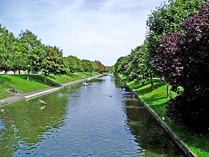
The Royal Military Canal is a long waterway in England. It stretches for about 28 miles (45 km) (45 km) between Seabrook, near Folkestone, and Cliff End, near Hastings. This canal follows the edge of a flat, marshy area called Romney Marsh. It was built a long time ago, during the Napoleonic Wars, to protect England from a possible invasion by the French leader Napoleon.
Contents
Why Was the Canal Built?
Building a Defense Line
The idea for the canal came from a soldier named Lieutenant-Colonel John Brown in 1804. At this time, England was worried about France invading. People thought that Romney Marsh could be flooded to stop an invasion. But Colonel Brown pointed out that flooding the marsh would take ten days and cause a lot of problems if it was a false alarm.
So, on September 26, 1804, important leaders like the Prime Minister, William Pitt the Younger, and the Commander of the Army, the Duke of York, loved the idea of building a canal. A famous engineer named John Rennie was hired to help. Pitt even convinced local landowners to agree to the canal being built on their land.
How the Canal Was Built
Work on the canal started on October 30, 1804, in Seabrook, near Hythe in Kent. By May 1805, only six miles were finished. William Pitt stepped in, and the first builders were let go.
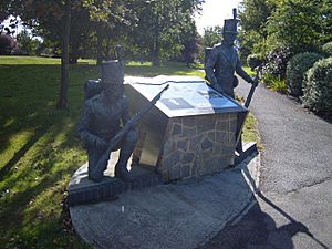
The army then took over, with Lieutenant-Colonel Brown in charge. Regular workers, called navvies, dug the canal. Soldiers helped build the banks. Up to 1,500 men worked on the project!
The canal was built in two parts. The main part goes from Hythe to Iden Lock in East Sussex. A smaller part runs from Winchelsea Hill to Cliff End. These two parts are connected by the River Rother and River Brede.
Along the canal, there were places for cannons every 500 yards (460 m). The canal was built with zig-zag sections so the cannons could shoot along the water. A military road was also built on the side of the canal away from the coast. This road was protected by a high earth bank made from the soil dug out of the canal. Bridges across the canal were made of wood and could be moved.
The canal was finished in April 1809. It cost about £234,000, which was a huge amount of money back then! People hoped that charging tolls for using the canal and road would help pay for it. Also, some special towers called Martello towers were built to protect the gates that controlled the water level in the canal. Three of these towers are still standing today.
The Canal After the Wars
Peaceful Uses
Even though the canal was built for war, it was never used in a battle. Instead, it was used to try and stop smuggling from Romney Marsh. Guard houses were built at every bridge along the canal. However, this didn't work very well because some of the guards were dishonest.
A boat service was set up from Hythe to Rye, but the canal was eventually stopped being used in 1877. It was then leased to the local landowners of Romney Marsh.
World War II Defenses
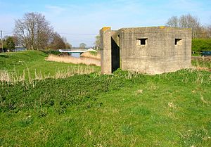
During the early part of World War II, when Germany threatened to invade Britain, the canal was used again for defense. Soldiers guarded it and built concrete bunkers, called pillboxes, and put up barbed wire fences. Many of these pillboxes can still be seen today.
In Germany's invasion plan, called Operation Sea Lion, paratroopers were supposed to land and capture the crossing points over the Royal Military Canal on the first day of the invasion.
The Canal Today
Today, there's a public walking path, called the Royal Military Canal Path, that runs along the entire length of the canal. This path is also part of the longer 163-mile (262 km) Saxon Shore Way.
As you walk along the path, you can see many interesting things. You'll find the old World War II pillboxes and unusual acoustic mirrors, which were used to listen for enemy planes. The path also passes through historic towns like Hythe, Winchelsea, and Rye. You can also see the 12th-century St Rumwold's church, and the castles of Lympne and Camber.
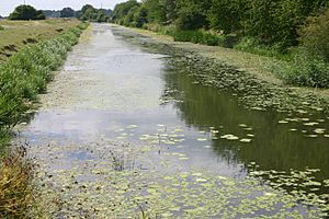
The canal is also a very important place for nature. It goes through several Sites of Special Scientific Interest. The Environment Agency manages the water levels in the canal to help control the water in Romney Marsh and Walland Marsh. It's a great place for fish and other wildlife, including beautiful kingfishers, colorful dragonflies, and noisy marsh frogs.
 | Victor J. Glover |
 | Yvonne Cagle |
 | Jeanette Epps |
 | Bernard A. Harris Jr. |


