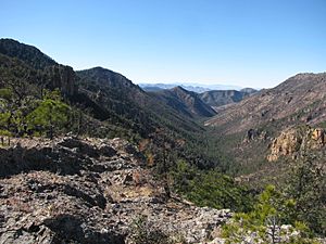
Rucker Canyon facts for kids
Rucker Canyon is a large canyon located in the southwestern part of the Chiricahua Mountains in southeastern Cochise County, Arizona. This area is very close to the border with New Mexico. Rucker Canyon is well-known because of the historic Camp Rucker, which was once an important place there.
Contents
What is Rucker Canyon?
Rucker Canyon is a deep valley carved by water over many years. It is found in the Chiricahua Mountains, which are a big mountain range in Arizona. The canyon helps drain, or carry water away from, the western side of these mountains.
Rucker Creek and Rucker Lake
Inside Rucker Canyon, you'll find a stream called Rucker Creek. Sometimes, this stream is also called Rucker Wash, especially when it's dry or has less water. Further upstream, closer to where the creek starts, there used to be a small lake called Rucker Lake. Sadly, Rucker Lake was destroyed by a landslide some years ago and no longer exists.
Where Does the Water Go?
The water from Rucker Wash flows westwards. It empties into the southern part of the Sulphur Springs Valley. This valley stretches from the northwest to the southeast. The wash flows east of U.S. Route 191, a main road, and some small towns like Elfrida, McNeal, and Sunizona.
Rucker Wash is also near a water divide. A water divide is like a high point in the land. It separates areas where water flows in different directions. For example, some water from this area flows north towards the Willcox Playa, which is a dry lakebed. Other water flows south towards Douglas, Arizona and even into Mexico.
Nearby Mountains and Valleys
The Rucker Wash area is next to the small Swisshelm Mountains. These mountains are along the southern edge of the Sulphur Springs Valley. The wash also passes through a named area called Whitewater Draw. This shows how the water from Rucker Creek moves through the landscape.
 | George Robert Carruthers |
 | Patricia Bath |
 | Jan Ernst Matzeliger |
 | Alexander Miles |


