Sulphur Springs Valley facts for kids
Quick facts for kids Sulphur Springs Valley |
|
|---|---|

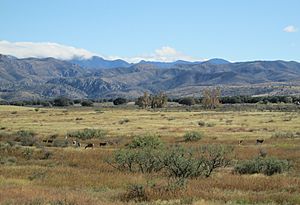
Sulphur Springs Valley and the Chiricahua Mountains.
|
|
| Length | 65 mi (105 km) |
| Width | 25 mi (40 km) |
| Geography | |
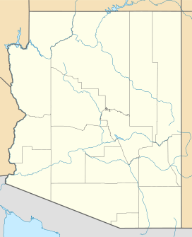
| Location | Cochise County, Arizona, United States |
| Population centers | Willcox, AZ-N Douglas, AZ–Agua Prieta-S |
| Borders on | Dos Cabezas Mountains-NE Chiricahua Mountains-E Dragoon Mountains-W Little Dragoon Mountains-NW Mule Mountains-SW |
| Rivers | Willcox Playa |
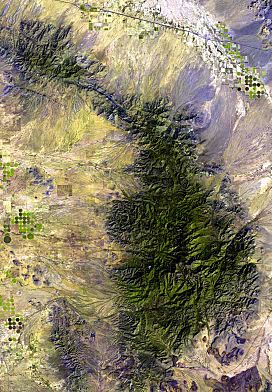
The Sulphur Springs Valley is a long, flat area in the eastern part of Cochise County, Arizona. It stretches out like a tall rectangle to the west of the Chiricahua Mountains and Dos Cabezas Mountains. This valley is a big, open space surrounded by mountains.
Contents
Exploring Sulphur Springs Valley
Where is the Sulphur Springs Valley?
The Sulphur Springs Valley is located in southeastern Arizona. It is about 65 miles (105 km) long and 25 miles (40 km) wide. The valley got its name from two special springs found there. These "sulfur springs" have water that smells a bit like rotten eggs because of sulfur gas.
How Water Flows in the Valley
Water in the valley mostly flows from the north to the south. In the northern part, there's a large flat area called the Willcox Playa. This is a "closed basin," meaning water flows into it but doesn't flow out to a river or ocean. Instead, it usually dries up.
The southern part of the valley drains into Mexico. Water from here flows through towns like Douglas, Arizona and Agua Prieta, Sonora. Eventually, this water makes its way to the Yaqui River in Mexico.
What the Valley Looks Like

The Sulphur Springs Valley is mostly a dry area. It is part of the northeastern Sonoran Desert. However, it also gets some influence from the Chihuahuan Desert, which is to its southeast.
When there's a lot of rain, the lower parts of the mountains become green grasslands. But for most of the year, the valley is quite arid, meaning it's very dry.
Mountains Around the Valley
The Sulphur Springs Valley is surrounded by several mountain ranges. These mountains are often called "sky islands." This is because they are like tall islands of cooler, wetter land rising out of the hot, dry desert.
On the western side of the valley, from north to south, you'll find the Little Dragoon Mountains, the Dragoons, and the Mule Mountains. At the southern end of the valley, there are also smaller ranges connected to the southern Chiricahua Mountains. These include the Swisshelm, Pedregosa, and Perella Mountains.
Getting Around the Valley
Roads and Routes
A main road, U.S. Route 191, runs through the Sulphur Springs Valley from north to south. This road connects Douglas, Arizona in the south to Willcox in the north. Willcox is located right on Interstate 10, a major highway.
Another road, Arizona 181, helps people reach the western and northwestern parts of the Chiricahua Mountains. This includes the famous Chiricahua National Monument. Arizona 181 also connects to Arizona 186. This route travels along the southwestern foothills of the Dos Cabezas mountain range.
Protecting Nature in the Valley
Wildlife and Conservation Efforts
The Sulphur Springs Valley is an important place for wildlife. The Southeastern Arizona Bird Observatory works hard in this area. They are especially active around the Willcox Playa. Thousands of sandhill cranes gather and rest there, making it a spectacular sight.
The Sky Island Alliance is another group that helps protect the "sky island" mountains. They work to save the plants and animals that live in these unique mountain areas. Their efforts help keep the natural beauty and wildlife of the Sulphur Springs Valley safe for the future.
 | Shirley Ann Jackson |
 | Garett Morgan |
 | J. Ernest Wilkins Jr. |
 | Elijah McCoy |


