Mule Mountains facts for kids
Quick facts for kids Mule Mountains |
|
|---|---|

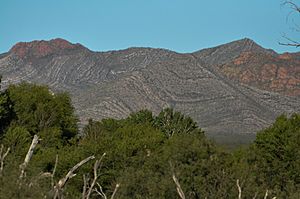
Mule Mountains, viewed from near Hereford, Arizona
|
|
| Highest point | |
| Peak | Mount Ballard |
| Elevation | 7,374 ft (2,248 m) NAVD 88 |
| Dimensions | |
| Length | 21 mi (34 km) North to South |
| Width | 33 mi (53 km) East to West Extent includes low land hills and valleys |
| Area | 500 sq mi (1,300 km2) |
| Geography | |
| Country | United States |
| State | Arizona |
| Region | Madrean Sky Islands |
| County | Cochise |
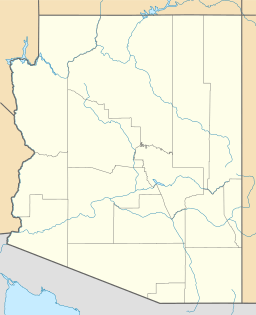
| Range coordinates | 31°29′N 109°52′W / 31.483°N 109.867°W |
The Mule Mountains are a mountain range in Cochise County, Arizona. They run from north to south. The tallest point is Mount Ballard, which is about 7,500 feet (2,286 meters) high.
Long ago, these mountains were covered in thick forests. There were many large Rocky Mountain Douglas-fir trees and other conifers. But these trees were cut down to build homes and to fuel furnaces. These furnaces were used to melt ore for mining in Douglas, Arizona.
Today, the main plants you will find are manzanita brush, juniper trees, and different types of oaks and pines. You can also see various grasses. To the east of the mountains is the Sulphur Springs Valley. To the west are the San Pedro River and Valley.
Contents
What are the Mule Mountains Like?
The land in the Mule Mountains is very rugged. It has steep slopes that drop into deep canyons. This makes the area quite wild and beautiful.
Animals and Plants
Many different animals live in the Mule Mountains. You might see desert mule deer and Coues' White-tailed deer. There are also Collared Peccary, which are often called javelinas. You can find many types of rodents, lizards, and a wide variety of birds too.
The higher parts of the mountains are mostly made of a very hard rock. This rock is called brecciate limestone. It is common to find fossils of clams and snails stuck in these rocks. This shows that the area was once covered by water.
Mining History
The Mule Mountains are famous for their rich mining history. Huge amounts of valuable metals were found here.
The Lavender Pit
To the east of the mountains is the Lavender Pit. This was a very large and deep open pit copper mine. The Phelps Dodge Corporation operated this mine from 1951 to 1974.
Over a billion tons of copper were taken from the Lavender Pit. Miners also found a lot of gold, silver, and lead there. As a bonus, high-quality turquoise was discovered. This special turquoise is known as Bisbee Blue.
The Copper Queen Mine
The Copper Queen Mine is on the east side of the Mule Mountains. When it was active in the late 1800s and early 1900s, it was the richest copper mine ever found. This mine made the nearby town of Bisbee, Arizona very successful.
Under this part of the Mule Mountains, there are many mining tunnels. These tunnels were dug to find the valuable copper ore. Today, there are no large mining operations happening in the Mule Mountains. Much of the eastern and southeastern parts of the mountains are private land, owned by the Phelps Dodge Corporation.
Bisbee: A Mining Town Today
Bisbee is also called the "mile-high city" because it is about 5,300 feet (1,615 meters) high. Today, Bisbee is mostly a tourist town. Many people also choose to retire there. The town is located along the slopes of Tombstone Canyon, right in the heart of the Mule Mountains. Visitors can explore its history and enjoy the mountain scenery.
 | Madam C. J. Walker |
 | Janet Emerson Bashen |
 | Annie Turnbo Malone |
 | Maggie L. Walker |


