Russell Fork facts for kids
Quick facts for kids Russell Fork |
|
|---|---|

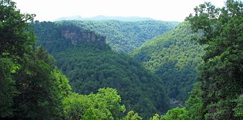
Russell Fork flowing through Breaks Interstate Park
|
|
| Country | United States |
| Physical characteristics | |
| Main source | Virginia |
The Russell Fork is a river that flows for about 51.9-mile (83.5 km) (around 83 kilometers). It's a smaller river, called a tributary, that joins the Levisa Fork. You can find the Russell Fork in the southwestern part of Virginia and the southeastern part of Kentucky in the United States.
This river is super famous for its exciting whitewater. It's a favorite spot for people who love adventure sports like kayaking and rafting!
Discover the Russell Fork River
The Russell Fork river begins its journey in the Appalachian Mountains. These mountains are located in the southwest of Virginia, specifically in southern Buchanan County. It starts near the bottom of a place called Big A Mountain.
The River's Path
From its start, the Russell Fork flows towards the northwest. It enters Dickenson County as it continues its path.
The river then travels through several towns and a special park:
- First, it goes through the town of Haysi, Virginia.
- Next, it flows right through the amazing Breaks Interstate Park. This park is known for its deep canyon, which the river helped create!
- Finally, it reaches the town of Elkhorn City, Kentucky, in Pike County.
Joining Other Rivers
After passing through Elkhorn City, the Russell Fork flows into the Levisa Fork. The Levisa Fork then joins with another river called the Tug Fork. Together, these two rivers form a much larger river known as the Big Sandy River.
 | Selma Burke |
 | Pauline Powell Burns |
 | Frederick J. Brown |
 | Robert Blackburn |

