Rutland, Ohio facts for kids
Quick facts for kids
Rutland, Ohio
|
|
|---|---|
|
Village
|
|

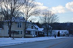
Salem Street
|
|

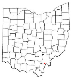
Location of Rutland, Ohio
|
|

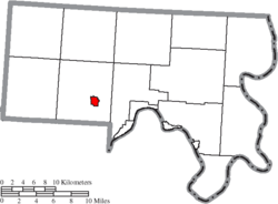
Location of Rutland in Meigs County
|
|
| Country | United States |
| State | Ohio |
| County | Meigs |
| Township | Rutland |
| Incorporated | 1913 |
| Government | |
| • Type | Mayor council government |
| Area | |
| • Total | 0.87 sq mi (2.26 km2) |
| • Land | 0.87 sq mi (2.26 km2) |
| • Water | 0.00 sq mi (0.00 km2) |
| Elevation | 591 ft (180 m) |
| Population
(2020)
|
|
| • Total | 427 |
| • Density | 488.56/sq mi (188.55/km2) |
| Time zone | UTC-5 (Eastern (EST)) |
| • Summer (DST) | UTC-4 (EDT) |
| ZIP code |
45775
|
| Area code(s) | 740 |
| FIPS code | 39-69358 |
| GNIS feature ID | 2399150 |
| Website | www.villageofrutland.org |
Rutland is a small town located in Meigs County, Ohio, United States. In 2020, about 427 people lived there. It's a quiet place with a rich history.
Contents
Where is Rutland Located?
Rutland is found in the Appalachian Plateau region, which is known for its hills and valleys. The village sits in a wide valley next to a stream called Little Leading Creek.
Rutland's Mining Past and Environment
The hills around Rutland once had a lot of bituminous coal, a type of coal. In the early and mid-1900s, people used a method called strip mining to dig up this coal. Strip mining involves removing the top layer of soil and rock to get to the coal underneath.
Today, there are no active mining operations in the area. However, some old, abandoned mines have caused a problem called Acid mine drainage. This is when acidic water seeps out of the mines. It has unfortunately affected the water quality in the Little Leading Creek watershed, which is the area of land where all the water drains into the creek.
According to the United States Census Bureau, the village covers about 0.83 square miles (2.26 square kilometers) of land. There is no water area within the village limits.
Who Lives in Rutland?
Rutland's population has changed over the years. Here's a quick look at how many people have lived there:
| Historical population | |||
|---|---|---|---|
| Census | Pop. | %± | |
| 1880 | 139 | — | |
| 1920 | 500 | — | |
| 1930 | 570 | 14.0% | |
| 1940 | 562 | −1.4% | |
| 1950 | 554 | −1.4% | |
| 1960 | 687 | 24.0% | |
| 1970 | 663 | −3.5% | |
| 1980 | 635 | −4.2% | |
| 1990 | 469 | −26.1% | |
| 2000 | 401 | −14.5% | |
| 2010 | 393 | −2.0% | |
| 2020 | 427 | 8.7% | |
| U.S. Decennial Census | |||
A Look at the 2010 Census
In 2010, there were 393 people living in Rutland. These people lived in 161 households, and 115 of these were families. Most of the people living in Rutland were White (98.7%). A small number were from other racial backgrounds (0.3%) or from two or more races (1.0%). About 1.0% of the population identified as Hispanic or Latino.
Many households (34.8%) had children under 18 living with them. About 52.2% of households were married couples living together. The average household had about 2.44 people, and the average family had about 2.85 people.
The average age of people in Rutland in 2010 was 39.3 years old.
Learning in Rutland
Students in Rutland attend public schools managed by the Meigs Local School District. The schools that serve the village include:
- Meigs Primary School (for students in Kindergarten through 2nd grade)
- Meigs Intermediate School (for students in 3rd to 5th grade)
- Meigs Middle School (for students in 6th to 8th grade)
- Meigs High School (for students in 9th to 12th grade)
Before these schools were combined, Rutland had its own school called Rutland High School. Their football team was known as the "Rutland Red Devils" and was even called the "Yanks of Football."
Famous People from Rutland
Rutland has been home to some notable individuals:
- Brewster Higley VI: He was a composer famous for writing the song "Home on the Range," which is a well-known American folk song.
- William P. Halliday: He was a successful businessman and a leader in the railroad industry.
See also
 In Spanish: Rutland (Ohio) para niños
 | May Edward Chinn |
 | Rebecca Cole |
 | Alexa Canady |
 | Dorothy Lavinia Brown |

