Río Abajo, Utuado, Puerto Rico facts for kids
Quick facts for kids
Río Abajo
|
|
|---|---|
|
Barrio
|
|

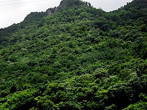
View of Río Abajo from bordering Río Arriba in Arecibo
|
|

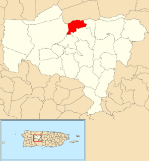
Location of Río Abajo within the municipality of Utuado shown in red
|
|
| Commonwealth | |
| Municipality | |
| Area | |
| • Total | 2.31 sq mi (6.0 km2) |
| • Land | 2.30 sq mi (6.0 km2) |
| • Water | 0.01 sq mi (0.03 km2) |
| Elevation | 1,070 ft (330 m) |
| Population
(2010)
|
|
| • Total | 237 |
| • Density | 103/sq mi (40/km2) |
| Source: 2010 Census | |
| Time zone | UTC−4 (AST) |
Río Abajo is a small area, called a barrio, located in the town of Utuado, Puerto Rico. In 2010, about 237 people lived there. It's a quiet, countryside area found in the Cordillera Central (Puerto Rico), which is a big mountain range crossing the middle of Puerto Rico from east to west.
History of Río Abajo
Puerto Rico used to belong to Spain. After the Spanish–American War, in 1898, it became a territory of the United States. In 1899, the U.S. government counted the people living in Puerto Rico. They found that 1,235 people lived in Río Abajo at that time.
Hurricane Maria's Impact
On September 20, 2017, a very strong storm called Hurricane Maria hit Puerto Rico. This hurricane caused a lot of damage in Río Abajo. The storm washed away the main bridge, leaving about 60 families completely cut off from others.
To get food and supplies, the people of Río Abajo came up with a clever idea. They created a temporary zip line to send things across the river! This helped them until a new, temporary bridge could be built. A permanent bridge was finally finished in March 2018, connecting the community once again.
| Historical population | |||
|---|---|---|---|
| Census | Pop. | %± | |
| 1900 | 1,235 | — | |
| 1980 | 511 | — | |
| 1990 | 404 | −20.9% | |
| 2000 | 325 | −19.6% | |
| 2010 | 237 | −27.1% | |
| U.S. Decennial Census 1899 (shown as 1900) 1910-1930 1930-1950 1980-2000 2010 |
|||
See Also
- List of communities in Puerto Rico
 In Spanish: Río Abajo (Utuado) para niños
 | Calvin Brent |
 | Walter T. Bailey |
 | Martha Cassell Thompson |
 | Alberta Jeannette Cassell |


