Sachigo Lake facts for kids
Quick facts for kids Sachigo Lake |
|
|---|---|
| Location | Kenora, Ontario, Canada |
| Coordinates | 53°48′28″N 92°04′55″W / 53.80778°N 92.08194°W |
| Type | Lake |
| Part of | Hudson Bay drainage basin |
| Primary outflows | Sachigo River |
| Max. length | 32 km (20 mi) |
| Max. width | 17 km (11 mi) |
| Surface elevation | 248 m (814 ft) |
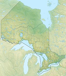
Sachigo Lake is a large lake located in Ontario, Canada. It is found in the northwestern part of the province, within the Kenora District. This lake is an important part of the Hudson Bay drainage basin, which means its waters eventually flow into Hudson Bay.
Where is Sachigo Lake?
Sachigo Lake is situated in a wild, undeveloped area of Northwestern Ontario. It is about 32 km long and 17 km wide. The lake sits at an elevation of 248 m above sea level. Its remote location makes it a peaceful natural spot.
How Water Flows Through the Lake
Lakes often have rivers flowing into them and out of them. These are called inflows and outflows.
- Inflows: The main rivers that flow into Sachigo Lake are the Sachigo River (from the southwest) and the Morrison River (from the east). These rivers bring fresh water into the lake.
- Outflows: The main river that flows out of Sachigo Lake is also the Sachigo River, but it leaves the lake from the north. From there, the water travels through the Severn River until it reaches the vast Hudson Bay. This connection to Hudson Bay is why the lake is part of its drainage basin.
Sachigo Lake First Nation
An important community, the Sachigo Lake First Nation, has its main settlement on the northwest shore of Sachigo Lake. First Nations are the Indigenous peoples of Canada. This community has a long history and connection to the lake and the surrounding land.
 | Emma Amos |
 | Edward Mitchell Bannister |
 | Larry D. Alexander |
 | Ernie Barnes |


