Saddle Rock Estates, New York facts for kids
Quick facts for kids
Saddle Rock Estates, New York
|
|
|---|---|

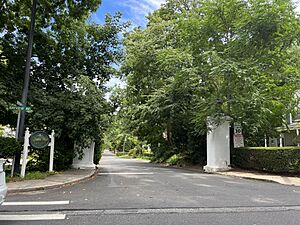
The Woodland Place entrance to Saddle Rock Estates on August 14, 2022.
|
|

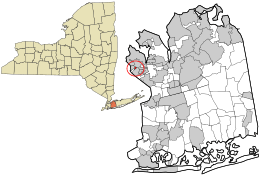
Location in Nassau County and the state of New York
|
|
| Country | |
| State | |
| County | Nassau |
| Town | North Hempstead |
| Named for | Its proximity to Saddle Rock |
| Area | |
| • Total | 0.08 sq mi (0.20 km2) |
| • Land | 0.08 sq mi (0.20 km2) |
| • Water | 0.00 sq mi (0.00 km2) |
| Elevation | 26 ft (8 m) |
| Population
(2020)
|
|
| • Total | 428 |
| • Density | 5,487.18/sq mi (2,120.71/km2) |
| Time zone | UTC-5 (Eastern (EST)) |
| • Summer (DST) | UTC-4 (EDT) |
| ZIP code |
11021
|
| Area code | 516, 363 |
| FIPS code | 36-64441 |
| GNIS feature ID | 0963209 |
Saddle Rock Estates is a small community called a hamlet in Nassau County, New York. It's located on the Great Neck Peninsula on the North Shore of Long Island. In 2020, about 428 people lived here.
Contents
History of Saddle Rock Estates
Saddle Rock Estates gets its name from the nearby Incorporated Village of Saddle Rock. Even though they share a name, Saddle Rock Estates has never been part of that village. It simply adopted the name from its neighbor.
Early Developments
In 1941, people living in Saddle Rock Estates worked to get the Great Neck Water Pollution Control District to expand into their hamlet. This project would help manage water and waste. The expansion was planned to cost around $140,000 at that time.
A few years later, in the summer of 1946, Nassau County started a project to cover up the Old Mill Pond Brook. They placed the brook into a large, enclosed pipe called a culvert. Residents had asked for this since 1943 because the brook often caused roads to wash out and basements to flood.
Geography and Location
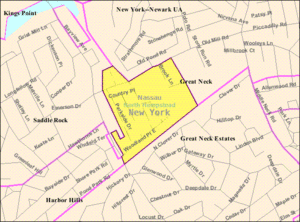
Saddle Rock Estates is a small area of land. According to the United States Census Bureau, it covers about 0.1 square miles (0.26 square kilometers). All of this area is land, with no water.
Population and People
| Historical population | |||
|---|---|---|---|
| Census | Pop. | %± | |
| 2000 | 424 | — | |
| 2010 | 466 | 9.9% | |
| 2020 | 428 | −8.2% | |
| U.S. Decennial Census | |||
In 2000, there were 424 people living in Saddle Rock Estates. By 2010, the population grew to 466 people, but then it slightly decreased to 428 people in 2020.
Community Makeup
In 2000, most residents (about 94%) were White. There were also smaller groups of African American and Asian residents. About 1% of the population was Hispanic or Latino.
There were 134 households in the community. More than half of these households (50.7%) had children under 18 living with them. Most households (82.8%) were married couples living together.
The average age of people in Saddle Rock Estates in 2000 was 40 years old. About 30.9% of the population was under 18, and 13.4% were 65 or older.
Education in Saddle Rock Estates
School District
All of Saddle Rock Estates is part of the Great Neck Union Free School District. This means that all children living in the hamlet who attend public schools go to schools within the Great Neck district.
Library Services
Saddle Rock Estates is also included in the Great Neck Library District. Residents can use the services and resources provided by the Great Neck Library.
See also
 In Spanish: Saddle Rock Estates para niños
 | Victor J. Glover |
 | Yvonne Cagle |
 | Jeanette Epps |
 | Bernard A. Harris Jr. |


