Sagarmatha Zone facts for kids
Quick facts for kids
Sagarmatha
सगरमाथा अञ्चल
|
|
|---|---|

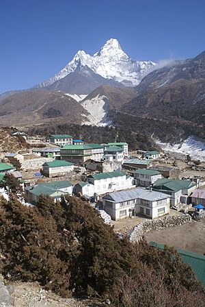
Lower Pangboche village in Khumbu, Nepal
|
|
 |
|
| Country | |
| Time zone | UTC+5:45 (Nepal Time) |
Sagarmatha (Nepali: सगरमाथा अञ्चल) was one of the fourteen zones in eastern Nepal. It was named after Mount Everest, which is known as Sagarmatha in Nepali. This zone included high mountains, green hills, and flat plains. It stretched from the mighty Himalayas in the north to the Terai region in the south.
Sagarmatha Zone shared borders with China to the north and India to the south. To its east was the Koshi Zone, and to its west was the Janakpur Zone. The main city and administrative center of Sagarmatha Zone was Rajbiraj.
About Sagarmatha Zone
Sagarmatha Zone was a very diverse area. It had tall mountains, including the world's highest peak, Mount Everest. The northern part of the zone was home to these huge mountains.
In the middle, there were rolling hills. These areas were often covered in forests and had many small villages. The southern part of the zone was flat land called the Terai. This area was good for farming.
The zone's location meant it had different climates. The mountains were cold and snowy, while the Terai plains were warm. This made Sagarmatha a unique place in Nepal.
Districts of Sagarmatha
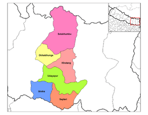
Sagarmatha Zone was divided into six smaller areas called districts. Each district had its own main town, known as its headquarters. These districts helped manage the different parts of the zone.
Here are the districts that made up Sagarmatha Zone:
| District | Type of Land | Headquarters |
|---|---|---|
| Khotang | Hilly | Diktel |
| Okhaldhunga | Hilly | Okhaldhunga |
| Saptari | Outer Terai (Plains) | Rajbiraj |
| Siraha | Outer Terai (Plains) | Siraha |
| Solukhumbu | Mountainous | Salleri |
| Udayapur | Inner Terai (Valleys) | Triyuga |
Related Information
See also
 In Spanish: Zona de Sagarmatha para niños
 | Emma Amos |
 | Edward Mitchell Bannister |
 | Larry D. Alexander |
 | Ernie Barnes |

