Sainte-Marguerite River (Sept-Îles) facts for kids
Quick facts for kids Sainte-Marguerite River |
|
|---|---|

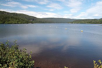
Sainte-Marguerite river, upstream of Sainte-Marguerite 2 Dam
|
|
| Native name | Rivière Sainte-Marguerite |
| Country | Canada |
| Province | Quebec |
| Region | Côte-Nord |
| Physical characteristics | |
| River mouth | 50°08′34″N 66°35′48″W / 50.14278°N 66.59666°W |
| Length | 316 kilometres (196 mi) |
| Basin features | |
| Basin size | 6,190 square kilometres (2,390 sq mi) |
| Tributaries |
|
| Bridges | |
| MNR Id | EJGWT |
The Sainte-Marguerite River (French: Rivière Sainte-Marguerite) is a long river in Quebec, Canada. It flows for 316 kilometres (196 mi) and empties into the Gulf of Saint Lawrence. This is west of the city of Sept-Îles. People have lived along this river for about 4,000 years. Later, industries like paper making and mining started here. Today, the river is also home to a huge hydroelectric dam. This dam, called the Denis-Perron dam, creates a reservoir that is 140 kilometres (87 mi) long.
Contents
River's Journey
The Sainte-Marguerite River is in the middle part of Quebec's Côte-Nord region. It flows between Baie-Comeau and Havre-Saint-Pierre. The area of land that drains into the river is about 6,190 square kilometres (2,390 sq mi). The river starts in a mountainous area near the border with Labrador. It then flows for over 200 kilometres (120 mi) across a flatter coastal plain.
A small community called Barrage-Sainte-Marguerite is about 10 kilometres (6.2 mi) north of where the river meets the sea. This community grew around a power plant built in 1908. Highway 138 crosses the dam there.
The Sainte-Marguerite River flows into the Gulf of Saint Lawrence about 30 kilometres (19 mi) west of Sept-Îles. Its mouth is a safe spot for small boats during bad weather. This is because the area is protected by Pointe Sainte-Marguerite.
River's Name
The name "Sainte-Marguerite" was first used a very long time ago. In 1603, Samuel de Champlain wrote about anchoring near a "Saincte Marguerite" river. There is another large river in Quebec with the same name. That one is a tributary of the Saguenay River. The river also has other names, like Tshimanipishtuk River.
Nature and Environment
The Sainte-Marguerite River flows through different natural areas. In its upper parts, it goes through a boreal forest region. This area is known for spruce trees and moss. As the river flows south, it enters a different part of the boreal forest. This section has more fir trees and white birch.
Ancient History Along the River
When a third Hydro-Québec dam was planned on the river, experts looked for old human sites. This project happened between 1991 and 1998. They found 67 archaeological sites, and explored 12 of them.
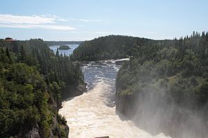
One important area is called the Grand Portage. This section is less than 100 kilometres (62 mi) from the river's mouth. It has many waterfalls and rapids that boats cannot pass. People had to carry their canoes and supplies around these obstacles. This "portage" could take a week!
Evidence shows that people have used this portage for 4,000 years. It seems that different groups of people lived in the river valley. Those to the south were connected to the Saint Lawrence coast. People to the north were more connected to the large lakes inland. The oldest site found on the river is at the portage. It was a temporary camp where hunters sharpened spear points about 4,000 years ago.
Another site along the Grand Portage is on the north shore of Lac Jourdain. Here, archaeologists found 11 structures and many stone tools. A site further up the river, from 600 to 1000 years ago, shows that people caught and smoked fish there. This site was likely used only by men for short periods.
Making Electricity: Hydroelectric Dams
The Sainte-Marguerite River has three hydroelectric dams. The first two are close to its mouth. The third and largest one is about 90 kilometres (56 mi) inland. These dams use the river's power to create electricity.
| Dam | Coordinates | Power Capacity (MW) |
Started Working |
|---|---|---|---|
| Sainte-Marguerite-1 | 50°11′51″N 66°38′11″W / 50.1975°N 66.6365°W | 30.5 | 1993 |
| Sainte-Marguerite-2 | 50°12′48″N 66°39′41″W / 50.2132°N 66.6614°W | 17.6 | 1954 |
| Sainte-Marguerite-3 | 50°47′27″N 66°47′29″W / 50.7908°N 66.7913°W | 882 | 2003 |
Clarke City and Early Power
In the late 1800s, four brothers named Clarke visited the area for fishing. They were publishers of famous books like the Century Dictionary. They saw that the river had a lot of wood and strong water flow. This was perfect for making paper.
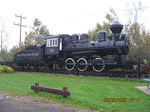
Between 1903 and 1908, the Clarke brothers built a paper mill 7 kilometres (4.3 mi) from the river's mouth. In 1908, they opened the first hydroelectric plant. This plant provided electricity for the mill and the nearby town of Clarke City. They also built a 12 kilometres (7.5 mi) railway to move paper to a wharf at Pointe-Noire. The paper mill operated until 1967.
Sainte-Marguerite-1 Dam
The Sainte-Marguerite-1 (SM-1) dam is near Clarke City. It is a 30.5 MW hydroelectric plant. It started with one turbine in 1993. In 2002, two more turbines were added. This increased its power. The water flow for SM-1 is controlled by the larger SM-3 dam upstream.
Sainte-Marguerite-2 Dam
The Sainte-Marguerite-2 (SM-2) dam is an earth-fill dam 9.3 metres (31 ft) high. It was built in 1951 and started producing electricity in 1954. It makes 17.6 MW of power. This electricity was used by a company to process iron ore.
Sainte-Marguerite-3 Dam
The Sainte-Marguerite-3 (SM-3) power station is very powerful, with a capacity of 882 MW. Its huge reservoir, which is 315 square kilometres (122 sq mi), was filled between 1998 and 2002. The main dam, called the Denis-Perron dam, is 171 metres (561 ft) high. The reservoir behind it is 140 kilometres (87 mi) long.
When the reservoir was filled, it caused some small earthquakes. Also, the levels of mercury in some fish, like lake whitefish and northern pike, went up. However, another fish, the Brook trout, which local people prefer, avoided the large reservoir. The amount of mercury people might get from eating the fish stayed safe.
Images for kids
 | Mary Eliza Mahoney |
 | Susie King Taylor |
 | Ida Gray |
 | Eliza Ann Grier |


