Salem, Utah facts for kids
Quick facts for kids
Salem, Utah
|
|
|---|---|
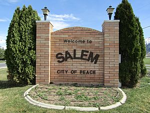
Welcome to Salem sign, March 2017
|
|
| Nickname(s):
City of peace
|
|
| Motto(s):
Making Life Better
|
|
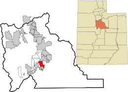
Location in Utah County and the state of Utah
|
|
| Country | United States |
| State | Utah |
| County | Utah |
| Settled | 1851 |
| Incorporated | May 10, 1920 |
| Named for | Salem, Massachusetts |
| Government | |
| • Type | Strong Mayor Municipal Format |
| Area | |
| • Total | 10.53 sq mi (27.26 km2) |
| • Land | 10.50 sq mi (27.21 km2) |
| • Water | 0.02 sq mi (0.06 km2) |
| Elevation | 4,613 ft (1,406 m) |
| Population
(2020)
|
|
| • Total | 9,298 |
| • Density | 885.52/sq mi (341.71/km2) |
| Time zone | UTC-7 (Mountain (MST)) |
| • Summer (DST) | UTC-6 (MDT) |
| ZIP code |
84653
|
| Area code(s) | 385, 801 |
| FIPS code | 49-65770 |
| GNIS feature ID | 2411765 |
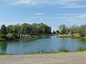
Salem is a city located in Utah County, Utah. It is part of the larger Provo–Orem metropolitan area. In 2020, about 9,298 people lived there. Two well-known spots in Salem are the Dream Mine and the Salem Pond.
Contents
History of Salem, Utah
Long ago, Native Americans called this area "Summer Spring." Later, early settlers named it "Pond Town." The first settlers arrived in 1851.
Salem was later named after New Salem, Massachusetts. This was done to honor Lyman Curtis, who was born there. Curtis was an important early settler in Utah. He helped found a lumber mill and worked on irrigation projects to bring water to farms.
Salem Days: A Community Celebration
Salem Days is a fun, week-long festival that happens every August. It started in 1949 when the Church of Jesus Christ of Latter-day Saints encouraged towns in Utah to have yearly celebrations.
The festival has many exciting activities for everyone. These include a baby contest, a car show, and a unique cardboard boat race. There's also a big parade, a fireworks show, and a children's parade. You can even enjoy a movie in the park!
Population and People
| Historical population | |||
|---|---|---|---|
| Census | Pop. | %± | |
| 1860 | 179 | — | |
| 1870 | 353 | 97.2% | |
| 1880 | 510 | 44.5% | |
| 1890 | 527 | 3.3% | |
| 1900 | 894 | 69.6% | |
| 1910 | 693 | −22.5% | |
| 1920 | 609 | −12.1% | |
| 1930 | 610 | 0.2% | |
| 1940 | 659 | 8.0% | |
| 1950 | 781 | 18.5% | |
| 1960 | 920 | 17.8% | |
| 1970 | 1,081 | 17.5% | |
| 1980 | 2,233 | 106.6% | |
| 1990 | 2,284 | 2.3% | |
| 2000 | 4,372 | 91.4% | |
| 2010 | 6,423 | 46.9% | |
| 2020 | 9,298 | 44.8% | |
| U.S. Decennial Census | |||
According to the census from 2000, there were 4,372 people living in Salem. Most people in Salem are White. A small number of people are Hispanic or Latino.
Many households in Salem have children under 18. The average family size is about four people. The median age in the city was 24 years old. This means half the people were younger than 24, and half were older.
Geography and Climate
Salem covers an area of about 26.4 square kilometers (10.2 square miles). Most of this is land, with a small amount of water. Salem is located about 4.5 miles south of Spanish Fork. It is also 3.3 miles northeast of Payson.
Salem's Climate
Salem has a humid continental climate. This means it has big changes in temperature throughout the year. Summers are warm to hot, and sometimes humid. Winters are cold, and can sometimes be very cold.
Education in Salem
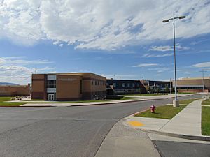
Public schools in Salem are part of the Nebo School District. Salem has several schools for different age groups. There are three elementary schools, one junior high school, one middle school, and one high school. The Superintendent of Schools is Rick Nielsen.
See also
 In Spanish: Salem (Utah) para niños


