Salvatierra, Guanajuato facts for kids
Quick facts for kids
San Andrés de Salvatierra
Ciudad de Salvatierra
|
||
|---|---|---|
|
City and municipality
|
||
|
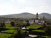
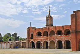
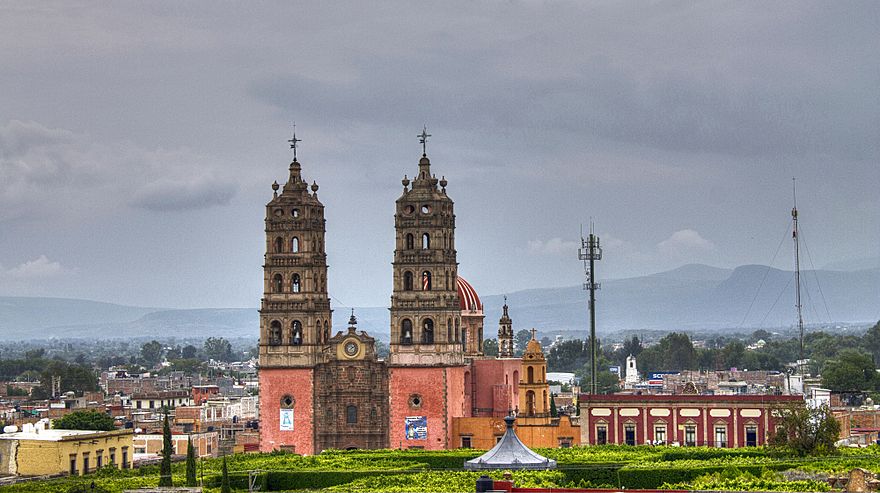
Clockwise from upper left: View of the Tetilla hills, Templo de San Francisco, the historic Puente de Batanes, Parroquia de Nuestra Señora de la Luz, Templo y Convento Las Capuchinas, Eco Parque El Sabinal, Templo del Señor del Socorro, Ex-Hacienda San José del Carmen and the Salvatierra city sign.
|
||
|
||
| Country | Mexico | |
| Founded (officially) | 1644 (By Garcia Sarmiento de Sotomayor) | |
| Elevation | 1,749 m (5,738 ft) | |
| Population
(2020)
|
||
| • Total | 35,401 city; 94,126 municipality | |
| Demonym(s) | Salvaterrense | |
| Time zone | UTC-6 (Central Standard Time) | |
| • Summer (DST) | UTC-5 (Central Daylight Time) | |
| Postal code |
38900
|
|
| Area code(s) | 466 | |
| Website | https://salvatierra.gob.mx/salvatierra/ | |
| Average temperature 18°C | ||
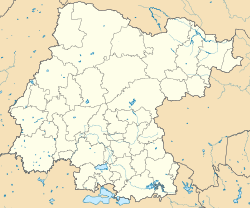
Salvatierra (Spanish: [salβaˈtjera]) is a city and municipality in Guanajuato, Mexico. It is located in the beautiful Huatzindeo valley. This area is known for its many old buildings, including haciendas (large estates), bridges, and convents.
Salvatierra covers about 507.70 square kilometers. This is about 1.66% of the total area of the state of Guanajuato. The city is surrounded by other municipalities. To the north are Tarimoro and Cortazar. To the south, you'll find Acámbaro and the state of Michoacán. To the west are Yuriria and Santiago Maravatío. Finally, to the northeast is Jaral del Progreso.
In 2020, the municipality of Salvatierra had 94,126 people living there. The city itself had 35,401 residents.
Long ago, before Europeans arrived, this area was called Huatzindeo. This name means "Place of beautiful vegetation." The Purépecha were the main inhabitants. In 1646, Salvatierra became the very first city in Guanajuato. This makes it the oldest city in the state. In 2012, the Mexican government named Salvatierra a Pueblo Mágico, which means "Magical Town."
Contents
History of Salvatierra
The first people to live in the Huatzindeo valley were from the Chichimeca culture. By the 1100s, they had many communities there. Later, the Purépecha people took control of this area. They also controlled most of what is now southern Guanajuato.
European Arrival and Founding
The first Europeans to reach the valley were Franciscan friars. These religious men came to teach the native people about Christianity. Between 1535 and 1550, the Franciscans built a small hospital in the native village of Huatzindeo. This village was on the left side of the Lerma River.
Soon, Spanish leaders and settlers joined the friars. They built large farms called haciendas. Native people often worked on these haciendas through a system called encomienda. This system required them to work for the Spanish.
Around 1600, many native people got sick from diseases like typhoid fever and smallpox. These diseases were new to them, and they didn't have protection against them. Because of this, the village of Huatzindeo almost disappeared. Many Spaniards moved to a nearby town called Yuririapundaro. Others stayed and started a new settlement called San Andrés Chochones. This new place was built on the right side of the Lerma River, right across from old Huatzindeo.
San Andrés de Salvatierra was officially founded on February 9, 1644. It was ordered by a Spanish leader named Don Garcia Sarmiento de Sotomayor. Just two years later, in 1646, the town was given the important title of "city." This made it the first city in the state of Guanajuato.
Battles and Growth
During the Mexican War of Independence, an important battle happened in Salvatierra. On April 18, 1813, a fight took place at the Bridge of Batanes. Insurgent forces, led by Ramón López Rayón, fought against royalist forces. The royalists were led by Agustín de Iturbide. The insurgents lost the battle and much of their equipment. They also lost Salvatierra, which was an important base for them. This victory helped Iturbide become a more important leader.
For many years, Salvatierra was a very successful city. It had rich soil and a great location. It was midway between Mexico City, Guadalajara, and Monterrey, which were three major areas. However, Salvatierra did not grow into a big industrial city like some others in Guanajuato. Because of this, many people have moved to nearby cities or even to the United States to find jobs. Some areas in the municipality have a lot of people who have moved away.
Many people from Salvatierra now live in cities in the United States. These include Los Angeles, Salem, Dallas, Houston, Detroit, Atlanta, Philadelphia, Moline, and Chicago.
Geography of Salvatierra
Salvatierra is located in the Huatzindeo Valley. This area is part of the Southern Valleys region of Guanajuato. The land here is shaped by the Mexican transversal neo-volcanic axis. The city is built along the Lerma River. This river helps keep the landscape green for most of the year. Most of Salvatierra is on the east side of the Lerma River.
Climate in Salvatierra
Salvatierra generally has a warm, mild climate. It is mostly a humid subtropical climate (Cwa). Some northern and southern parts have a cooler, more temperate climate. This can be called a subtropical highland climate (Cwb).
| Climate data for Salvatierra | |||||||||||||
|---|---|---|---|---|---|---|---|---|---|---|---|---|---|
| Month | Jan | Feb | Mar | Apr | May | Jun | Jul | Aug | Sep | Oct | Nov | Dec | Year |
| Record high °C (°F) | 34.0 (93.2) |
35.0 (95.0) |
34.5 (94.1) |
39.5 (103.1) |
39.5 (103.1) |
37.0 (98.6) |
34.0 (93.2) |
33.0 (91.4) |
33.5 (92.3) |
32.5 (90.5) |
32.0 (89.6) |
32.0 (89.6) |
39.5 (103.1) |
| Mean daily maximum °C (°F) | 23.9 (75.0) |
25.5 (77.9) |
27.6 (81.7) |
29.3 (84.7) |
30.1 (86.2) |
28.6 (83.5) |
26.7 (80.1) |
26.8 (80.2) |
26.6 (79.9) |
26.3 (79.3) |
25.7 (78.3) |
24.3 (75.7) |
26.8 (80.2) |
| Daily mean °C (°F) | 14.7 (58.5) |
16.0 (60.8) |
17.9 (64.2) |
19.9 (67.8) |
21.3 (70.3) |
21.2 (70.2) |
20.0 (68.0) |
20.0 (68.0) |
19.7 (67.5) |
18.3 (64.9) |
16.6 (61.9) |
15.2 (59.4) |
18.4 (65.1) |
| Mean daily minimum °C (°F) | 5.5 (41.9) |
6.4 (43.5) |
8.2 (46.8) |
10.4 (50.7) |
12.5 (54.5) |
13.8 (56.8) |
13.3 (55.9) |
13.1 (55.6) |
12.8 (55.0) |
10.2 (50.4) |
7.6 (45.7) |
6.1 (43.0) |
10.0 (50.0) |
| Record low °C (°F) | −4.0 (24.8) |
−3.0 (26.6) |
−3.0 (26.6) |
2.5 (36.5) |
3.0 (37.4) |
5.0 (41.0) |
8.0 (46.4) |
7.5 (45.5) |
2.5 (36.5) |
0.5 (32.9) |
−2.0 (28.4) |
−3.0 (26.6) |
−4.0 (24.8) |
| Average precipitation mm (inches) | 15.0 (0.59) |
8.3 (0.33) |
5.9 (0.23) |
10.6 (0.42) |
34.9 (1.37) |
127.8 (5.03) |
171.4 (6.75) |
161.1 (6.34) |
126.7 (4.99) |
45.8 (1.80) |
11.8 (0.46) |
6.7 (0.26) |
726.0 (28.58) |
| Average precipitation days (≥ 0.1 mm) | 2.1 | 1.5 | 1.7 | 2.4 | 6.1 | 14.2 | 18.3 | 17.0 | 12.9 | 5.9 | 2.0 | 1.6 | 85.7 |
| Source: Servicio Meteorologico Nacional (normals 1951-2010, extremes 1951-2022) | |||||||||||||
Salvatierra Cityscape
Salvatierra Microregions
| Name | Population |
|---|---|
| Urireo | 8,679 |
| San Nicolás de los Agustinos | 7,148 |
| San Pedro de los Naranjos | 4,494 |
| El Sabino | 4,095 |
| Maravatío del Encinal | 3,262 |
| Cupareo | 1,982 |
| Santo Tomás Huatzindeo | 1,950 |
| Ojo de Agua de Ballesteros | 1,633 |
| San Miguel Eménguaro | 1,526 |
| La Luz | 1,335 |
| La Estancia de San José del Carmen | 1,252 |
| El Capulín | 1,249 |
| San Pablo Pejo | 1,227 |
| El Salvador (Ranchito San José del Carmen) | 1,205 |
| La Quemada | 1,123 |
| San Antonio Eménguaro | 1,061 |
| Puerta del Monte | 970 |
| La Estancia del Carmen de Maravatio (short name El Carmen) or (La Estancia)-- contrary to its name it belongs to Salvatierra | 913 |
| San José del Carmen | 882 |
| San Isidro | 814 |
| Gervacio Mendoza | 759 |
| La Palma de Eménguaro | 757 |
| La Virgen | 745 |
| La Magdalena | 460 |
| La Esquina | 264 |
| San Miguel el Alto | 40 |
Economy in Salvatierra
In the past, Salvatierra's economy was mostly based on farming. Today, it focuses more on trade and business. Farming is still important, but it's now more specialized. Many farm products are sent outside the municipality.
The commercial sector makes up about 50.4% of the economy. This includes shops and businesses. Next is temporary housing and food services, like restaurants, at 13.3%. Other services, such as barbers and mechanics, make up 12%. The manufacturing industry, especially making textiles (cloth and clothing), accounts for 9.19%.
Culture and Festivals
Salvatierra hosts many fun festivals throughout the year.
- The Fiesta de la Candelaria takes place from January 26 to February 9. February 9 is also the city's founding anniversary!
- In May, people celebrate the Fiesta de la Virgen de la Luz.
- The Fiesta de San Antonio de Padua is held on June 13.
- On July 16, there's the Fiesta de la Virgen del Carmen.
- And on November 20, the Feast of La Virgen del Rosario is celebrated.
Since 2007, Salvatierra has also celebrated its history with bullfighting. This led to a festival called "Marquesada." The main event is a running of the bulls, similar to the famous one in Pamplona, Spain. This tradition remembers the city's past, as the first bullfight in honor of Mexico's independence happened here.
Sister Cities
Salvatierra has special connections with other cities around the world. These are called sister cities:
 Huamantla, Mexico
 Irwindale, California, USA
 Medina Sidonia, Spain
 Comares, Spain
 Zalamea de la Serena, Spain
See also
 In Spanish: Salvatierra (Guanajuato) para niños


