Samuel H. Boardman State Scenic Corridor facts for kids
Quick facts for kids Samuel H. Boardman State Scenic Corridor |
|
|---|---|

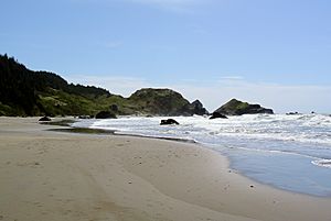
Lone Ranch Beach seen towards south
|
|
| Lua error in Module:Location_map at line 420: attempt to index field 'wikibase' (a nil value). | |
| Type | Public, state |
| Location | Curry County, Oregon, United States |
| Nearest city | Brookings |
| Created | 1949 |
| Operated by | Oregon Parks and Recreation Department |
The Samuel H. Boardman State Scenic Corridor is a beautiful state park located in southwestern Oregon, in the United States. It stretches for about 12 miles (19 kilometers) along the coast. This park is famous for its thick forests, dramatic cliffs, and a few small, sandy beaches. It was named after Samuel H. Boardman, who was the very first superintendent of Oregon's parks.
This amazing park is found just north of Brookings, between the Pacific Ocean and U.S. Route 101. It starts near the Pistol River State Scenic Viewpoint in the north. More than 14 different creeks flow through the park, adding to its natural beauty.
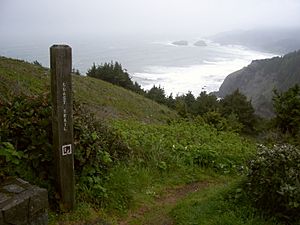
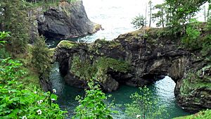
The Oregon Coast Trail winds for about 27 miles (43 kilometers) through the park. Along this trail, you can see huge, old Sitka spruce trees, some of which are 300 years old! You'll also find cool natural arches and bridges formed by the ocean. The park offers places to reach the beach and explore some sand dunes. The Oregon Islands National Wildlife Refuge and Oregon Islands Wilderness protect the animals and their homes on about 130 rocks and islands right off the park's shore.
Contents
History of Samuel H. Boardman Park
Who Lived Here First?
Long ago, Native American tribes lived in the area that is now Samuel H. Boardman State Scenic Corridor. They used the land and its resources for many years. Later, some mining companies tried to find valuable minerals here. You can still see the old ruins from these mining operations today.
Ancient Discoveries at Indian Sands
At a place called Indian Sands within the park, scientists have found amazing clues about people living here a very long time ago. These finds show human activity from 10,000 to 12,000 years ago! This suggests that people might have traveled along the Pacific coast from the area of the Bering Land Bridge to reach this spot.
How the Park Was Created
The first part of the park was bought in May 1949. This first purchase was 121 acres (49 hectares) of land. Over the next few years, at least 12 more pieces of land were added to the park by May 1957. The Oregon Parks Commission also received a special gift in 1950. A company from London, Borax Consolidated, Ltd, donated 367 acres (149 hectares) of land. This company had bought the land around 1880 for mining. They still have the right to mine for minerals like borax underground.
The park has always been a place for day visits. There have never been places for people to stay overnight, like campgrounds or cabins.
 | Roy Wilkins |
 | John Lewis |
 | Linda Carol Brown |


