Oregon Coast Trail facts for kids
Quick facts for kids Oregon Coast Trail |
|
|---|---|

The Oregon Coast Trail at Floras Lake, looking north to the BLM's New River Area of Critical Environmental Concern (ACEC)
|
|
| Length | 425 mi (684 km) |
| Location | Pacific Ocean coast of Oregon, United States |
| Trailheads | Mouth of the Columbia River/California border |
| Use | Hiking |
| Difficulty | Easy to moderate |
The Oregon Coast Trail (OCT) is a very long hiking path. It stretches along the beautiful Pacific coast of Oregon, in the United States. This trail follows the entire Oregon coastline. It starts at the mouth of the Columbia River in the north. It ends at the California border, south of Brookings.
A geography professor named Samuel N. Dicken first thought of the trail in 1959. The idea was approved in 1971. The Oregon Parks and Recreation Department helps manage and develop the trail. The trail is part of Oregon's state park system.
The exact length of the trail can change. It depends on how you cross rivers and estuaries (where rivers meet the sea). If you can't use a ferry, you might have to walk on roads. The trail is about 425 miles (684 km) long if you don't use any ferries. About 39% of the trail is on the beach. Another 41% is on paved roads. The last 20% is on dirt trails and roads.
One cool thing about the trail is the public beaches. The Oregon Beach Bill in 1967 made sure all beaches were open to everyone. Many parts of the trail, especially in the south, are quiet and remote. The Oregon coast has a temperate rainforest. This means it's a cool, wet forest.
The trail's difficulty ranges from easy to moderate. This means some parts are simple walks. Other parts might have small hills to climb.
Exploring the Trail's Path
The northern start of the trail is near the Columbia River. It's about 4 miles (6 km) north of Fort Stevens State Park. It's also about 13 miles (21 km) from Astoria. The trail goes from north to south along the whole Oregon Coast. It stays as close to the shore as it can.
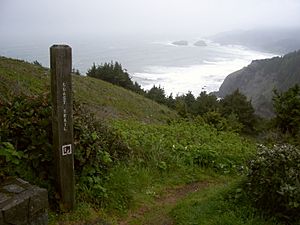
Many parts of the trail are beach walks, mostly on sand. In towns, the trail often follows the street closest to the ocean. Sometimes, the trail leaves the beach and goes inland. This happens when the shoreline is too hard to pass. For example, at Cape Kiwanda, you have to go around.
Some rocky areas can only be crossed at low tide. Other rocky areas have trails high above the sea. In many other places, the only way to go is on U.S. Route 101. The very end of the trail is the Oregon/California border. This is about 5 miles (8 km) south of Brookings.
You will also find many rivers and creeks to cross. Most small creeks can be waded through. But sometimes the water can be deep, even when the tide is low. At high tide, some crossings can be dangerous or impossible. You might need a boat or have to take a longer route to a bridge. More rain in winter and spring means fewer streams are safe to cross.
Tips for Hiking the Trail
There isn't one special guidebook just for the Oregon Coast Trail. But in 2009, the State of Oregon put out maps you can download. These maps have short descriptions of the path. Other local hiking books also describe parts of the trail. You can find updated guides online in discussion groups.
The Oregon Coast Trail is a "described route." This means it's not always a smooth, continuous path. More than 150 miles (241 km) of the trail are on paved roads. The OCT has signs along its whole length. However, sometimes the signs are hard to find. But it's tough to get lost because you are never far from a paved road.
The trail is open to hikers. Some parts also allow bicycles and horses. It's very helpful to carry a current tide table. This is because some parts of the trail can only be crossed at low tide. You might have to wait for the tide to go down. Or you might need to walk inland to avoid high water.
Special rules are in place from March 15 to September 15. These rules protect nesting shorebirds. During this time, dogs, camping, bikes, and kites are not allowed in certain areas. Hikers and horse riders must stay on the wet sand. These areas are clearly marked with yellow signs on the beach. You can find maps online from the Oregon Parks and Recreation Department.
Many state campgrounds have special areas for hikers and bikers. These spots cost less than regular campsites. You can camp on the beach in some places. But you must be out of sight of houses. You also can't camp next to state parks. And you must avoid areas where snowy plover birds are nesting. This means camping is limited in some northern beach areas. The State of Oregon plans to create more free camping spots.
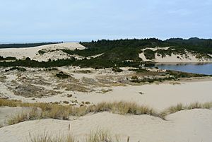
Vehicles are allowed on a few beaches. Dune buggies are popular in the Oregon Dunes National Recreation Area. This is a 40-mile (64 km) stretch of beach from Florence to Coos Bay.
Some parts of the trail are very quiet and beautiful. For example, the section from Bandon to Port Orford is very peaceful. You can find free camping there for several days.
The wind usually blows from the northwest. This makes it easier to hike the trail from north to south. Most trail guides also describe the route in this direction.
Cities and towns are located along Highway 101. They are usually every 20 to 25 miles (32 to 40 km). This means you can get supplies regularly. Public transportation along the coast is very limited.
Cool Places Along the Trail
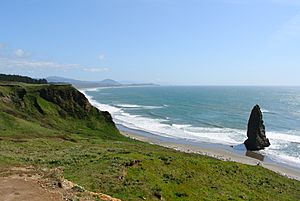
Here are some interesting places you'll find along the Oregon Coast Trail, from north to south:
- Fort Stevens State Park
- Gearhart, near the Necanicum River
- Seaside
- Tillamook Head
- Ecola State Park
- Cannon Beach
- Oswald West State Park
- Manzanita
- Nehalem and Nehalem Bay State Park
- Garibaldi
- Tillamook Bay
- Tillamook
- Cape Meares State Park
- Oceanside
- Netarts
- Cape Lookout and Cape Lookout State Park
- Neskowin
- Lincoln City
- Depoe Bay
- Devils Punch Bowl State Natural Area
- Beverly Beach State Park
- Newport
- South Beach State Park
- Ona Beach State Park
- Seal Rock State Recreation Site
- Waldport
- Yachats
- Neptune State Scenic Viewpoint
- Carl G. Washburne Memorial State Park
- Heceta Head Light
- Jessie M. Honeyman Memorial State Park
- Oregon Dunes National Recreation Area
- Reedsport
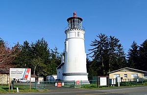
- Umpqua Lighthouse State Park
- Coos Bay
- Bullards Beach State Park
- BLM primitive campground, at the New River ACEC
- Boice Cope Park, a Curry County campground at Floras Lake
- Cape Blanco and Cape Blanco State Park
- Humbug Mountain State Park
- Gold Beach and Rogue River (Oregon)
- Samuel Boardman State Park
- Harris Beach State Park
- Brookings
- Winchuck River
 | James Van Der Zee |
 | Alma Thomas |
 | Ellis Wilson |
 | Margaret Taylor-Burroughs |


