Santa Rosa Range facts for kids
Quick facts for kids Santa Rosa Range |
|
|---|---|
| Highest point | |
| Peak | Granite Peak |
| Elevation | 2,966 m (9,731 ft) |
| Geography | |
| Country | United States |
| State | Nevada |
| District | Humboldt County |
| Range coordinates | 41°27′25.632″N 117°41′0.479″W / 41.45712000°N 117.68346639°W |
| Topo map | USGS Five Fingers |
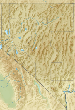
The Santa Rosa Range is a long chain of mountains located in Humboldt County, Nevada, in the United States. Most of these mountains are part of the Humboldt-Toiyabe National Forest, which is a large protected area.
The two tallest peaks in the range are Granite Peak, standing at 2,966 meters (9,732 feet), and Santa Rosa Peak, which is 2,957 meters (9,701 feet) tall. The Santa Rosa Range stretches for about 120 kilometers (75 miles) from Winnemucca Mountain near the city of Winnemucca all the way north to the border with Oregon.
About the Santa Rosa Range
The higher parts of the southern section of the range are a special protected area. This area is called the Santa Rosa-Paradise Peak Wilderness Area. It helps keep the natural environment safe.
Surrounding Areas
On the eastern side of the Santa Rosa Range, you'll find a farming and ranching area. This district is around a place called Paradise Valley. The Little Humboldt River flows through this area. This river eventually joins the larger Humboldt River.
To the west of the mountains is the Quinn River Valley. Further northeast, beyond the northern end of the range, lies the Owyhee Desert. This desert is part of a much larger landform known as the Columbia Plateau.
Why the Name?
The Santa Rosa Range got its name because of the many wild roses that grow in the area. Imagine seeing beautiful wild roses blooming in the mountains!
See also
 In Spanish: Cordillera de Santa Rosa para niños
 | Valerie Thomas |
 | Frederick McKinley Jones |
 | George Edward Alcorn Jr. |
 | Thomas Mensah |


