Sapotaweyak Cree Nation facts for kids

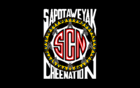
Flag of the Sapotaweyak Cree Nation.
|
|
| Treaty | Treaty 4 |
|---|---|
| Headquarters | Pelican Rapids, Manitoba |
| Land | |
| Main reserve | Shoal River Indian Reserve 65A |
| Government | |
| Chief | Nelson Genaille |
| Tribal Council | |
| Swampy Cree Tribal Council | |
The Sapotaweyak Cree Nation (SCN) is a First Nation community in Manitoba, Canada. Their lands, called reserves, are located in northern Manitoba. They are about 400 kilometres northwest of Winnipeg, near Swan River.
The people of Sapotaweyak Cree Nation are mainly Cree. They speak a mix of Plains Cree, Swampy Cree, and Saulteaux languages. This unique way of speaking is also shared with the Wuskwi Sipihk First Nation.
Their main community area is called Shoal River Indian Reserve 65A. It is right next to Pelican Rapids. About half of the community lives on the reserve. The other half lives in other places.
The Sapotaweyak Cree Nation signed Treaty 4 in 1874. This was an agreement with the Canadian government.
The SCN is part of the Swampy Cree Tribal Council. This council helps several Cree First Nations work together. Other nations in this council include the Chemawawin Cree Nation and the Opaskwayak Cree Nation.
In 2018, about 900 people from the community had to leave their homes. This was because of wildfires. They were able to return safely after about two weeks.
Contents
Community Needs and Development
The Sapotaweyak Cree Nation works to improve life for its members. In 2016, Chief Nelson Genaille talked about important needs. He said the community needed better housing, water systems, and schools.
Homes for the Community
Living near a river and lake can cause challenges for homes. Sometimes, the area floods in spring and fall. This means new homes need to be built in safer places.
In 2016, the Chief said the community needed many new homes. Some existing homes had problems like mould. Building new, safe homes is very important for families.
Clean Water and Waste Systems
Having clean drinking water is vital for everyone. The Sapotaweyak Cree Nation gets its water from the Shoal River or Dawson Bay.
A new water treatment plant was built for the community. It cost $14.2 million. In 2021, tests showed the water was safe to drink. This meant a long-term warning about drinking water could be lifted. This was a big step forward for the community's health.
Learning and Education
The Neil Dennis Kematch Memorial School opened in 2007. It allows students from junior kindergarten to grade 8 to learn in their community. Students can also choose to go to schools outside the reserve.
In 2016, there were differences in funding for students. Schools on reserves received less money per student than public schools. This made it hard for the school to offer special programs. It also made it difficult to pay teachers competitive wages. More funding is needed to give students the best education.
Community Economy
The Sapotaweyak Cree Nation has different ways of supporting itself. In 2004, their economy included fishing and trapping. They also had cattle ranching and logging operations. These activities help provide jobs and resources for the community.
Important Community Issues
The Sapotaweyak Cree Nation has faced some important challenges. They have worked to protect their rights and lands.
Hunting Rights and Moose Conservation
The Sapotaweyak Cree Nation and the Swampy Cree Tribal Council are working to protect their hunting rights. These rights are part of their Treaty 4 agreement. In 2011, Manitoba put rules in place to protect moose. This was because the moose population was getting smaller.
However, the First Nations believe that other activities have harmed the moose more. These include logging and building power lines. They argue that their traditional hunting practices are not the main problem. In 2020, a community member was arrested for hunting a moose. He was following his traditional customs. The community is working to make sure their treaty rights are respected.
Protecting Ancestral Lands from Power Lines
In 2015, the Sapotaweyak Cree Nation tried to stop a large power line project. This was the Bipole III transmission line by Manitoba Hydro. The line was planned to cross about 200 kilometres of their ancestral land. This land includes important burial grounds and spiritual sites.
The community felt that they were not properly consulted. They had an agreement from 1997 that said they should be involved in such decisions. Even though a judge did not agree with their claim, the community continues to protect their land and heritage.
Sapotaweyak Cree Nation Reserves
The Sapotaweyak Cree Nation has several reserves. These are lands set aside for the First Nation. Most are along the shores of Lake Winnipegosis.
- Channel Island Sapotaweyak Cree Nation Indian Reserve — 13.59 square kilometres.
- Overflowing River Sapotaweyak Cree Nation Indian Reserve — 4.69 square kilometres.
- Pelican Rapids Access Road Phase 1 Indian Reserve — 84.1 square kilometres.
- PTH 10 Sapotaweyak Cree Nation Indian Reserve — 0.58 square kilometres.
- Sapotaweyak Cree Nation Indian Reserve — 282.048 square kilometres.
- Sapotaweyak Cree Nation - Spruce Island Indian Reserve — 18.48 square kilometres.
- Shoal River Indian Reserve No. 65A — 3.922 square kilometres; 83 km south of The Pas.
- Shoal River Indian Reserve No. 65B — 9.551 square kilometres; at Steep Rock Point, Dawson Bay, Lake Winnipegosis.
- Shoal River Indian Reserve No. 65F — 0.441 square kilometres; at Dawson Bay, Lake Winnipegosis.
One reserve is shared with 32 other First Nations. All of these nations signed Treaty 4.
- Treaty Four Reserve Grounds Indian Reserve No. 77 — 0.379 square kilometres; near Fort Qu'Appelle, Saskatchewan.
 | Anna J. Cooper |
 | Mary McLeod Bethune |
 | Lillie Mae Bradford |

