Satsop Hills facts for kids
Quick facts for kids Satsop Hills |
|
|---|---|

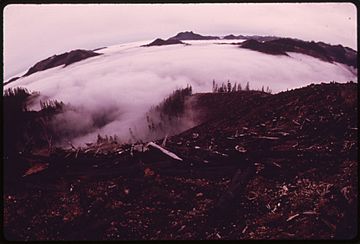
Logged hill, foreground, and peaks rising above fog in Satsop Hills
|
|
| Highest point | |
| Peak | Rock Peak |
| Elevation | 3,294 ft (1,004 m) |
| Geography | |
| Country | United States |
| State | Washington |
| Region | Western Washington |
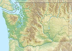
| Range coordinates | 47°22′N 123°27′W / 47.367°N 123.450°W |
| Parent range | Olympic Mountains |
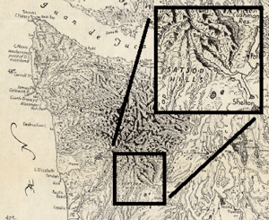
The Satsop Hills are a group of smaller mountains, also called foothills, located in Mason County, Washington. They are found north of a town called Matlock, Washington. To their west is Wynoochee Lake, and to their east is Lake Cushman. These hills are part of the larger Olympic Mountains range.
Contents
Exploring the Satsop Hills' Geography

The Satsop River starts in these hills. Its watershed, which is the area of land that drains into the river, covers about 300 square miles. The river then flows south to the Chehalis River.
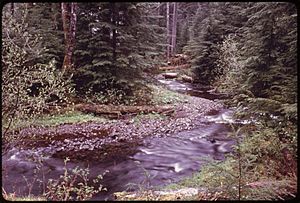
Some parts of the Satsop watershed get a lot of rain, about 160 inches each year. This much rain means it's a temperate rainforest. A weather station called Wynoochee Oxbow, on the west side of the hills, has the highest average yearly rainfall in the continental United States. It also had the second highest rainfall ever recorded there.
The Satsop Hills are partly inside the Olympic National Forest. However, they are not part of the Olympic National Park.
Tallest Spots in the Satsop Hills
Here are some of the main peaks, or high points, in the Satsop Hills:
| Name | Height | Location | Fire lookout? |
|---|---|---|---|
| Dusk Point | 3201 feet | 47°24′40″N 123°28′08″W / 47.411°N 123.469°W | Yes |
| Grisdale Hill | 1446 feet | 47°22′23″N 123°17′56″W / 47.373°N 123.299°W | 1940s |
| Rock Peak | 3294 feet | 47°24′17″N 123°22′54″W / 47.40472°N 123.38167°W | |
| South Mountain | 2903 feet | 47°18′43″N 123°22′16″W / 47.312°N 123.371°W | 1956–1976 |
History of the Satsop Hills
Forest fires have happened many times in the Satsop Hills. People have used the name "Satsop Hills" since at least 1885. Back then, a newspaper called the Morning Oregonian used it to describe where forest fires were burning.
In September 1902, huge fires swept across Southwest Washington. One fire burned from Elma all the way to Shelton. It destroyed a lot of lumber at a mill in the hills above Elma. It also burned countless trees. On September 12, the town of Montesano became dark at noon because of the smoke. A wide area of trees, about one to two miles across, was completely burned. This area stretched from Elma to Summit Lake, which is 13 miles west.
During the 20th century, several fire lookouts were built on the peaks. These lookouts, like the ones listed above, were part of a national plan to help control fires.
Getting Around the Satsop Hills
The hills have many logging roads. There is also an old logging railroad that was once used by the Simpson Timber Company. The Vance Creek Bridge is located here. It is 347 feet above Vance Creek. This bridge was once the highest railroad bridge in the United States. It is still one of the twenty highest bridges in the country.
Wildlife in the Satsop Hills
The Satsop Hills are home to many animals. You can find deer and Roosevelt Elk herds here. There are also black bears and cougars. Game birds like grouse live in the hills. The area also has the largest group of mountain quail in the state. The elk probably move between the hills and the Olympic National Park.
Some people also report seeing Sasquatch in the hills. As of 2014, there have been 22 reported sightings. One case was found by a sheriff's deputy in 1982. An Idaho State University biologist even looked into it in 2004.
Fun Activities in the Satsop Hills
There are many fun things to do in the Satsop Hills. You can go canoeing and kayaking on the rivers. Camping, fishing, hunting, and hiking are also popular.
Schafer State Park is located on the Satsop River. It is part of the Washington State Parks system. Truman Glick County Park is another park, about 35 acres in size. It is along the old railroad on the south side of the hills.
Many guides mention great hiking spots. These include Satsop Lakes and Spoon Creek Falls. South Mountain is also a well-known place for winter hiking in Mason County. The Vance Creek Bridge became very famous from pictures shared online. Even though it's on private land, it was one of the most popular places to visit on the Olympic Peninsula.
The highest point in Grays Harbor County is a 4880-foot peak. It is near a slightly taller peak in Mason County, which is sometimes called Wynoochee Point. People who enjoy highpointing (trying to reach the highest point in different areas) like to visit this spot. It is on the border between Grays Harbor and Mason counties, either in the Satsop Hills or nearby.
 | Aurelia Browder |
 | Nannie Helen Burroughs |
 | Michelle Alexander |


