Saugeen River facts for kids
Quick facts for kids Saugeen River |
|
|---|---|

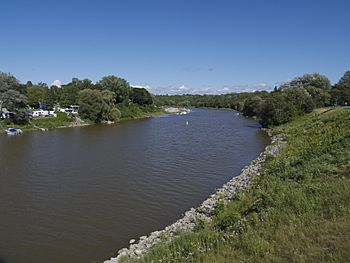
Saugeen River in Southampton, about 1 km from its mouth at Lake Huron
|
|
| Country | Canada |
| Province | Ontario |
| Region | Southwestern Ontario |
| Counties |
|
| Physical characteristics | |
| Main source | Wetland Osprey Wetland Conservation Lands, Grey County 525 m (1,722 ft) 44°14′58″N 80°21′12″W / 44.24944°N 80.35333°W |
| River mouth | Lake Huron Southampton, Bruce County 190 m (620 ft) 44°30′03″N 81°22′25″W / 44.50083°N 81.37361°W |
| Length | 160 km (99 mi) |
| Basin features | |
| River system | Great Lakes Basin |
| Tributaries |
|
The Saugeen River is a cool river in southern Ontario, Canada. It starts in the Osprey Wetland Conservation Lands and flows about 160 kilometers (100 miles) northwest. It then empties into Lake Huron.
Long ago, people used the river to move goods on barges. Today, it's a great place for fun activities. It's super popular for fishing and canoeing adventures!
The river's name comes from the Ojibwe language. The word Zaagiing means "outlet" or "mouth of the river."
Contents
Journey of the Saugeen River
The Saugeen River starts its journey in the Osprey Wetland Conservation Lands. It flows west, then briefly north through the village of Wareham. After Wareham, it turns west again.
The river then flows southwest, crossing Ontario Highway 10. It meanders south-southwest before turning west. Next, it turns north and flows through the village of Priceville.
Waterfalls and Turns
After Priceville, the Saugeen flows west, following the old route of Ontario Highway 4. It reaches the town of Durham. Here, the river creates McGowan Falls, a beautiful cascade waterfall in the Durham Conservation Area.
The river then crosses Ontario Highway 6 in downtown Durham. After leaving Durham, the Saugeen River turns northwest. It meets the Rocky Saugeen River here.
Meeting Other Rivers
Soon after, the Saugeen makes a sharp turn south. It takes in the Styx River and then Camp Creek near the village of Allan Park. The river then turns west again, once more following the old Highway 4.
The Saugeen River flows past the northern edge of Hanover. It enters the Darroch Nature Reserve, where it meets the South Saugeen River.
Final Stretch to Lake Huron
The Saugeen River continues west before making a sharp north turn near Walkerton. It flows north through Walkerton and then north-northwest.
The river enters the town of Paisley. In Paisley, it takes in the Teeswater River and then the North Saugeen River just north of town. The river continues north through the Saugeen Bluffs Conservation Area. It then flows into Denny's Dam Conservation Area.
Finally, the Saugeen turns west and enters Southampton. It crosses Ontario Highway 21 at the Zgaa-biig-ni-gan Bridge. From there, it empties into the vast Lake Huron.
River Branches: Tributaries
The Saugeen River has many smaller rivers and streams that flow into it. These are called tributaries. The two biggest ones are the South Saugeen and the North Saugeen.
- The South Saugeen starts near Dundalk.
- The North Saugeen begins near Holland Centre.
The North Saugeen joins the main Saugeen River just north of Paisley. This is about 24 kilometers (15 miles) before the Saugeen flows into Lake Huron. The South Saugeen joins the Saugeen about 35 kilometers (22 miles) further southeast, near Hanover.
Here are some of the Saugeen River's tributaries:
- Mill Creek (flows in from the left)
- North Saugeen River (flows in from the right)
- Teeswater River (flows in from the left)
- South Saugeen River (flows in from the left)
- Beatty Saugeen River (flows into the South Saugeen from the right)
- Camp Creek (flows in from the left)
- Styx River (flows in from the right)
- Rocky Saugeen River (flows in from the right)
Towns and Villages Along the River
Many communities are located along the Saugeen River and its branches.
Along the Main Saugeen River
- Southampton
- Paisley
- Walkerton
- Hanover
- Durham
- Priceville
- Wareham
Along the North Saugeen River
- Chesley
- Scone
- Williamsford
Along the South Saugeen River
- Neustadt
- Ayton
- Mount Forest
Along the Rocky Saugeen River
- Aberdeen
- Markdale
The Tiny Hungerford's Crawling Water Beetle
The North Saugeen River is home to a very special and rare insect: the Hungerford's crawling water beetle. This beetle is one of the most endangered insects in the world!
In 1986, scientists found 42 of these beetles near Scone in Bruce County, Ontario. This was the only place outside of the United States where these beetles were known to live.
The last time any beetles were seen was in 2001. After that, surveys in 2002 did not find any. This means we don't know if this group of Hungerford's crawling water beetles is still there.
Even though this beetle was listed as endangered in the U.S. in 1994, it does not currently have special protection in Canada.
 | Laphonza Butler |
 | Daisy Bates |
 | Elizabeth Piper Ensley |

