Sautens facts for kids
Quick facts for kids
Sautens
|
||
|---|---|---|
 |
||
|
||

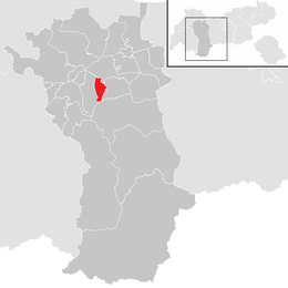
Location in the district
|
||
| Country | Austria | |
| State | Tyrol | |
| District | Imst | |
| Area | ||
| • Total | 11.61 km2 (4.48 sq mi) | |
| Elevation | 812 m (2,664 ft) | |
| Time zone | UTC+1 (CET) | |
| • Summer (DST) | UTC+2 (CEST) | |
| Postal code |
6432
|
|
| Area code | 05252 | |
| Vehicle registration | IM | |
| Website | www.sautens.tirol.gv.at | |
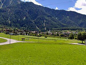
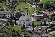
Sautens is a small town, also called a municipality, in the Imst area of Austria. It is located about 9 kilometers (5.6 miles) southeast of the town of Imst. Sautens sits on the lower part of the Ötztaler Ache river.
The village gets a lot of sunshine and is protected from strong winds. This creates a very mild climate, meaning the weather is usually pleasant. The main way people in Sautens earn money is through farming. Growing fruit is especially important here. A lot of the fruit harvested is used to make a special drink called Schnapps.
The name "Sautens" might come from ancient Roman times. Sautens used to be connected with the nearby town of Oetz. However, in 1836, Sautens became its own separate community. In recent years, more and more tourists have started visiting the village.
How Many People Live in Sautens?
Sautens has seen its population grow over time. More people have chosen to live in this sunny and protected village. The number of residents has steadily increased, especially in recent decades.
| Historical population | ||
|---|---|---|
| Year | Pop. | ±% |
| 1869 | 692 | — |
| 1880 | 657 | −5.1% |
| 1890 | 609 | −7.3% |
| 1900 | 559 | −8.2% |
| 1910 | 543 | −2.9% |
| 1923 | 604 | +11.2% |
| 1934 | 650 | +7.6% |
| 1939 | 654 | +0.6% |
| 1951 | 761 | +16.4% |
| 1961 | 792 | +4.1% |
| 1971 | 927 | +17.0% |
| 1981 | 1,081 | +16.6% |
| 1991 | 1,203 | +11.3% |
| 2001 | 1,280 | +6.4% |
| 2011 | 1,417 | +10.7% |
| 2018 | 1,601 | +13.0% |
See also
 In Spanish: Sautens para niños
 | Tommie Smith |
 | Simone Manuel |
 | Shani Davis |
 | Simone Biles |
 | Alice Coachman |


