Scholls, Oregon facts for kids
Quick facts for kids
Scholls, Oregon
|
|
|---|---|

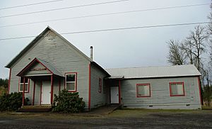
Scholls Grange
|
|
| Country | United States |
| State | Oregon |
| County | Washington |
| Elevation | 151 ft (46 m) |
| Time zone | UTC-8 (Pacific (PST)) |
| • Summer (DST) | UTC-7 (PDT) |
| ZIP code |
97140
|
| Area code(s) | 503 and 971 |
| GNIS feature ID | 1158471 |
Scholls, Oregon is a small community in Washington County, Oregon, United States. It is an unincorporated community, which means it does not have its own local government like a city. Scholls is located along the southern side of the Tualatin River. You can find it near where Oregon Routes 210 and 219 meet.
Scholls is about seven miles north of Newberg. It is also seven miles west of Tigard. Hillsboro is about eight miles to the south. The land around Scholls is mostly used for farming.
Discovering Scholls' Past
The community of Scholls was named after an early settler named Peter Scholl. He was a pioneer who claimed land here in 1847. This was done under the Donation Land Claim Act, which allowed settlers to claim land for free.
Scholls was once an important place for crossing the Tualatin River. There was a ferry called Scholls Ferry that connected Scholls with Kinton. Today, a bridge has replaced the old ferry. However, Oregon Route 210 is still known as Scholls Ferry Road by local people.
Peter Scholl was related to the famous pioneer Daniel Boone. He was likely connected through Boone's grandson, Alphonso Boone, who also settled in Oregon. Alphonso Boone built Boones Ferry further south.
A general store has been open in Scholls since the 1890s. The Petrich family bought this store in 1964. Sadly, the original Petrichs General Store burned down in 1994.
The "Scholls Ferry" post office opened in 1871. Its name was changed to "Scholls" in 1895. The ZIP Code for Scholls is 97123.
Campo Azul: A Community's Story
Campo Azul was a special living area located on a farm near Scholls. It was on the east side of Scholls Ferry Road, next to the Tualatin River. This community was started in the 1970s. It was named "Campo Azul" because the housing units were blue. "Campo Azul" means "Blue Camp" in Spanish.
For many years, people who worked on farms lived at Campo Azul. Sometimes, their children lived there too. Up to 90 adults and children lived in this community. The farm was sold in 2004.
By 2009, the new owners started using the farm for new things. They opened a U-pick Pumpkin Patch where visitors could pick their own pumpkins. They also began raising sheep. Today, the farm is also a place for special events and parties. It is also used for community farming projects.


