Schooley's Mountain facts for kids
Quick facts for kids Schooleys Mountain |
|
|---|---|

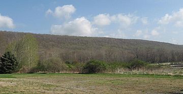
Schooleys Mountain near Long Valley, NJ
|
|
| Highest point | |
| Elevation | 1,200 feet (366 m) |
| Geography | |
| Location | Washington Township, Morris County, New Jersey, U.S. |
| Topo map | USGS Hackettstown |
| Climbing | |
| Easiest route | Road |
Schooleys Mountain is a cool mountain ridge in northern New Jersey. A ridge is like a long, narrow mountain top. This mountain stretches from Lake Hopatcong in the north all the way to Hampton in the south.
It sits right in the middle of the southern Highlands region. The Highlands are a group of mountains and hills. Schooleys Mountain is also one of the biggest ridges in a group of similar mountains. These include Allamuchy Mountain, Pohatcong Mountain, Scotts Mountain, and Jenny Jump Mountain.
Contents
Where is Schooleys Mountain Located?
Schooleys Mountain is separated from Musconetcong Mountain by a small gap. This gap has a valley with a stream called Spruce Run. The mountain ridge goes for about 20 miles to the northeast.
Budd Lake and the South Branch Raritan River separate it from Mooney Mountain. The very tip of the northeast part of the mountain looks over Waterloo. The Musconetcong River valley is on its northwest side. On the southeast side is Washington Township, Morris County, New Jersey. The South Branch Raritan River drains this area.
What are the Highest Points?
Some important smaller peaks on Schooleys Mountain include Mount Kipp. It is about 951 feet (290 meters) tall. Point Mountain is another peak, about 935 feet (285 meters) high. It looks over Anderson in the Musconetcong Valley.
The very top of the main ridge is in an area with private homes. This is on the northeastern part of the ridge. The community of Schooley's Mountain is right on top of the ridge. It rises about 400 to 800 feet (122 to 244 meters) above the valleys around it.
The History of Schooleys Mountain
The mountain gets its name from the Schooley family. They were Quaker landowners in the area way back in the 1790s.
Why Was Schooleys Mountain Popular?
A long time ago, the fresh mountain air and special springs made Schooleys Mountain a popular summer spot. These springs had iron in the water, which people thought was good for them. Because of the good air, a state hospital for people with lung problems was once located near Mount Kipp.
Many small iron mines operated on the mountain in the late 1800s. You can still see some remains of these mines today. People also dug out granite, a type of rock, from the mountain.
How Did People Travel Across the Mountain?
The main road across the mountain is Schooley's Mountain Road. It used to be called Washington Turnpike. General George Washington wrote in his diary that he thought the route from "Dutch Valley to Schooley's Mountain" was difficult and indirect.
Fun Things to Do at Schooleys Mountain
Even though many flat areas on the ridge have houses now, a lot of Schooleys Mountain is still covered in trees.
Exploring Parks and Waterfalls
On the northwest side, you can visit Cataract Park. It's along Schooleys Mountain Road (Route 24). This park protects a beautiful waterfall and an old mine entrance.
Schooley's Mountain County Park is on the southeastern side. This park includes the valley of Long Valley and a small lake called Lake George. Lake George has been cleaned up, but you can't swim there anymore. Electric Brook flows from Lake George over several waterfalls in the park. It then reaches the South Branch of the Raritan River. The park lets you rent boats and has many other fun things to do besides hiking. Part of the Patriots' Path trail goes through this park.
 | Dorothy Vaughan |
 | Charles Henry Turner |
 | Hildrus Poindexter |
 | Henry Cecil McBay |

