Scotland, Indiana facts for kids
Quick facts for kids
Scotland, Indiana
|
|
|---|---|
 |
|

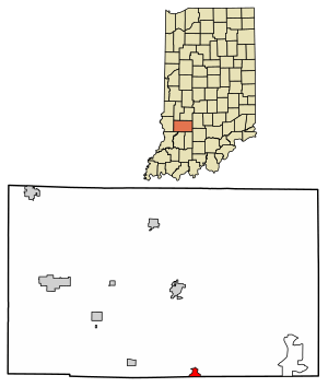
Location of Scotland in Greene County, Indiana.
|
|
| Country | United States |
| State | Indiana |
| County | Greene |
| Township | Taylor |
| Area | |
| • Total | 0.58 sq mi (1.49 km2) |
| • Land | 0.58 sq mi (1.49 km2) |
| • Water | 0.00 sq mi (0.00 km2) |
| Elevation | 614 ft (187 m) |
| Population
(2020)
|
|
| • Total | 98 |
| • Density | 170.14/sq mi (65.65/km2) |
| ZIP code |
47424
|
| FIPS code | 18-68382 |
| GNIS feature ID | 2583469 |
Scotland is a small place in Indiana, United States. It is known as an unincorporated community, which means it's not officially a city or town with its own local government. It's also a census-designated place (CDP), which is an area the government counts for population statistics.
Scotland is located in Greene County, within Taylor Township. In 2010, about 134 people lived there. By 2020, the population was 98.
Contents
History of Scotland
The first post office in Scotland opened in 1837. Many of the first people who settled here came from the country of Scotland. This is how the community got its name!
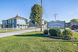
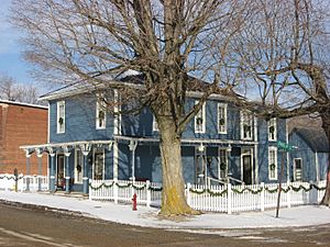
A very important building in Scotland is the Scotland Hotel. It was added to the National Register of Historic Places in 1993. This means it's a special building recognized for its history.
Where is Scotland Located?
Scotland is in the southern part of Greene County. Its southern edge is close to the borders of Martin and Daviess counties.
Main roads like State Road 45 and State Road 58 pass just north of Scotland. These roads connect to U.S. Route 231 and Interstate 69 about 1 mile west of the community.
Here are some distances to other nearby places:
- Owensburg is about 10 miles to the east.
- Bloomfield, which is the main town of Greene County, is about 9 miles to the north.
- Loogootee is about 17 miles to the south.
- Interstate 69 goes northeast about 33 miles to Bloomington.
- Interstate 69 also goes southwest about 28 miles to Washington.
The area of Scotland is about 1.5 square kilometers (0.58 square miles), and it's all land. It sits on high ground south of Doans Creek. This creek flows into the White River, which is part of the larger Wabash River system.
Population and People
| Historical population | |||
|---|---|---|---|
| Census | Pop. | %± | |
| 2020 | 98 | — | |
| U.S. Decennial Census | |||
The population of Scotland has changed over the years. In 2010, 134 people lived there. By the 2020 census, the population was 98.
Schools in Scotland
Students in Scotland attend schools that are part of the Bloomfield School District.
See also
 In Spanish: Scotland (Indiana) para niños
 | Sharif Bey |
 | Hale Woodruff |
 | Richmond Barthé |
 | Purvis Young |


