Scottsville, New York facts for kids
Quick facts for kids
Scottsville
|
|
|---|---|

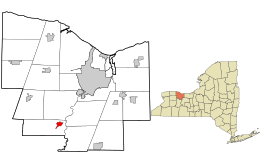
Location in Monroe County and the state of New York.
|
|

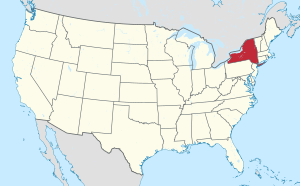
Location of New York in the United States
|
|
| Country | United States |
| State | New York |
| County | Monroe |
| Township | Wheatland |
| Settled | 1790 |
| Incorporated | October 16, 1914 |
| Area | |
| • Total | 1.09 sq mi (2.82 km2) |
| • Land | 1.08 sq mi (2.80 km2) |
| • Water | 0.01 sq mi (0.01 km2) |
| Elevation | 537 ft (164 m) |
| Population
(2020)
|
|
| • Total | 2,009 |
| • Density | 1,855.03/sq mi (716.38/km2) |
| Time zone | UTC-5 (EST) |
| • Summer (DST) | UTC-4 (EDT) |
| ZIP code |
14546
|
| Area codes | 585 |
| FIPS code | 36-65959 |
| Website | http://www.scottsvilleny.org/ |
Scottsville is a small village located in the southwestern part of Monroe County, New York, in the United States. It is part of the town of Wheatland. In 2020, about 2,009 people lived there. The village is named after an early settler, Isaac Scott. Many people who live in Scottsville work in or near the city of Rochester, which is only about a ten-minute drive away.
Contents
History of Scottsville
Early Settlers
One of the first people to settle in the area was Isaac Scott. He arrived in 1790. Mr. Scott bought about 150 acres (0.61 square kilometers) of land. This land was owned by people living in London, Great Britain. Much of what is now Scottsville village was part of this land. Isaac Scott's first home was a log house. It was located at the corner of Main and Rochester Streets.
Historic Places
Several important places in Scottsville are listed on the National Register of Historic Places. This means they are special historical sites that are protected. Some of these sites include:
- Isaac Cox Cobblestone Farmstead
- Cox–Budlong House
- Grace Church
- David McVean House
- Simeon Sage House
- William Shirts House
- Union Presbyterian Church
- Windom Hall
The Rochester Street Historic District is also a special historic area. It was added to the list in 1973.
Geography of Scottsville
Scottsville is located at 43°1′19″N 77°45′13″W. This is its exact position on a map.
The village is about one mile (1.6 kilometers) west of where Oatka Creek meets the Genesee River.
According to the United States Census Bureau, Scottsville covers a total area of about 1.1 square miles (2.8 square kilometers). All of this area is land.
Population and People
| Historical population | |||
|---|---|---|---|
| Census | Pop. | %± | |
| 1870 | 119 | — | |
| 1880 | 784 | 558.8% | |
| 1920 | 784 | — | |
| 1930 | 936 | 19.4% | |
| 1940 | 925 | −1.2% | |
| 1950 | 1,025 | 10.8% | |
| 1960 | 1,863 | 81.8% | |
| 1970 | 1,967 | 5.6% | |
| 1980 | 1,789 | −9.0% | |
| 1990 | 1,912 | 6.9% | |
| 2000 | 2,128 | 11.3% | |
| 2010 | 2,001 | −6.0% | |
| 2020 | 2,009 | 0.4% | |
| U.S. decennial census | |||
As of the census in 2020, there were 2,009 people living in Scottsville. There were 1,048 households, which are groups of people living together in one home. About 623 of these were families.
The population density was about 1,826 people per square mile (705 people per square kilometer). This means how many people live in a certain amount of space. There were 900 housing units, like houses or apartments.
Most people in the village (85.4%) were White. Other groups included African American (3.03%), Native American (0.59%), and Asian (1.84%). About 4.77% of the population was Hispanic or Latino.
Household Information
About 23.9% of households had children under 18 living with them. Almost half (47.0%) were married couples living together. About 24.9% of all households were made up of people living alone. This included 10.1% who were 65 years old or older.
The average household had 2.21 people. The average family had 2.76 people.
Age and Income
The population was spread out by age. About 19.5% were under 18 years old. About 17.5% were 65 years old or older. The average age in the village was 39.5 years.
The median income for a household was $60,469. This is the middle income for all households. For families, the median income was $69,417. The average income per person in the village was $33,499.
About 9.1% of families and 15.2% of all people lived below the poverty line. This included 40% of those under 18 and 2.4% of those 65 or older.
Education in Scottsville
The public schools in Scottsville are managed by the Wheatland-Chili Central School District. This district includes an elementary school, a middle school, and a high school.
See also
 In Spanish: Scottsville (Nueva York) para niños
 | John T. Biggers |
 | Thomas Blackshear |
 | Mark Bradford |
 | Beverly Buchanan |

