Segedunum facts for kids
Quick facts for kids Segedunum |
|
|---|---|
Segedunum Roman Fort
|
|
| Founded | c. 122 AD |
| Abandoned | c. 400 AD |
| Attested by | Notitia Dignitatum |
| Place in the Roman world | |
| Province | Britannia |
| Nearby water | River Tyne |
| Structure | |
| — Stone structure — | |
| Size and area | 138 m × 120 m (1.65 ha) |
| Stationed military units | |
| — Cohorts — | |
|
|
| Location | |
| Coordinates | 54°59′16″N 1°31′56″W / 54.98791°N 1.53231°W |
| Town | Wallsend |
| County | Tyne and Wear |
| Country | England |
| Reference | |
| UK-OSNG reference | NZ301660 |
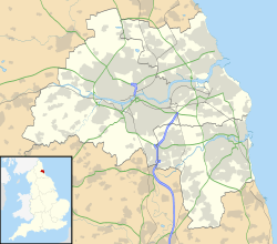
Segedunum was a Roman fort located in what is now Wallsend, North Tyneside, in North East England. This fort marked the eastern end of Hadrian's Wall, right by the River Tyne. It was an active military base for about 300 years, from around 122 AD until nearly 400 AD.
Today, Segedunum is special because it's the most thoroughly dug-up (excavated) fort along Hadrian's Wall. It's now known as the Segedunum Roman Fort, Baths and Museum. This important historical site is also part of the Hadrian's Wall UNESCO World Heritage Site, meaning it's recognized globally for its cultural value.
Contents
What's in a Name? The Meaning of Segedunum
The name Segedunum was used for five different places in the Roman Empire. One was in Britain, one in Germany, and three were in Gaul (modern-day France).
Historians believe the name Segedunum comes from ancient Celtic words. Many think it means "strong fort" or "victory fort." The first part, sego, is linked to ideas of strength and victory. The second part, dunum, was a common Celtic word for a fort or a fortified place.
History of the Fort
Hadrian's Wall was first built to end at a fort called Pons Aelius (which is now Newcastle upon Tyne) around 122 AD. But about five years later, around 127 AD, the wall was made longer. It stretched about 4 miles (6.4 km) further east. This extension likely helped protect the river crossing at Pons Aelius.
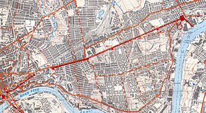
The wall passed through an area now called Byker and ended at the new fort of Segedunum. This new part of the wall was narrower than other sections, about 7 feet 6 inches (2.3 meters) wide. It also didn't have the usual ditch and earth bank (called a Vallum) on its south side. The River Tyne itself acted as a natural defense there.
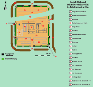
The Segedunum fort was quite large, measuring about 453 feet (138 meters) from north to south and 393 feet (120 meters) from east to west. This covered an area of about 4.1 acres (1.65 hectares). A wide ditch and an earth bank surrounded the fort on all sides. It had four main gates, each with two openings. The east, west, and north gates opened outside the wall. Only the south gate opened inside the wall. A smaller wall, about 6 feet 6 inches (2 meters) wide, also ran from the fort's southeast corner down to the riverbank.
Outside the fort, there was a large village called a vicus. This village was where families of soldiers and people who traded with the fort lived.
Who Guarded Segedunum?
We don't know exactly which soldiers were first stationed at Segedunum. However, in the 2nd century, a unit called the Cohors II Nerviorum was based there. Later, in the 3rd and 4th centuries, the fort was home to the Fourth Cohort of the Lingones. This unit included both cavalry (soldiers on horseback) and infantry (foot soldiers). Both units had about 600 soldiers, with 120 cavalry and 480 infantry.
What Happened After the Romans Left?
Around 400 AD, the Roman soldiers left Segedunum, and the fort was abandoned. For many centuries, the area was just open farmland. But in the 1700s, coal mines were dug nearby. The area slowly grew into a busy mining village. By 1884, houses had been built all over the old fort site, completely covering it.
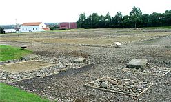
In 1929, some digging (excavations) helped map out where the fort used to be. The local council even marked its outline with white paving stones. Then, in the 1970s, the houses covering the site were taken down.
In the early 1990s, a part of Hadrian's Wall was dug up, and a reconstructed section was built. The big project to create the Segedunum museum began in 1997. This involved more excavations, building a Roman bathhouse, and turning old shipyard buildings into the new museum. The Segedunum Roman Fort, Baths & Museum officially opened in June 2000.
Segedunum Today: What You Can See
Today, when you visit Segedunum, you can see the excavated foundations of the original Roman fort buildings. There's also a reconstructed Roman military bathhouse. This bathhouse was built to look like others found at forts like Vindolanda and Chesters.
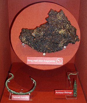
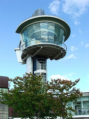
The museum at Segedunum displays many interesting items found during the excavations. You can also climb a tall observation tower for a great view over the entire site. A small piece of the original Hadrian's Wall is visible across the street from the museum. There's also a reconstruction showing what the wall might have looked like.
At the eastern end of Hadrian's Wall, the main natural defense was the River Tyne. The very last part of the wall ran down from Segedunum fort to the river's edge. The town of Wallsend gets its name because Segedunum was at the easternmost end of Hadrian's Wall. The wall's western end is at Bowness-on-Solway.
See also
 In Spanish: Segedunum para niños
 | Madam C. J. Walker |
 | Janet Emerson Bashen |
 | Annie Turnbo Malone |
 | Maggie L. Walker |


