Seneca Creek (North Fork South Branch Potomac River tributary) facts for kids
Quick facts for kids Seneca Creek |
|
|---|---|

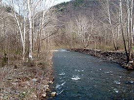
Seneca Creek just upstream of its mouth
|
|
| Country | United States |
| State | West Virginia |
| Counties | Pendleton |
| Physical characteristics | |
| Main source | Slab Camp Run Allegheny Mountain, Pendleton County, WV 3,912 ft (1,192 m) 38°43′29″N 79°33′23″W / 38.72472°N 79.55639°W |
| 2nd source | Trussel Run Spruce Mountain, Pocahontas County, WV 3,944 ft (1,202 m) 38°42′47″N 79°32′31″W / 38.71306°N 79.54194°W |
| River mouth | North Fork South Branch Potomac River Seneca Rocks, WV 1,532 ft (467 m) 38°09′42″N 81°11′47″W / 38.16167°N 81.19639°W |
Seneca Creek is a cool stream in West Virginia, about 19.6 miles (31.5 km) long. It flows into the North Fork of the South Branch of the Potomac River. You can find this creek entirely within Pendleton County, West Virginia.
This creek is nestled in the beautiful Appalachian Mountains. It's part of the Spruce Knob-Seneca Rocks National Recreation Area inside the Monongahela National Forest. Seneca Creek starts from two streams fed by springs: Slab Camp Run and Trussel Run. These streams begin on the western side of Spruce Mountain, north of Spruce Knob. The creek then flows into the North Fork of the South Branch near the town of Seneca Rocks. This is also where the famous Seneca Rocks sandstone cliff stands tall.
Contents
Fun Activities at Seneca Creek
Seneca Creek is a popular spot for people who love the outdoors. Many visitors come here to fish, hike, and go backpacking.
Fishing for Trout
In 1999, Seneca Creek was even named one of the top 100 trout streams in the United States. It's home to native brook trout and wild rainbow trout. This makes it a great place for anglers (people who fish) to try their luck.
Hiking the Seneca Creek Trail
The upper part of Seneca Creek has a special path called the Seneca Creek Trail. This trail is about 5 miles (8 km) long. It starts at the Eastern Continental Divide on National Forest Road 112. The trail then connects with the Horton Trail.
This trail is part of a bigger system called the Seneca Creek Backcountry trail system. This network of trails is huge, covering about 60 miles (97 km)! It stretches from the Eastern Continental Divide down to the towns of Whitmer and Onego. To the west, it's bordered by Gandy Creek, and to the east, by Spruce Mountain.
Streams Joining Seneca Creek
Many smaller streams flow into Seneca Creek. Here are some of them, listed from the south (where the creek starts) to the north (where it ends):
- Slab Camp Run
- Trussel Run
- Beech Run
- Lower Gulf Run
- Whites Run
- Gulf Run
- Strader Run
- Horsecamp Run
- Wamsley Run
- McIntosh Run
- Roaring Creek
- Brushy Run
Towns Along Seneca Creek
Several small communities are located along the banks of Seneca Creek:
 | Kyle Baker |
 | Joseph Yoakum |
 | Laura Wheeler Waring |
 | Henry Ossawa Tanner |

