Severnaya Zemlya facts for kids
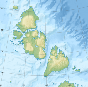
Severnaya Zemlya is a group of about 30 islands in the Arctic Ocean. It is also known as Emperor Nicholas II Land. These islands were first seen in 1913 and fully mapped between 1930 and 1932. This makes Severnaya Zemlya the last group of islands on Earth to be discovered!
Even though these islands are part of Russia's Krasnoyarsk Krai region, no people live there permanently. However, there is an Arctic base and a special weather station on Golomjanny Island. Scientists stay there for several months each year to study the weather and environment.
Contents
What is Severnaya Zemlya?
Severnaya Zemlya is an archipelago, which means it's a group of many islands. It sits in the middle of the Arctic Ocean. This island group divides the Arctic Sea into two parts: the Laptev Sea to the west and the Kara Sea to the east.
A Changing Arctic
The islands of Severnaya Zemlya show us how the Arctic is changing. For a long time, these islands were always covered in ice, even in summer. This permanent ice blocked a famous shipping route called the Northeast Passage. If this passage were free of ice, ships could travel easily from the Atlantic Ocean to the Pacific Ocean.
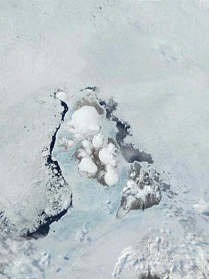
However, the amount of ice in the Arctic Sea is shrinking. This is called Arctic sea ice decline. By the end of summer in 2012, the permanent ice around Severnaya Zemlya reached a very low level. Open water appeared north of the islands, showing how much the ice had melted.
Life on the Islands
Even though no people live on Severnaya Zemlya all year, there is still some amazing wildlife!
Arctic Animals
The most common animal you'd find here is the Arctic lemming. These small, furry creatures are important for the food chain. You might also see birds like the little auk and the thick-billed murre. These birds come to the islands to nest and raise their young.
Arctic Plants
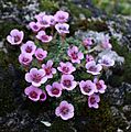
Despite the cold, some plants manage to grow on Severnaya Zemlya. One example is the purple saxifrage. This hardy plant adds a splash of color to the rocky landscape.
Images for kids
-
1975 map showing Severnaya Zemlya and the Taymyr Peninsula
-
Severnaya Zemlya is the easternmost point in the little auk's breeding range.
-
Thick-billed murre (Uria lomvia).
-
Collared lemming (Dicrostonyx torquatus), the most common mammal on Severnaya Zemlya.
See also
 In Spanish: Tierra del Norte para niños
 | Mary Eliza Mahoney |
 | Susie King Taylor |
 | Ida Gray |
 | Eliza Ann Grier |


