
Seymour, Missouri facts for kids
Quick facts for kids
Seymour, Missouri
|
|
|---|---|
|
City
|
|

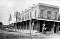
Seymour Square, looking North, 2006
|
|

Location of Seymour in Webster County and Missouri
|
|
| Country | United States |
| State | Missouri |
| County | Webster |
| Area | |
| • Total | 3.48 sq mi (9.03 km2) |
| • Land | 3.48 sq mi (9.02 km2) |
| • Water | 0.00 sq mi (0.00 km2) |
| Elevation | 1,644 ft (501 m) |
| Population
(2020)
|
|
| • Total | 1,841 |
| • Density | 528.42/sq mi (204.01/km2) |
| Time zone | UTC-6 (Central (CST)) |
| • Summer (DST) | UTC-5 (CST) |
| ZIP code |
65746
|
| Area code(s) | 417 |
| FIPS code | 29-66800 |
Seymour is a city located in southeastern Webster County, Missouri, in the United States. In 2020, about 1,841 people lived here. It is part of the larger Springfield area.
Contents
History of Seymour
Seymour was officially started in 1882. The town got its name from Mr. T.P. Crabbe, who named it after a city called Seymour, Indiana. A post office has been open in Seymour since 1881.
A special building, the Col. Thomas C. Love House, was added to the National Register of Historic Places in 1985. This means it is an important historical place in the country.
Geography and Location
Seymour is found on the edge of the Springfield Plateau, which is part of the Ozarks region. Water from the eastern side of town flows into the Gasconade River. To the north, you can find the start of the James River. Finley Creek drains the southern part of the town.
Major roads like US 60 pass by the north side of Seymour. Other Missouri roads, K, C, and BB, also serve the town. The nearby town of Diggins is about 4.5 miles west. Mansfield is 10 miles east along Route 60. The Burlington Northern Santa Fe railroad line, which connects Springfield to Memphis, also runs through Seymour.
The city covers a total area of about 2.76 square miles (7.15 square kilometers). All of this area is land.
Population and People
| Historical population | |||
|---|---|---|---|
| Census | Pop. | %± | |
| 1890 | 388 | — | |
| 1900 | 527 | 35.8% | |
| 1910 | 590 | 12.0% | |
| 1920 | 751 | 27.3% | |
| 1930 | 681 | −9.3% | |
| 1940 | 751 | 10.3% | |
| 1950 | 1,015 | 35.2% | |
| 1960 | 1,046 | 3.1% | |
| 1970 | 1,208 | 15.5% | |
| 1980 | 1,535 | 27.1% | |
| 1990 | 1,636 | 6.6% | |
| 2000 | 1,834 | 12.1% | |
| 2010 | 1,921 | 4.7% | |
| 2020 | 1,841 | −4.2% | |
| U.S. Decennial Census | |||
2010 Census Information
In 2010, the city of Seymour had 1,921 people living there. There were 746 households, which are groups of people living together. The population density was about 696 people per square mile (269 per square kilometer).
The average household in Seymour had about 2.52 people. The average family size was about 3.05 people. The median age of people in the city was 39.2 years old. About 26.7% of the residents were under 18 years old.
Amish Community Near Seymour
Outside of Seymour, there is a large community of Old Order Amish people. This group of Swiss Amish started in 1968. By 2014, their community had 13 church districts and about 2,250 people.
This community has continued to grow. In 2019, it had 16 church districts and about 3,270 people. This makes it one of the 12 largest Amish communities in the world.
Education in Seymour
Public schools in Seymour are managed by the Seymour R-II School District. The city also has a public library, which is called the Seymour Community Library.
Arts and Culture
The Seymour Merchants Association hosts an annual Apple Festival. This fun event takes place on the second weekend of every September.
The Ozark Mennonite School also holds an Apple Butter Day. This event is a fundraiser to support the school. It happens every third Saturday of October.
Images for kids
-
The Bank of Seymour in 1912.
.jpg)
See also
 In Spanish: Seymour (Misuri) para niños
