Sgùrr an Utha and Fraoch-bheinn facts for kids
Quick facts for kids Sgùrr an Utha and Fraoch-bheinn |
|
|---|---|

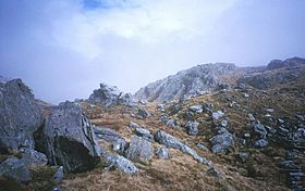
West ridge of Sgùrr an Utha, just below the summit
|
|
| Highest point | |
| Elevation |
|
| Prominence |
|
| Listing | |
| Naming | |
| English translation | Peak of the udder and Heather hill |
| Language of name | Gaelic |
| Pronunciation | and |
| Geography | |
| Topo map | OS Landranger 40 |
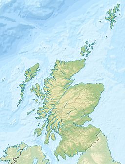
Sgùrr an Utha and Fraoch-bheinn are two interesting hills located near Glenfinnan in Lochaber, Highland, Scotland. These two mountain tops are connected by a ridge. This ridge is 735 meters (about 2,411 feet) above sea level at its lowest point. The beautiful valley of Glen Finnan is just to the east of these hills.
Contents
Discovering Sgùrr an Utha and Fraoch-bheinn
Sgùrr an Utha and Fraoch-bheinn are popular spots for hikers. People often start their climbs from Glen Finnan, which is to the south of the hills.
Popular Hiking Routes
One common way to climb these hills is to follow a path along the river Allt an Utha. This path starts about 2.5 kilometers (about 1.5 miles) west of Glenfinnan station from the A830 road. This route first takes you up Sgùrr an Utha.
You can also make a circular trip. After reaching the top of Fraoch-bheinn, you can continue south. Eventually, you will find a path on the slopes of Druim na Brein Choille. This is Fraoch-bheinn's southern ridge.
Other Ways to Explore
There are other ways to climb these hills too. You can go straight up Fraoch-bheinn from Glenfinnan station. Another option is to climb to the low point between the two summits. This route starts from the Caol-ghleann, which is a valley on the north side of the hill.
The Caol-ghleann curves around and meets Glen Finnan near the station. This means that people who travel by train can also enjoy a circular hiking route in this area.
Unique Plant Life
These hills are home to a very special plant called Diapensia lapponica. This arctic plant is very rare. In fact, this is the only place in the British Isles where it is known to grow! It was first found here in 1951.
 | Lonnie Johnson |
 | Granville Woods |
 | Lewis Howard Latimer |
 | James West |


