Shady Point, Oklahoma facts for kids
Quick facts for kids
Shady Point, Oklahoma
|
|
|---|---|

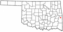
Location of Shady Point, Oklahoma
|
|
| Country | United States |
| State | Oklahoma |
| County | Le Flore |
| Area | |
| • Total | 2.56 sq mi (6.63 km2) |
| • Land | 2.56 sq mi (6.63 km2) |
| • Water | 0.00 sq mi (0.00 km2) |
| Elevation | 489 ft (149 m) |
| Population
(2020)
|
|
| • Total | 972 |
| • Density | 379.69/sq mi (146.58/km2) |
| Time zone | UTC-6 (Central (CST)) |
| • Summer (DST) | UTC-5 (CDT) |
| ZIP code |
74956
|
| Area code(s) | 539/918 |
| FIPS code | 40-66550 |
| GNIS feature ID | 2413274 |
Shady Point, sometimes called Shadypoint, is a town in Le Flore County, Oklahoma, United States. It is part of the larger Fort Smith, Arkansas-Oklahoma area. In 2010, about 1,026 people lived here. This was a good increase from the 848 people living there in 2000. By 2020, the population was 972.
Contents
History of Shady Point
Let's learn about the history of Shady Point! The area first had a post office in 1891. It was called Harrison back then. The name came from William H. Harrison, a lawyer and a leader of the Choctaw people. In 1894, the name changed to Shady Point. At that time, it was part of the Choctaw Nation.
Railroads and Growth
The town moved a bit in 1894. It moved closer to where a new railroad was planned. The Kansas City, Pittsburg and Gulf Railroad built tracks through the area in 1895–96. In 1900, another company, the Kansas City Southern Railway, took over the railroad.
By 1901, about 200 people lived in Shady Point. That same year, the Poteau Valley Railroad built more tracks. These tracks connected Shady Point to coal mines nearby. This made Shady Point an important place for shipping coal.
Changes Over Time
During the Great Depression, farming became the main way people made a living in Shady Point. The Evans Coal Company, a big coal mine, closed in 1980. This was the same year the town officially became a town. At that time, only 235 people lived there.
In 1991, a power plant was built by Applied Energy Services. This plant used a lot of coal from Oklahoma.
Geography and Location
Shady Point is located about 6 miles (10 km) north of Poteau.
The United States Census Bureau says the town covers about 2.5 square miles (6.6 km2) of land. There is no water area within the town limits.
Population and People
| Historical population | |||
|---|---|---|---|
| Census | Pop. | %± | |
| 1980 | 235 | — | |
| 1990 | 597 | 154.0% | |
| 2000 | 848 | 42.0% | |
| 2010 | 1,026 | 21.0% | |
| 2020 | 972 | −5.3% | |
| U.S. Decennial Census | |||
In 2000, there were 848 people living in Shady Point. These people lived in 306 homes, and 241 of these were families. The town had about 333 people per square mile (129 per km2).
Most people in Shady Point were White (about 86.5%). About 9% were Native American. A small number of people were Asian or from other backgrounds. About 2.6% of the people were Hispanic or Latino.
Households and Families
About 36% of homes had children under 18 living there. Most homes (66%) were married couples living together. About 9.5% of homes had a female head of household with no husband. About 21% of homes were not families.
The average home had about 2.77 people. The average family had about 3.19 people.
Age and Income
The population in Shady Point was spread out by age. About 29.6% were under 18 years old. About 10.3% were between 18 and 24. And about 12.5% were 65 years or older. The average age in the town was 33 years.
In 2000, the average income for a home was $24,453. For families, the average income was $31,250. About 19.7% of families and 23.8% of all people lived below the poverty line. This included about 30.2% of children and 22.4% of people aged 65 or older.
Historic Places to See
Several important places in and around Shady Point are listed on the National Register of Historic Places listings in Le Flore County, Oklahoma. These include the Dog Creek School, the Shady Point School, and Trahern's Station. These sites help us remember the history of the area.
See also
 In Spanish: Shady Point (Oklahoma) para niños
 | Chris Smalls |
 | Fred Hampton |
 | Ralph Abernathy |

