National Register of Historic Places listings in Le Flore County, Oklahoma facts for kids
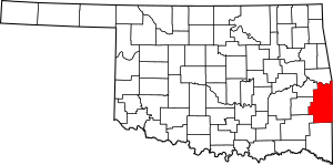
Have you ever wondered about the oldest and most important places in your state? In Le Flore County, Oklahoma, there are many special spots that are part of the National Register of Historic Places. This is a list of places in the United States that are considered important to history and worth protecting.
These places tell us stories about the past, from old schools and homes to ancient Native American sites. There are 24 different buildings and areas in Le Flore County that have been added to this important list. Let's explore some of them!
Discovering Le Flore County's Historic Treasures
Le Flore County is full of amazing historical sites. Each one has a unique story to tell about the people and events that shaped this part of Oklahoma. These places help us understand how life used to be and why certain areas became important.
Ancient History at Spiro Mounds
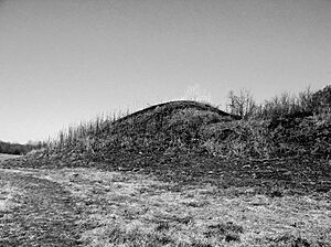
One of the most incredible places is the Spiro Mounds. This site is near Spiro and is super old! It was once a major city for Native American people called the Caddoan Mississippian culture, who lived here over 800 years ago.
- What it is: A group of large mounds built by ancient people.
- Why it's special: It's one of the most important Native American archaeological sites in the United States.
- What they found: Archaeologists have found amazing artifacts here, like pottery, tools, and jewelry, showing how advanced these ancient people were.
Important Buildings from the Past
Many historic places in Le Flore County are buildings that were important to daily life. These include old schools, courthouses, and community centers.
Learning at Historic Schools
Several old schools in the county are on the National Register. These buildings remind us of how education has changed over time.
- Arkoma School: Located in Arkoma, this school building was added to the list in 1988. It served students for many years.
- Dog Creek School: Southwest of Shady Point, this school also became historic in 1988.
- Poteau School Gymnasium-Auditorium: In Poteau, this building was a place for sports and performances. It was listed in 1988.
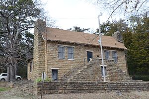
- Shady Point School: Found on the northeastern edge of Shady Point, this school was recognized in 1988.
- Summerfield School: Near Summerfield, this school building was added to the list in 1988.
- Tucker School: Off U.S. Route 59 near Spiro, this school was listed in 1988.
- Williams School: Northwest of Cameron, this school building was also added in 1988.
Government and Community Hubs
Other buildings show us where important decisions were made or where people gathered.
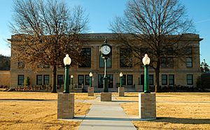
- LeFlore County Courthouse: Located in Poteau, this courthouse has been the center of local government for a long time. It was listed in 1984.
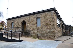
- Poteau Community Building: Also in Poteau, this building was a place for community events and meetings. It became historic in 1988.
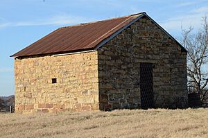
- Skullyville County Jail: West of Panama, this old jail tells a story about law and order in the past. It was listed in 1980.
Homes with History
Some of the historic places are old houses that belonged to important people or families.
- Peter Conser House: Near Heavener, this house belonged to Peter Conser, a leader of the Choctaw Nation. It was listed in 1971.
- Overstreet House: Northeast of Cowlington, this house was added to the list in 1980.
- James E. Reynolds House: East of Cameron, this home became historic in 1977.
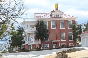
- Terry House: On Terry Hill in Poteau, this house was listed in 1980.
Other Unique Historic Sites
Le Flore County also has some very unique historic spots that aren't just buildings.
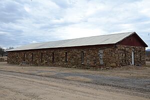
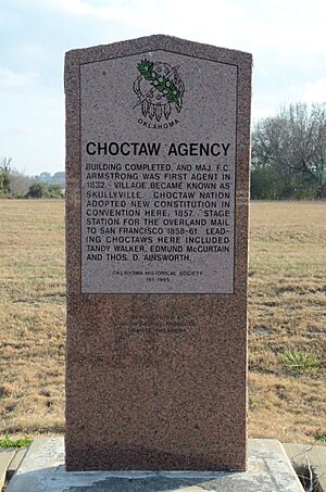
- Choctaw Agency: East of Spiro, this was an important place for the Choctaw Nation. It was listed in 1972.
- Jenson Tunnel: Northeast of Cameron, this old tunnel is a cool piece of engineering history. It was listed in 1976.
- Lake Wister Locality: This area near Lake Wister is a historic district, meaning it's a larger area with many important features. It was listed in 1975.
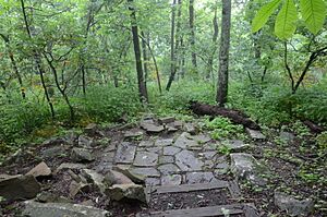
- Old Military Road: Seven miles northeast of Talihina, this old road was used by soldiers long ago. It was listed in 1976.
- State Line Marker: North of Whitesboro, this marker shows the border between Oklahoma and Arkansas. It was listed in 1976.
- Trahern's Station: West of Shady Point, this site was an important stop in the past. It was listed in 1972.
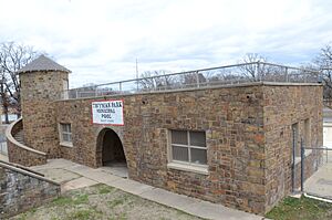
- Twyman Park: In Poteau, this park is a historic district, showing how public spaces have changed. It was listed in 1988.
These historic places help us remember the past and learn about the people who lived in Le Flore County long ago. They are important parts of Oklahoma's story!


