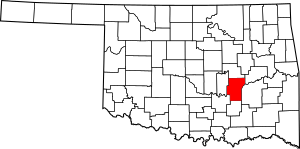
National Register of Historic Places listings in Hughes County, Oklahoma facts for kids
Welcome to Hughes County, Oklahoma! This article is all about some really special places here. Did you know that across the United States, there's a list of important buildings, sites, and objects that are worth protecting because of their history? It's called the National Register of Historic Places.
In Hughes County, Oklahoma, there are 10 amazing spots that have made it onto this important list. These places help us remember and understand the past of this area. Let's take a look at some of these historic treasures!
Exploring Hughes County's Historic Sites
Hughes County is home to several buildings and places that have played a big part in its past. Each one has a unique story, and they are all protected to make sure future generations can learn from them.
Important Buildings in Hughes County
Many of the historic places in Hughes County are buildings that once served important roles in their communities.
Dustin Agricultural Building
This building is located at Rutherford and 4th Streets in Dustin. It was added to the historic list in 1988. Agricultural buildings were often central to farming communities, helping with local activities and support.
Holdenville Armory
You can find the Holdenville Armory at U.S. Route 270 and North Butts Street in Holdenville. It became a historic site in 1988. Armories are buildings used by military reserves or national guard units for training and storing equipment.
Holdenville City Hall
The City Hall in Holdenville is at 102 Creek Street. It was recognized as historic in 1981. City halls are usually the main offices for a city's government, where important decisions are made and local services are provided.
Moss School Gymnasium
This gym is near the intersection of U.S. Route 75 and U.S. Route 270 in Holdenville. It was added to the list in 1988. School gymnasiums are often places where students gathered for sports, assemblies, and community events.
Spaulding School Gymnasium-Auditorium
Located at Section Line Highway and 2nd Street in Spaulding, this building was listed in 1988. It served as both a gym and an auditorium, likely a central spot for school and community activities.
Stuart Hotel
The Stuart Hotel is found off U.S. Route 270 in Stuart. It became a historic place in 1982. Hotels like this one were important stopping points for travelers and often served as social hubs in small towns.
John E. Turner House
This historic house is at 401 East 10th Street in Holdenville. It was added to the list in 1983. Historic homes often tell us about the people who lived there and the architectural styles of the past.
Wetumka Armory
Another armory on the list is in Wetumka, at St. Louis and Wetumka Streets. It was recognized in 1988. Like the Holdenville Armory, it played a role in local defense and community support.
Other Significant Historic Sites
Beyond buildings, some places are important because of their unique history or purpose.
Levering Mission
The Levering Mission is located northeast of Wetumka. It was added to the historic list in 1974. Missions often played a role in education and community development, especially in earlier times.
Wetumka Cemetery Pavilion and Fence
This historic site is found east of Wetumka. It was listed in 1988. Cemeteries are important places for remembering people from the past, and structures like pavilions can be significant historical markers.
Images for kids


