National Register of Historic Places listings in Garvin County, Oklahoma facts for kids
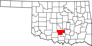
Welcome to Garvin County, Oklahoma! Did you know that some places here are so special and important to history that they are officially recognized? This article will tell you all about the amazing buildings and sites in Garvin County that are listed on the National Register of Historic Places.
The National Register of Historic Places is like a special list kept by the United States government. It includes buildings, sites, and objects that are important in American history, architecture, archaeology, engineering, or culture. When a place is on this list, it means it's a valuable part of our past and should be protected for future generations. Garvin County has 12 of these unique and historic spots!
Historic Places in Garvin County
Garvin County is home to many interesting places that tell stories from long ago. Let's explore some of them!
Antioch School District No. 15
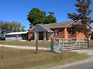
The Antioch Dependent School District No. 15 building is located near Elmore City. It was added to the National Register on December 6, 2004. This old school building reminds us of how education used to be. It's a great example of the kind of schools kids attended many years ago in rural Oklahoma.
Erin Springs Mansion
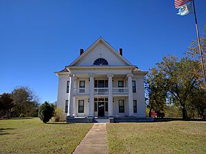
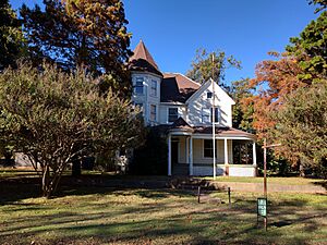
South of the Washita River in Erin Springs stands the beautiful Erin Springs Mansion. This grand house was listed on June 22, 1970. It's a historic home that shows us what life was like for important families in the past. Imagine living in such a big house!
Eskridge Hotel
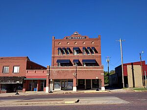
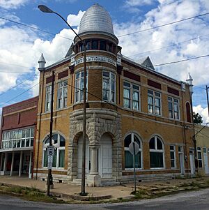
In Wynnewood, you can find the Eskridge Hotel at 114 East Robert S. Kerr Street. It joined the National Register on October 3, 1979. Hotels like this were once busy places where travelers would stay. It tells a story of how people traveled and rested in earlier times.
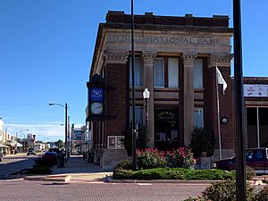
First National Bank Building
The First National Bank Building in Stratford is located at 100 West Main Street. It became a historic place on June 14, 2001. This old bank building shows us the style of architecture used for important businesses a long time ago. It played a big role in the town's economy.
Fort Arbuckle Site
Near Hoover, about half a mile north on State Highway 7, is the Fort Arbuckle Site. This important historical spot was added to the list on June 13, 1972. Fort Arbuckle was once a military fort. It was built to help keep peace and protect settlers and Native American tribes in the area during the 1800s.
Garvin County Courthouse
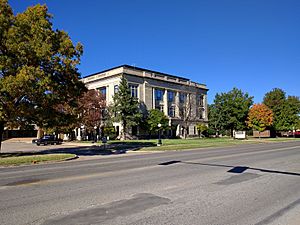
The Garvin County Courthouse is a very important building in Pauls Valley, located at Courthouse Square and Grant Avenue. It was recognized on November 8, 1985. Courthouses are where important government decisions are made and where justice is served. This building has seen many historical moments for the county.
Hargis-Mitchell-Cochran House
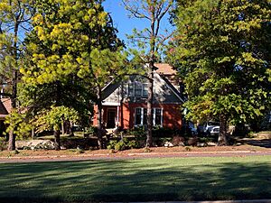
Another historic home in Wynnewood is the Hargis-Mitchell-Cochran House, found at 204 East Robert S. Kerr Street. It was listed on June 2, 1982. This house is special because of its unique design and the families who lived there, who were important to the community's history.
Initial Point
About 7.5 miles west of Davis, right on the border between Garvin and Murray counties, is a place called Initial Point. It was added to the National Register on October 6, 1970. This spot is super important because it's the starting point for all land surveys in Oklahoma. It's like the "zero" point on a map for the entire state!
Moore-Settle House
The Moore-Settle House is another historic residence in Wynnewood, located at 508 East Cherokee Street. It joined the list on March 25, 1983. Like other historic homes, it offers a glimpse into the past lives of people in the area and the architectural styles of its time.
Pauls Valley Historic District
The Pauls Valley Historic District in Pauls Valley is a whole area, not just one building! It's roughly bordered by railroad tracks, Grant Avenue, and Joy Street. This district was recognized on February 1, 1979. It includes many buildings that together show what a historic downtown area looked like and how it functioned.
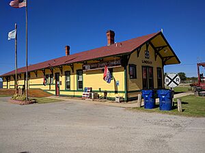
Santa Fe Depot of Lindsay
The Santa Fe Depot of Lindsay is located at 120 North Main Street in Lindsay. It was added to the National Register on April 25, 1986. Train depots were once very busy places, connecting towns and people across the country. This depot is a reminder of the important role railroads played in developing Oklahoma.
Images for kids


