National Register of Historic Places listings in Nowata County, Oklahoma facts for kids
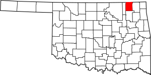
Welcome to Nowata County, Oklahoma! This page is all about some really special places here that are listed on the National Register of Historic Places. Think of this register as a super important list of buildings, sites, and objects across the United States that are worth saving because of their history.
These places tell us stories about the past. They might be old schools, courthouses, bridges, or even cemeteries. By being on this list, it means they are recognized for their historical importance and efforts are made to protect them for future generations. In Nowata County, there are 6 amazing places that have made it onto this special list!
Historic Treasures of Nowata County
Here are the special places in Nowata County that are listed on the National Register of Historic Places. Each one has a unique story!
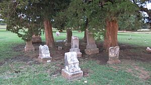
Cemetery Patent 110: A Quiet Place of History
- Location: Near Delaware, Oklahoma, on County Road 412.
- Listed: September 9, 2001
- What it is: This is a historic cemetery, a peaceful place where people from the past are laid to rest. Cemeteries can tell us a lot about the people who lived in an area long ago.
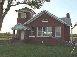
Diamond Point School: Learning from the Past
- Location: Near Nowata, Oklahoma, at the corner of County Roads 409 and 24.5.
- Listed: September 23, 1996
- What it is: The Diamond Point Dependent District No. 44 School is an old school building. Imagine kids your age learning here many years ago! Old schools often show us how education has changed over time.
Moore Ranch: A Glimpse into Ranch Life
- Location: About 6 miles west of Nowata on N4070 Road.
- Listed: September 3, 2010
- What it is: The Moore Ranch is a historic ranch property. Ranches played a huge part in the history and economy of Oklahoma, especially in the past. This site helps us remember that important way of life.
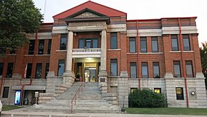
Nowata County Courthouse: A Center of Community
- Location: 229 North Maple Street, Nowata.
- Listed: August 23, 1984
- What it is: The Nowata County Courthouse is where many important decisions for the county have been made for decades. Courthouses are often grand buildings that stand as symbols of local government and justice.
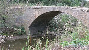
Opossum Creek Bridge: A Path Through Time
- Location: Near South Coffeyville, Oklahoma, carrying County Road NS–413 over Opossum Creek.
- Listed: March 4, 2009
- What it is: This is a historic bridge that crosses Opossum Creek. Bridges are not just ways to get from one side to another; old bridges can be amazing examples of engineering from the past.
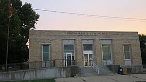
United States Post Office Nowata: Connecting Communities
- Location: 109 North Pine Street, Nowata.
- Listed: April 17, 2009
- What it is: The Nowata Post Office is a historic building where mail has been sorted and sent for many years. Post offices were, and still are, vital places for connecting people and communities.


